Page 21 of 30
Day 19, Saturday, October 26

Day 19: Albergue El Caminante in Santa Catalina de Somoza. French Janine (who only spoke French) and British Elizabeth ("Liz") who spoke 4 - 5 languages including Spanish.
- Photographer: Claus Nedergaard Jacobsen
- Date Taken: 2019:10:26 08:16:12
- GPS Location: 42.4552067N, -6.1581772E
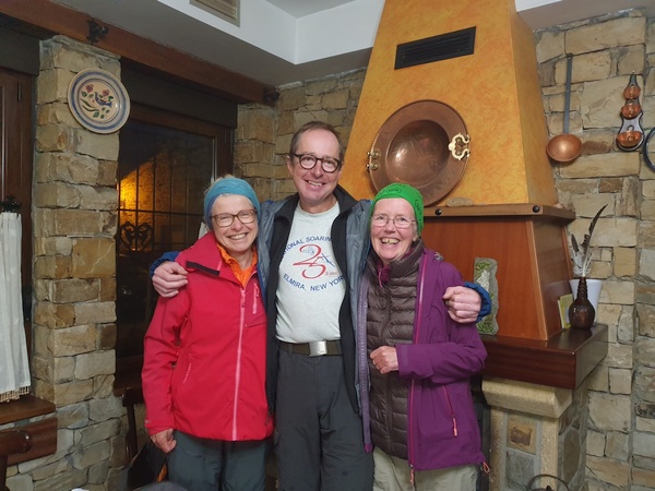
Day 19: Albergue El Caminante in Santa Catalina de Somoza. French Janine (who only spoke French), Claus and British Elizabeth ("Liz") who spoke 4 - 5 languages including Spanish. It was Liz' idea that this picture should be labelled "Europe before Brexit"
- Photographer: Claus Nedergaard Jacobsen
- Date Taken: 2019:10:26 08:16:40
- GPS Location: 42.4552067N, -6.1581772E

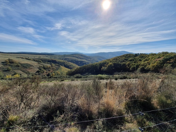
Day 19: Beautiful morning scenery just outside Santa Catalina de Somoza
- Photographer: Claus Nedergaard Jacobsen
- Date Taken: 2019:10:26 08:48:11
- GPS Location: 42.4560112N, -6.1643962E
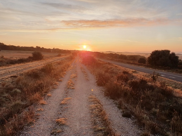
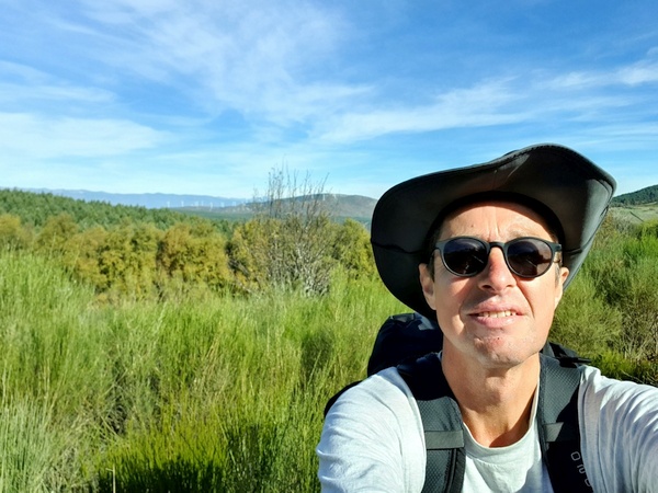
Day 19: Watching the sun rise behind me on a beautiful morning just outside Santa Catalina de Somoza
- Photographer: Claus Nedergaard Jacobsen
- Date Taken: 2019:10:26 08:58:22
- GPS Location: 42.4580294N, -6.1747304E
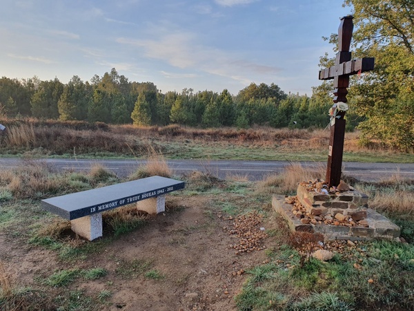
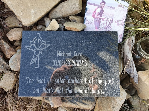
Another life that ended on the Camino. One wonders if it is dangerous or people just decide to walk there in times of trouble?
- Photographer: Claus Nedergaard Jacobsen
- Date Taken: 2019:10:26 09:17:25
- GPS Location: 42.4610629N, -6.1958275E

Day 19: Watching the sun rise behind me on a beautiful morning just outside Santa Catalina de Somoza
- Photographer: Claus Nedergaard Jacobsen
- Date Taken: 2019:10:26 09:25:30
- GPS Location: 42.4618179N, -6.2041284E

The Camino cannot give you what you want. But it does provide you of what you need.
- Photographer: Claus Nedergaard Jacobsen
- Date Taken: 2019:10:26 09:26:25
- GPS Location: 42.4619818N, -6.2046351E

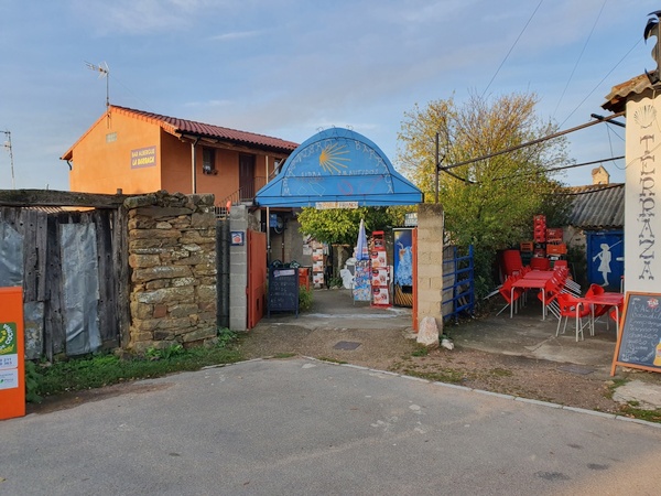
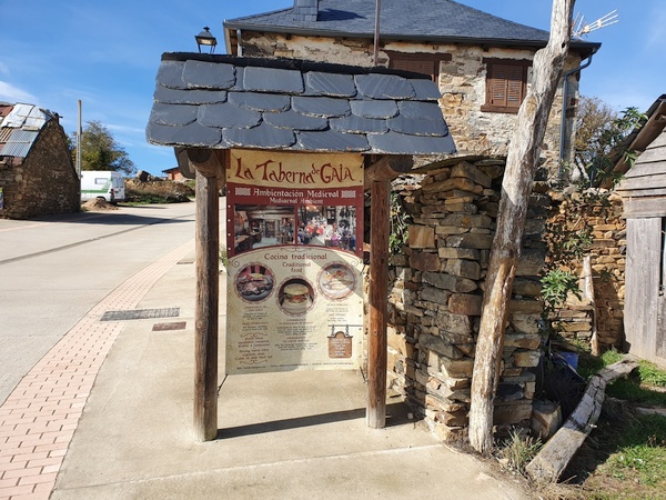
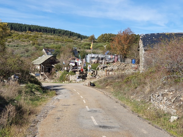
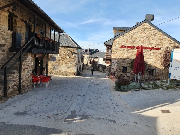
Funny bar in El Ganso
- Photographer: Claus Nedergaard Jacobsen
- Date Taken: 2019:10:26 09:29:23
- GPS Location: 42.4628225N, -6.2071193E
Another funny bar in El Ganso.
- Photographer: Claus Nedergaard Jacobsen
- Date Taken: 2019:10:26 09:29:31
- GPS Location: 42.4628225N, -6.2071193E
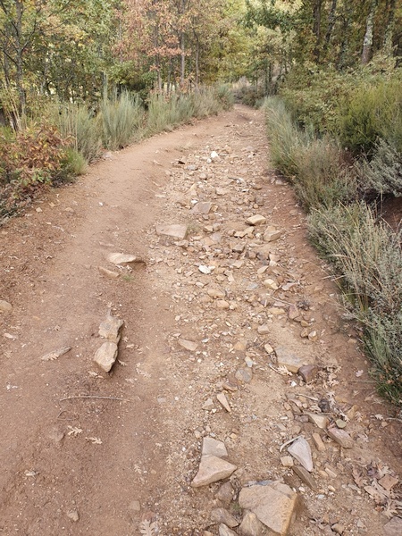
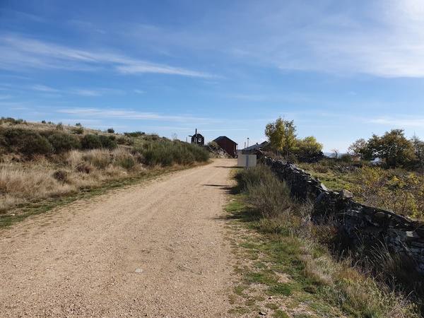
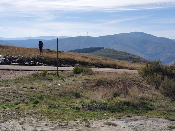
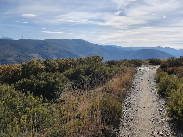
2 km west of Rabanal del Camino: The Camino gets rocky
- Photographer: Claus Nedergaard Jacobsen
- Date Taken: 2019:10:26 12:08:34
- GPS Location: 42.4894415N, -6.3185857E

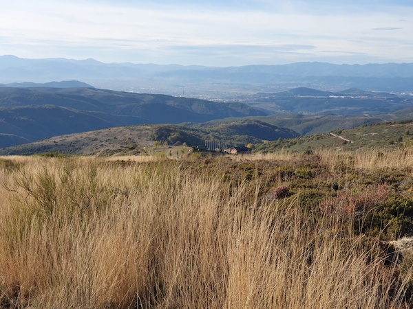
On day 19 we got into the mountains on a beautiful sunny day. The camera had to get out again and again. This is the first of many times. 1 km east of Foncebadón
- Photographer: Claus Nedergaard Jacobsen
- Date Taken: 2019:10:26 12:25:51
- GPS Location: 42.4704735N, -6.2533595E
Rocky road
- Photographer: Claus Nedergaard Jacobsen
- Date Taken: 2019:10:26 12:25:59
- GPS Location: 42.4896783N, -6.3305429E
Into the mountains at Foncebadón
- Photographer: Claus Nedergaard Jacobsen
- Date Taken: 2019:10:26 12:27:32
- GPS Location: 42.4917559N, -6.3443771E

Mountain cows at Foncebadón
- Photographer: Claus Nedergaard Jacobsen
- Date Taken: 2019:10:26 12:34:34
- GPS Location: 42.4910364N, -6.3379969E

Casa de Comidas in Foncebadón. Wonderful medieval restaurant where I had my dinner. The servants were dressed in beautiful gowns - the women, that is.
- Photographer: Claus Nedergaard Jacobsen
- Date Taken: 2019:10:26 14:12:43
- GPS Location: 42.4912092N, -6.3414893E

Casa Comidas. Did not catch the women in their beautiful dresses. Only this garcon.
- Photographer: Claus Nedergaard Jacobsen
- Date Taken: 2019:10:26 14:12:47
- GPS Location: 42.4912248N, -6.3415715E

The outside of Casa de Comidas in Foncebadón.
- Photographer: Claus Nedergaard Jacobsen
- Date Taken: 2019:10:26 14:13:07
- GPS Location: 42.4912248N, -6.3415715E
Foncebadón. Cross in the middle of the road
- Photographer: Claus Nedergaard Jacobsen
- Date Taken: 2019:10:26 14:13:21
- GPS Location: 42.4912248N, -6.3415715E
Casa de Comidas - menu card
- Photographer: Claus Nedergaard Jacobsen
- Date Taken: 2019:10:26 14:13:27
- GPS Location: 42.4912248N, -6.3415715E
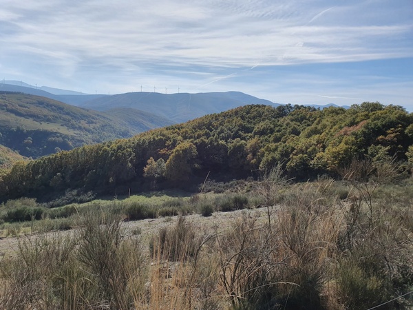
More scenery seen from Foncebadón
- Photographer: Claus Nedergaard Jacobsen
- Date Taken: 2019:10:26 14:19:51
- GPS Location: 42.4924852N, -6.3452393E

More scenery seen from Foncebadón
- Photographer: Claus Nedergaard Jacobsen
- Date Taken: 2019:10:26 14:19:54
- GPS Location: 42.4924852N, -6.3452393E

I knew it would come somewhere but not when: The Cruz de Ferro. All of a sudden, it was there, 1,5 km after Foncebadón. I had to ask the lady in front, if it was really it.
- Photographer: Claus Nedergaard Jacobsen
- Date Taken: 2019:10:26 14:38:44
- GPS Location: 42.4889529N, -6.361137E

The stone I had brought from home to leave at Cruz de Ferro.
- Photographer: Claus Nedergaard Jacobsen
- Date Taken: 2019:10:26 14:43:44
- GPS Location: 42.4889207N, -6.3612943E

The stone I had brought from home to leave at Cruz de Ferro.
- Photographer: Claus Nedergaard Jacobsen
- Date Taken: 2019:10:26 14:44:05
- GPS Location: 42.4917559N, -6.3443771E

The stone I had brought from home to leave at Cruz de Ferro. "Claus Ulla". Well, they said the stone should represent something you do not need any longer. I hope not.
- Photographer: Claus Nedergaard Jacobsen
- Date Taken: 2019:10:26 14:44:18
- GPS Location: 42.4917559N, -6.3443771E

Cruz de Ferro
- Photographer: Claus Nedergaard Jacobsen
- Date Taken: 2019:10:26 14:45:29
- GPS Location: 42.488861N, -6.3614746E
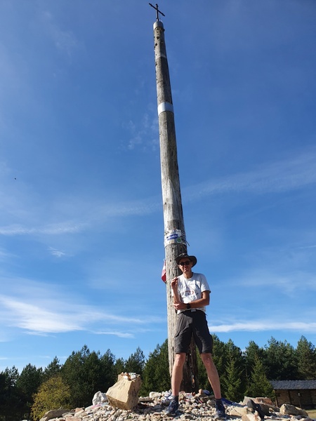
Claus in front of Cruz de Ferro. Finally time for the shorts again - but not a very good picture.
- Photographer: Claus Nedergaard Jacobsen
- Date Taken: 2019:10:26 14:47:39
- GPS Location: 42.488846N, -6.361392E

Description of Cruz de Ferro. Every pilgrim brings a stone from home to leave here. Over time the pile has grown 7 meter tall.
- Photographer: Claus Nedergaard Jacobsen
- Date Taken: 2019:10:26 14:51:33
- GPS Location: 42.4889328N, -6.3616532E

More beautiful scenery 1 km after Cruz de Ferro
- Photographer: Claus Nedergaard Jacobsen
- Date Taken: 2019:10:26 15:06:44
- GPS Location: 42.488583N, -6.3768618E
More beautiful scenery 1 km after Cruz de Ferro
- Photographer: Claus Nedergaard Jacobsen
- Date Taken: 2019:10:26 15:06:46
- GPS Location: 42.488583N, -6.3768618E

More beautiful scenery 1 km after Cruz de Ferro
- Photographer: Claus Nedergaard Jacobsen
- Date Taken: 2019:10:26 15:06:59
- GPS Location: 42.488583N, -6.3768618E
More beautiful scenery 1 km after Cruz de Ferro
- Photographer: Claus Nedergaard Jacobsen
- Date Taken: 2019:10:26 15:08:33
- GPS Location: 42.4884447N, -6.3769922E
More beautiful scenery 1 km after Cruz de Ferro
- Photographer: Claus Nedergaard Jacobsen
- Date Taken: 2019:10:26 15:14:09
- GPS Location: 42.4876125N, -6.3812661E

How the Camino looks 2 km after Cruz de Ferro
- Photographer: Claus Nedergaard Jacobsen
- Date Taken: 2019:10:26 15:18:15
- GPS Location: 42.4882582N, -6.3841882E
A crazy place offering prayers, healing etc at Manjarin 2 km after Cruz de Ferro. "No photos", it said, but I wonder if it was to protect the visitors. I wanted coffee but I did not want to go in there and get caught in a sales trick.
- Photographer: Claus Nedergaard Jacobsen
- Date Taken: 2019:10:26 15:22:02
- GPS Location: 42.4899993N, -6.3864504E
More scenery
- Photographer: Claus Nedergaard Jacobsen
- Date Taken: 2019:10:26 15:26:23
- GPS Location: 42.4899885N, -6.3900823E

More scenery
- Photographer: Claus Nedergaard Jacobsen
- Date Taken: 2019:10:26 15:26:30
- GPS Location: 42.4899885N, -6.3900823E
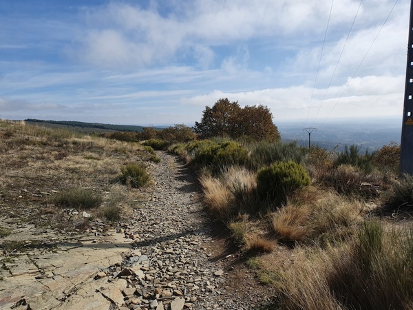
Mountain hiking at Manjarin. Over 1500 meter altitude.
- Photographer: Claus Nedergaard Jacobsen
- Date Taken: 2019:10:26 15:26:41
- GPS Location: 42.4897978N, -6.390601E

Mountain hiking at Manjarin. Over 1500 meter altitude.
- Photographer: Claus Nedergaard Jacobsen
- Date Taken: 2019:10:26 15:28:43
- GPS Location: 42.490054N, -6.3916088E

Mountain hiking at Manjarin. Over 1500 meter altitude.
- Photographer: Claus Nedergaard Jacobsen
- Date Taken: 2019:10:26 15:30:10
- GPS Location: 42.4906367N, -6.3923827E

Mountain hiking at Manjarin. Over 1500 meter altitude.
- Photographer: Claus Nedergaard Jacobsen
- Date Taken: 2019:10:26 15:30:15
- GPS Location: 42.4906367N, -6.3923827E

Mountain hiking at Manjarin. Over 1500 meter altitude.
- Photographer: Claus Nedergaard Jacobsen
- Date Taken: 2019:10:26 15:59:52
- GPS Location: 42.4920748N, -6.3982509E
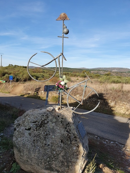
A remembrance sign for another pilgrim whose life ended here. A young one. And a slogan worth remembering.
- Photographer: Claus Nedergaard Jacobsen
- Date Taken: 2019:10:26 16:13:21
- GPS Location: 42.4897978N, -6.390601E

Mountain hiking at Manjarin. Over 1500 meter altitude.
- Photographer: Claus Nedergaard Jacobsen
- Date Taken: 2019:10:26 16:28:38
- GPS Location: 42.4887666N, -6.4188656E
Mountain hiking at Manjarin. Over 1500 meter altitude.
- Photographer: Claus Nedergaard Jacobsen
- Date Taken: 2019:10:26 16:28:50
- GPS Location: 42.4886141N, -6.4189496E

Mountain hiking at Manjarin. Over 1500 meter altitude.
- Photographer: Claus Nedergaard Jacobsen
- Date Taken: 2019:10:26 16:31:05
- GPS Location: 42.4884116N, -6.4207062E

Mountain hiking at Manjarin. Over 1500 meter altitude.
- Photographer: Claus Nedergaard Jacobsen
- Date Taken: 2019:10:26 16:52:15
- GPS Location: 42.4911791N, -6.4370867E

Mountain hiking at Manjarin. Over 1500 meter altitude.
- Photographer: Claus Nedergaard Jacobsen
- Date Taken: 2019:10:26 16:52:22
- GPS Location: 42.4911791N, -6.4370867E

Mountain hiking at Manjarin. Over 1500 meter altitude.
- Photographer: Claus Nedergaard Jacobsen
- Date Taken: 2019:10:26 16:52:30
- GPS Location: 42.4938937N, -6.441521E

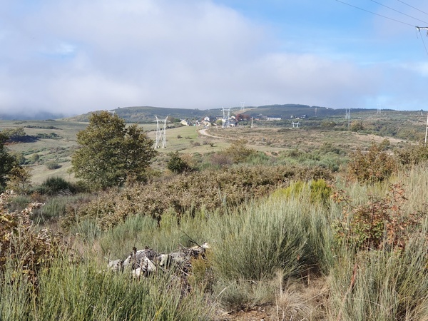
Molinaseca in the valley below. Still at 1500 meter altitude. Day 19 and 20 provided the best sceneries of the entire camino.
- Photographer: Claus Nedergaard Jacobsen
- Date Taken: 2019:10:26 16:55:48
- GPS Location: 42.4915513N, -6.4398651E

Mountain hiking close to El Acebo de San Miguel
- Photographer: Claus Nedergaard Jacobsen
- Date Taken: 2019:10:26 16:55:55
- GPS Location: 42.4915513N, -6.4398651E
El Acebo de San Miguel where I wanted to sleep over for the night. At 1400 meter approx. Walking downhill was very painful for the ancles.
- Photographer: Claus Nedergaard Jacobsen
- Date Taken: 2019:10:26 17:20:41
- GPS Location: 42.497057N, -6.4520716E

Downhill from some 1500 meter to some 1400 meter to get to El Acebo de San Miguel. Painful for the ancles.
- Photographer: Claus Nedergaard Jacobsen
- Date Taken: 2019:10:26 17:20:52
- GPS Location: 42.4971001N, -6.4521332E

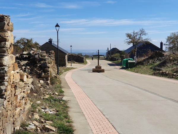
El Acebo de San Miguel
- Photographer: Claus Nedergaard Jacobsen
- Date Taken: 2019:10:26 17:25:37
- GPS Location: 42.4971001N, -6.4521333E

Austrian after-skiing atmosphere in El Acebo de San Miguel
- Photographer: Claus Nedergaard Jacobsen
- Date Taken: 2019:10:26 17:31:33
- GPS Location: 42.4977928N, -6.4559777E
El Acebo de San Miguel
- Photographer: Claus Nedergaard Jacobsen
- Date Taken: 2019:10:26 17:31:43
- GPS Location: 42.4977928N, -6.4559777E

El Acebo de San Miguel
- Photographer: Claus Nedergaard Jacobsen
- Date Taken: 2019:10:26 17:32:59
- GPS Location: 42.4977928N, -6.4559777E
The sign of another pilgrim whose life ended here prematurely.
- Photographer: Claus Nedergaard Jacobsen
- Date Taken: 2019:10:26 17:40:34
- GPS Location: 42.5012423N, -6.4593353E

The albergue for this night. Combined hotel, albergue, fitness center, aqua center and more.
- Photographer: Claus Nedergaard Jacobsen
- Date Taken: 2019:10:26 17:41:58
- GPS Location: 42.5010497N, -6.4600385E
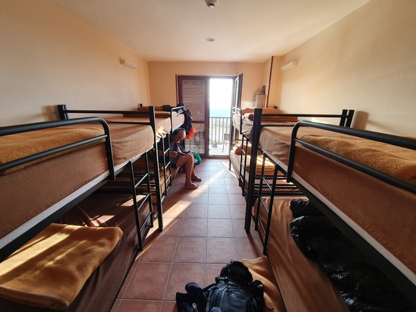
My room for this night. Austrian Frans catching up on the news
- Photographer: Claus Nedergaard Jacobsen
- Date Taken: 2019:10:26 17:56:45
- GPS Location: 42.5010353N, -6.4600936E

Beautiful view from the balcony at Albergue La Casa Del Peregrino
- Photographer: Claus Nedergaard Jacobsen
- Date Taken: 2019:10:26 17:57:04
- GPS Location: 42.5010353N, -6.4600936E

Laundry facilities at Albergue La Casa Del Peregrino could be worse
- Photographer: Claus Nedergaard Jacobsen
- Date Taken: 2019:10:26 18:37:18
- GPS Location: 42.5010776N, -6.4601463E
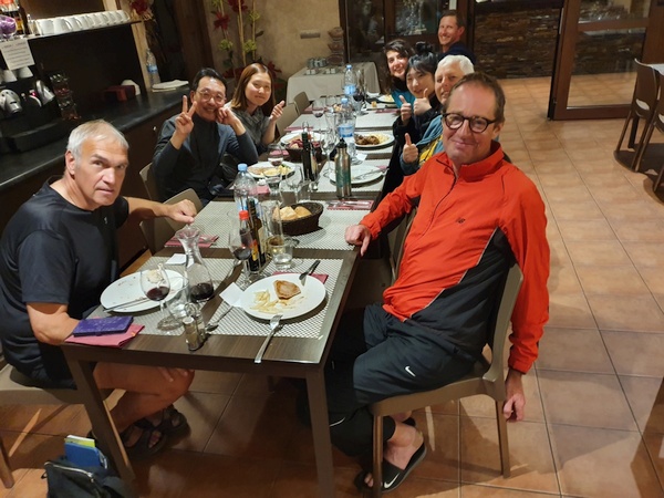
Pilgrim Dinner at Albergue La Casa Del Peregrino. To the left Franz from Holland, Joseph and AYoung (Koreans who could actually speak English). To the right: Claus, German Beatrix, KayHo from Korea, Irene from Italy and an American guy whose name I have forgotten. It was Irene's 26 year birthday and we all sang birthday songs to her in our own language.
- Photographer: Claus Nedergaard Jacobsen
- Date Taken: 2019:10:26 19:51:55
- GPS Location: 42.5010734N, -6.4601021E

Birthday party. From left to right: ?? from the US, Irene from Italy, Kayho from Korea, Beatrix from Germany, Claus, Frans from Holland, Ayoung and Joseph from Korea.
- Photographer: Claus Nedergaard Jacobsen
- Date Taken: 2019:10:26 19:52:10
- GPS Location: 42.5010734N, -6.4601021E