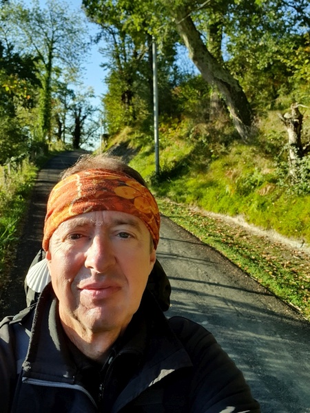
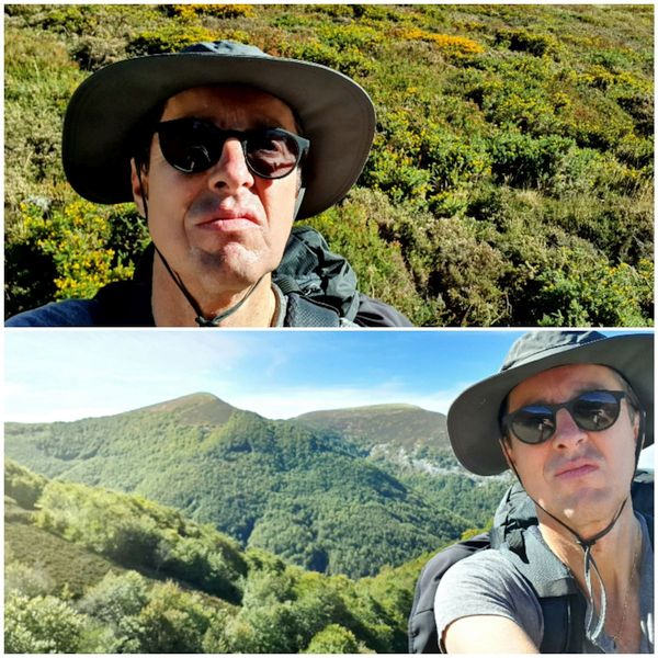
October 2019 finally gave me the chance to walk Camino de Santiago, all the way from Saint-Jean Pied-de-Port in France, over the Pyrenees via Route Napoleon to Roncevalles in Spain and along the traditional route named "Camino Frances" to Santiago de Compostella, 780 km in 27 days. It is one of those 4 - 5 experiences that I will think of as a highlight of my life. This article is mostly intended to share the photos with the friends that I met along the route. That is why it is in English. Most of the time we spoke either French or German but I have to find a common denominator.

Preludium, October 6 - 7

At 4:41 in the morning before the trip to Billund Airport in Denmark. First day of the winter where we had to scrape ice from the car. Great day to start the Camino.
- Photographer: Claus Nedergaard Jacobsen
- Date Taken: 2019:10:06 04:41:44
- GPS Location: 56.1781733N, 9.5359087E
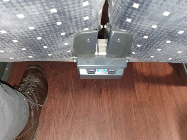
In the bus going from the Charles de Gaulle airport in Paris to the Orly airport. Wifi and USB chargers available.
- Photographer: Claus Nedergaard Jacobsen
- Date Taken: 2019:10:06 10:13:49
- GPS Location: 48.530934N, 1.8660673E

Cathedral in Bayonne - I think
- Photographer: Claus Nedergaard Jacobsen
- Date Taken: 2019:10:06 18:54:14
- GPS Location: 43.4877546N, -1.4139131E

Cafe in front of the train station at Bayonne in France. Spent 2 hours there waiting for the train to St. Jean Pied de Port
- Photographer: Claus Nedergaard Jacobsen
- Date Taken: 2019:10:06 19:03:44
- GPS Location: 43.4965795N, -1.4701424E

Bayonne
- Photographer: Claus Nedergaard Jacobsen
- Date Taken: 2019:10:06 19:04:02
- GPS Location: 43.4965795N, -1.4701424E
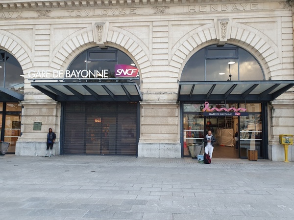
Train Station at Bayonne in France.
- Photographer: Claus Nedergaard Jacobsen
- Date Taken: 2019:10:06 19:04:13
- GPS Location: 43.4965795N, -1.4701424E

Claus at Nive de Béhérobie (River in St. Jean Pied de Port)
- Photographer: Claus Nedergaard Jacobsen
- Date Taken: 2019:10:06 19:08:48
- GPS Location: 43.4961649N, -1.4703195E
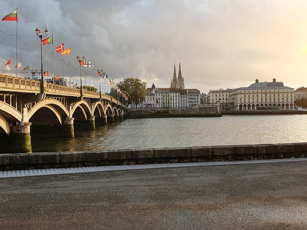
The river in St. Jean Pied de Port ("Nive de Béhérobie"). Notice the flags - even a Danish one.
- Photographer: Claus Nedergaard Jacobsen
- Date Taken: 2019:10:06 19:12:54
- GPS Location: 43.4953304N, -1.4708914E

Arrival at de train station at St. Jean Pied de Port at 10PM after a really long day of travel. Started at 4AM.
- Photographer: Claus Nedergaard Jacobsen
- Date Taken: 2019:10:06 22:06:41
- GPS Location: 43.1678682N, -1.2379494E

Arrival at de train station at St. Jean Pied de Port at 10PM after a really long day of travel. Started at 4AM.
- Photographer: Claus Nedergaard Jacobsen
- Date Taken: 2019:10:06 22:06:44
- GPS Location: 43.1678682N, -1.2379494E
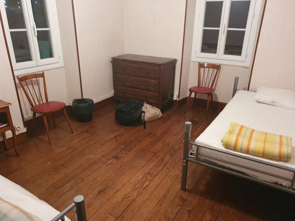
My room at St. Jean Pied de Port. Simple but sufficient.
- Photographer: Claus Nedergaard Jacobsen
- Date Taken: 2019:10:06 22:17:23
- GPS Location: 43.1631795N, -1.2405655E

The pedestrian street in St. Jean Pied de Port. Actually part of the Camino Frances. Every pilgrim from northern Europe would pass through this street.
- Photographer: Claus Nedergaard Jacobsen
- Date Taken: 2019:10:07 11:46:55
- GPS Location: 43.1616328N, -1.238776E
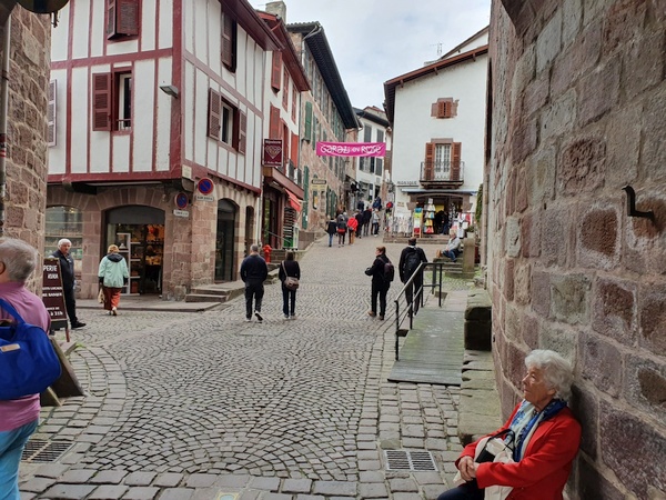
The pedestrian street in St. Jean Pied de Port. Actually part of the Camino Frances. Every pilgrim from northern Europe would pass through this street.
- Photographer: Claus Nedergaard Jacobsen
- Date Taken: 2019:10:07 11:50:24
- GPS Location: 43.1624644N, -1.237137E

Claus at the castle at St. Jean Pied de Port
- Photographer: Claus Nedergaard Jacobsen
- Date Taken: 2019:10:07 12:30:25
- GPS Location: 43.1630685N, -1.2350902E
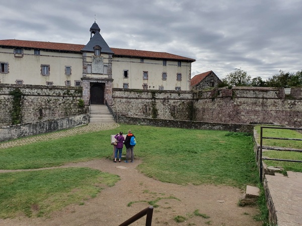
The castle in St. Jean Pied de Port
- Photographer: Claus Nedergaard Jacobsen
- Date Taken: 2019:10:07 12:30:42
- GPS Location: 43.1630685N, -1.2350902E

Lunch in St. Jean Jean Pied de Port
- Photographer: Claus Nedergaard Jacobsen
- Date Taken: 2019:10:07 13:03:25
- GPS Location: 43.1615016N, -1.2377469E

Famous photo object in St. Jean Pied de Port
- Photographer: Claus Nedergaard Jacobsen
- Date Taken: 2019:10:07 14:31:07
- GPS Location: 43.1624604N, -1.2383085E

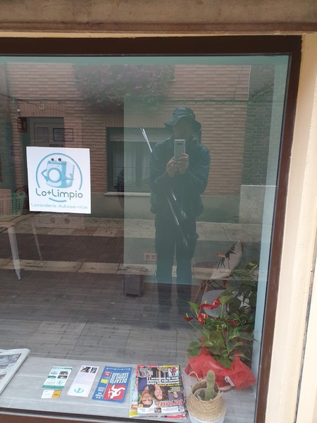
Claus in front of a famous reflection point in St. Jean Pied de Port
- Photographer: Claus Nedergaard Jacobsen
- Date Taken: 2019:10:07 14:31:29
- GPS Location: 43.1624699N, -1.2383092E

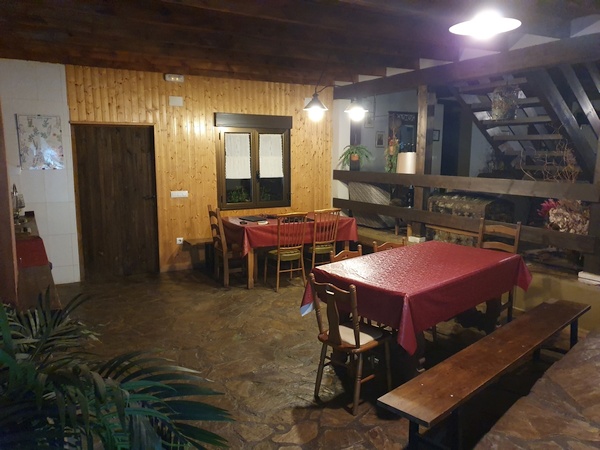
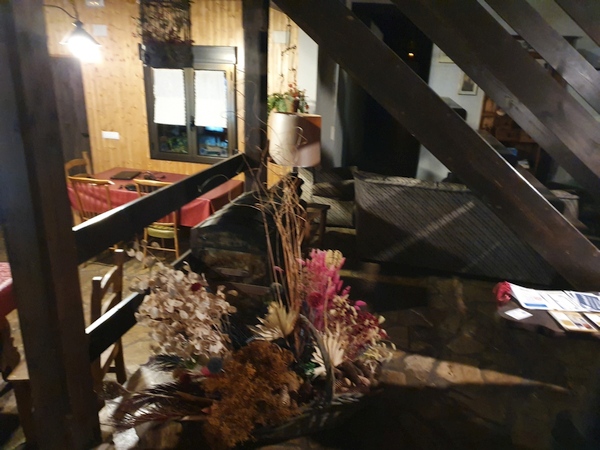
Living room at the gité in St. Jean Pied de Port.
- Photographer: Claus Nedergaard Jacobsen
- Date Taken: 2019:10:07 17:47:25
- GPS Location: 43.1631795N, -1.2405655E

My dinner wine at St. Jean Pied de Port
- Photographer: Claus Nedergaard Jacobsen
- Date Taken: 2019:10:07 20:07:02
- GPS Location: 43.1632902N, -1.2377123E
Day 1, Tuesday, October 8
Absolutely wonderful day for crossing the Pyrenees. Don't forget to turn on the sound.

Starting out on the Camino on October 10. Still in St. Jean Pied de Port
- Photographer: Claus Nedergaard Jacobsen
- Date Taken: 2019:10:08 08:30:42
- GPS Location: 43.1612894N, -1.2378334E
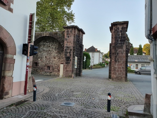
"La Porte d'Espagne" - the Spanish gate. Where the Camino officially starts in St. Jean Pied de Port. Before you head up the Pyrenees.
- Photographer: Claus Nedergaard Jacobsen
- Date Taken: 2019:10:08 08:31:57
- GPS Location: 43.1615644N, -1.2389398E

"La Porte d'Espagne" - the Spanish gate. Where the Camino officially starts in St. Jean Pied de Port. Before you head up the Pyrenees.
- Photographer: Claus Nedergaard Jacobsen
- Date Taken: 2019:10:08 08:32:11
- GPS Location: 43.1615644N, -1.2389398E

"La Porte d'Espagne" - the Spanish gate. Where the Camino officially starts in St. Jean Pied de Port. Before you head up the Pyrenees.
- Photographer: Claus Nedergaard Jacobsen
- Date Taken: 2019:10:08 08:32:14
- GPS Location: 43.1615644N, -1.2389398E
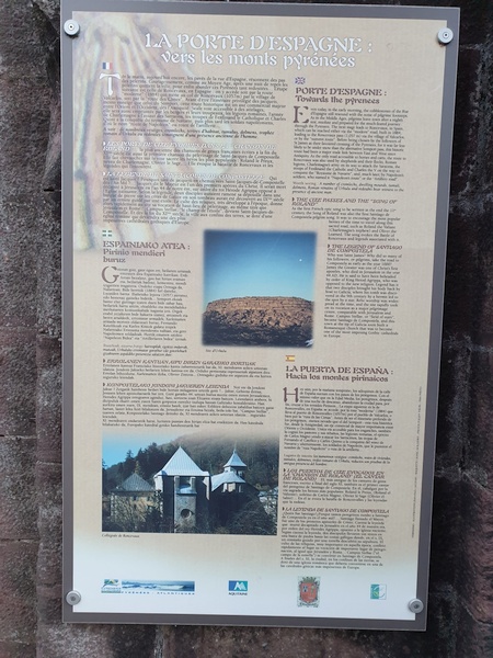
"La Porte d'Espagne" - the Spanish gate. Where the Camino officially starts in St. Jean Pied de Port. Before you head up the Pyrenees.
- Photographer: Claus Nedergaard Jacobsen
- Date Taken: 2019:10:08 08:32:32
- GPS Location: 43.1604547N, -1.238258E

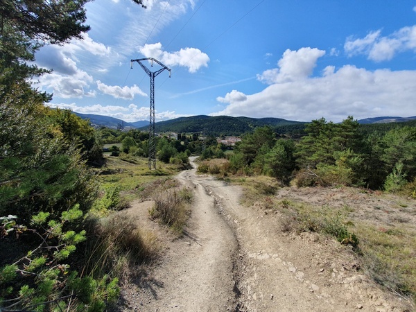
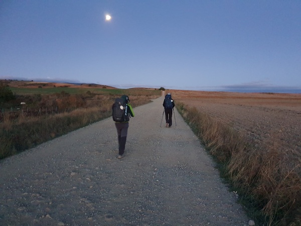
Pilgrims heading up Route Napoleon to cross the Pyrenees. Beautiful weather on the first day.
- Photographer: Claus Nedergaard Jacobsen
- Date Taken: 2019:10:08 09:09:49
- GPS Location: 43.1368378N, -1.2384432E

Pilgrims heading up Route Napoleon to cross the Pyrenees. Beautiful weather on the first day.
- Photographer: Claus Nedergaard Jacobsen
- Date Taken: 2019:10:08 09:09:53
- GPS Location: 43.1341852N, -1.2384224E
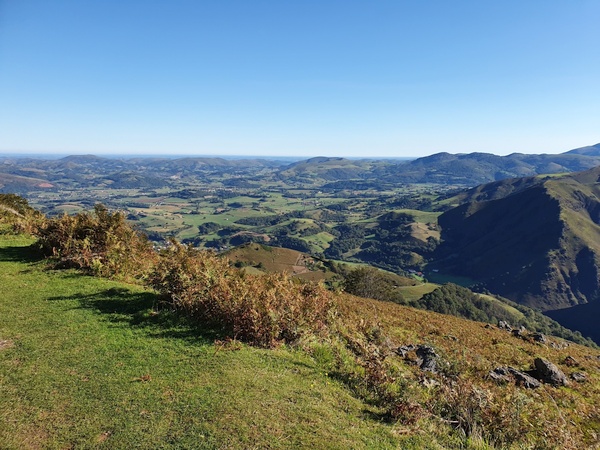
View of the mountains from the climb up the Pyrenees.
- Photographer: Claus Nedergaard Jacobsen
- Date Taken: 2019:10:08 09:09:57
- GPS Location: 43.1341852N, -1.2384224E
Climbing the Pyrenees. Not exactly rock climbing but the pulse gets up and you get to sweat.
- Photographer: Claus Nedergaard Jacobsen
- Date Taken: 2019:10:08 09:10:12
- GPS Location: 43.1341852N, -1.2384224E
Beautiful scenery when ascending to the pass between France and Spain via Route Napoleon.
- Photographer: Claus Nedergaard Jacobsen
- Date Taken: 2019:10:08 10:12:49
- GPS Location: 43.1232969N, -1.2445826E

Climbing the Pyrenees. Not exactly rock climbing but the pulse gets up and you get to sweat.
- Photographer: Claus Nedergaard Jacobsen
- Date Taken: 2019:10:08 10:12:53
- GPS Location: 43.1232969N, -1.2445826E

Climbing the Pyrenees. Not exactly rock climbing but the pulse gets up and you get to sweat.
- Photographer: Claus Nedergaard Jacobsen
- Date Taken: 2019:10:08 10:12:57
- GPS Location: 43.1232969N, -1.2445826E

Climbing the Pyrenees. Not exactly rock climbing but the pulse gets up and you get to sweat.
- Photographer: Claus Nedergaard Jacobsen
- Date Taken: 2019:10:08 10:17:29
- GPS Location: 43.1217761N, -1.2436486E
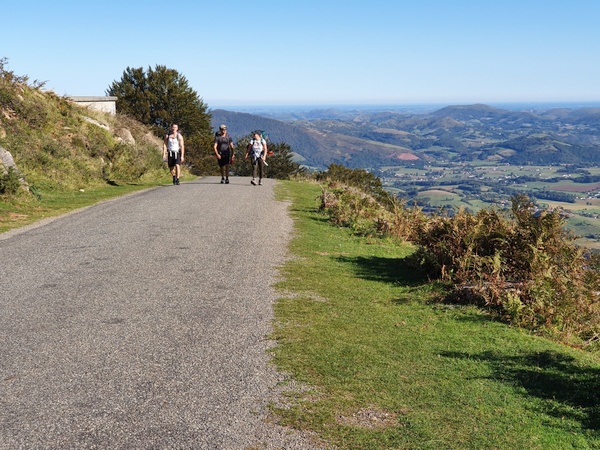
Other pilgrims walking up Route Napoleon. Beautfiful view into France
- Photographer: Claus Nedergaard Jacobsen
- Date Taken: 2019:10:08 10:52:41
- GPS Location: 43.11231N, -1.2372913E
Beautfiful view into France
- Photographer: Claus Nedergaard Jacobsen
- Date Taken: 2019:10:08 10:52:48
- GPS Location: 43.11231N, -1.2372913E
Route Napoleon, still in France. Bright sunny day. Beautiful
- Photographer: Claus Nedergaard Jacobsen
- Date Taken: 2019:10:08 10:52:53
- GPS Location: 43.11231N, -1.2372913E

Nice water hole on Route Napoleon. Still in France
- Photographer: Claus Nedergaard Jacobsen
- Date Taken: 2019:10:08 10:57:18
- GPS Location: 43.1095968N, -1.2385086E

Route Napoleon. France
- Photographer: Claus Nedergaard Jacobsen
- Date Taken: 2019:10:08 11:52:07
- GPS Location: 43.1079997N, -1.2393471E

Beautiful flowers near the Camino in France. Not at the top of the Pyrenees yet.
- Photographer: Claus Nedergaard Jacobsen
- Date Taken: 2019:10:08 11:54:21
- GPS Location: 43.1078022N, -1.2393343E

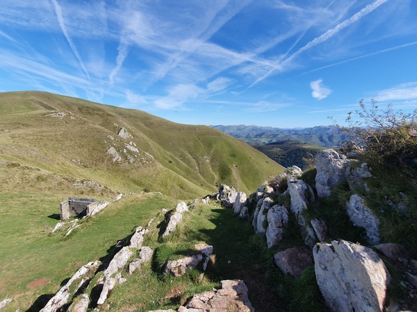
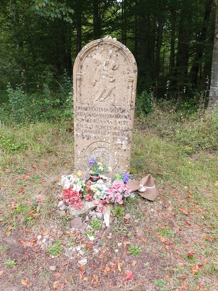
The first of many milestones with remembrance stones
- Photographer: Claus Nedergaard Jacobsen
- Date Taken: 2019:10:08 12:13:14
- GPS Location: 43.0978829N, -1.2413242E
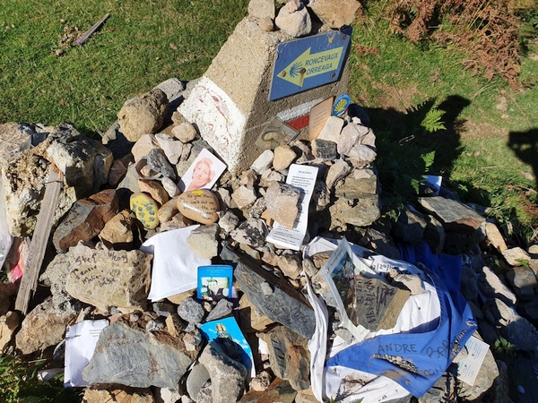
The first of many milestones with remembrance stones
- Photographer: Claus Nedergaard Jacobsen
- Date Taken: 2019:10:08 12:13:36
- GPS Location: 43.0978829N, -1.2413242E

The first of many milestones with remembrance stones
- Photographer: Claus Nedergaard Jacobsen
- Date Taken: 2019:10:08 12:13:55
- GPS Location: 43.0978829N, -1.2413242E
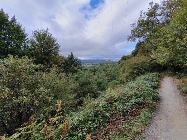
Still in France. Approaching the top of the Pyrenees.
- Photographer: Claus Nedergaard Jacobsen
- Date Taken: 2019:10:08 12:57:08
- GPS Location: 43.0895906N, -1.246605E

Sheep in France
- Photographer: Claus Nedergaard Jacobsen
- Date Taken: 2019:10:08 12:59:43
- GPS Location: 43.0892269N, -1.2470906E

We thought this was the border with Saint statues but it was not. La Vierge de Biakorri
- Photographer: Claus Nedergaard Jacobsen
- Date Taken: 2019:10:08 13:19:34
- GPS Location: 43.0804348N, -1.2516774E

Lovely grass field in front of the the Saint statues, La Vierge de Biakorri
- Photographer: Claus Nedergaard Jacobsen
- Date Taken: 2019:10:08 13:20:45
- GPS Location: 43.0804422N, -1.2516393E
Lovely grass field in front of the Saint statues, La Vierge de Biakorri
- Photographer: Claus Nedergaard Jacobsen
- Date Taken: 2019:10:08 13:20:56
- GPS Location: 43.0804422N, -1.2516393E
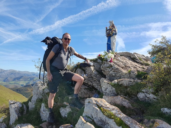
Saint statues at "La Vierge de Biakorri", shortly before the Spanish border
- Photographer: Claus Nedergaard Jacobsen
- Date Taken: 2019:10:08 13:30:46
- GPS Location: 43.0805093N, -1.2516503E

Eagles flying in the wind
- Photographer: Claus Nedergaard Jacobsen
- Date Taken: 2019:10:08 14:06:55
- GPS Location: 43.0725524N, -1.2668225E

Eagles flying in the wind
- Photographer: Claus Nedergaard Jacobsen
- Date Taken: 2019:10:08 14:07:08
- GPS Location: 43.0725524N, -1.2668225E

Eagles flying in the wind
- Photographer: Claus Nedergaard Jacobsen
- Date Taken: 2019:10:08 14:07:09
- GPS Location: 43.0725524N, -1.2668225E

Cruz de Thibault
- Photographer: Claus Nedergaard Jacobsen
- Date Taken: 2019:10:08 14:30:20
- GPS Location: 43.0590265N, -1.2674985E

Cruz de Thibault. In memory of resistance people tortured to death during WW2.
- Photographer: Claus Nedergaard Jacobsen
- Date Taken: 2019:10:08 14:32:49
- GPS Location: 43.0582836N, -1.2672466E

View of the Pyrenees
- Photographer: Claus Nedergaard Jacobsen
- Date Taken: 2019:10:08 14:48:34
- GPS Location: 43.0492961N, -1.266385E

View of the Pyrenees
- Photographer: Claus Nedergaard Jacobsen
- Date Taken: 2019:10:08 14:48:41
- GPS Location: 43.0492961N, -1.266385E

View of the Pyrenees
- Photographer: Claus Nedergaard Jacobsen
- Date Taken: 2019:10:08 14:48:45
- GPS Location: 43.0492961N, -1.266385E

765 km to go according to this sign at the French side of the border. Here St. James is "Saint-Jacques". We call him "Jacob" and so do the Germans
- Photographer: Claus Nedergaard Jacobsen
- Date Taken: 2019:10:08 14:52:26
- GPS Location: 43.0473271N, -1.2649247E

Finally at the French-Spanish border, "Fuente de Roldán". The lady is Australian, I found out.
- Photographer: Claus Nedergaard Jacobsen
- Date Taken: 2019:10:08 14:53:16
- GPS Location: 43.0473271N, -1.2649247E

The French-Spanish border, "Fuente de Roldán". No passport control
- Photographer: Claus Nedergaard Jacobsen
- Date Taken: 2019:10:08 15:02:43
- GPS Location: 43.0468308N, -1.2647437E
The French-Spanish border, "Fuente de Roldán". No passport control for humans. But animals have to demonstrate ability to cross that grid
- Photographer: Claus Nedergaard Jacobsen
- Date Taken: 2019:10:08 15:03:02
- GPS Location: 43.046799N, -1.2647258E

Into Spain
- Photographer: Claus Nedergaard Jacobsen
- Date Taken: 2019:10:08 15:27:27
- GPS Location: 43.0384725N, -1.2833846E
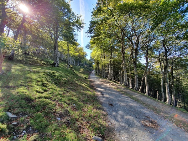
Beautiful autumn day when entering Spain through wood.
- Photographer: Claus Nedergaard Jacobsen
- Date Taken: 2019:10:08 15:27:40
- GPS Location: 43.0384725N, -1.2833846E

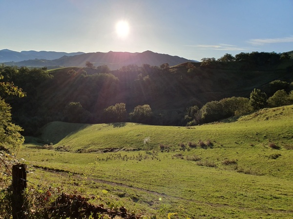
Hilly landscape. Still in the Pyrenees at some 1400 meter altitude. We started out in 300 meters at Saint Jean Pied de Port
- Photographer: Claus Nedergaard Jacobsen
- Date Taken: 2019:10:08 15:34:37
- GPS Location: 43.0369722N, -1.2893322E

Hilly landscape. Still in the Pyrenees at some 1400 meter altitude. Beautiful autumn colours.
- Photographer: Claus Nedergaard Jacobsen
- Date Taken: 2019:10:08 15:41:13
- GPS Location: 43.0345439N, -1.2914488E

Hilly landscape. Still in the Pyrenees at some 1400 meter altitude. Beautiful autumn colours.
- Photographer: Claus Nedergaard Jacobsen
- Date Taken: 2019:10:08 15:49:56
- GPS Location: 43.0305168N, -1.2951544E
Hilly landscape. Still in the Pyrenees at some 1400 meter altitude. Beautiful autumn colours.
- Photographer: Claus Nedergaard Jacobsen
- Date Taken: 2019:10:08 15:50:40
- GPS Location: 43.0305168N, -1.2951544E
Hilly landscape. Still in the Pyrenees at some 1400 meter altitude. Beautiful autumn colours.
- Photographer: Claus Nedergaard Jacobsen
- Date Taken: 2019:10:08 15:50:40
- GPS Location: 43.0305168N, -1.2951544E
Fortín Wellington. Finally we reached the top. Now it is downhill. Which turned out to be more difficult than uphill.
- Photographer: Claus Nedergaard Jacobsen
- Date Taken: 2019:10:08 15:59:07
- GPS Location: 43.0262074N, -1.2954276E

Horses in the mountains. No fences, we could tell. Wonder how they catch them. With food, probably
- Photographer: Claus Nedergaard Jacobsen
- Date Taken: 2019:10:08 15:59:19
- GPS Location: 43.0262074N, -1.2954276E
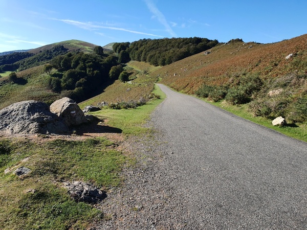
Downhill through wood into Spain towards Roncevalles.
- Photographer: Claus Nedergaard Jacobsen
- Date Taken: 2019:10:08 16:22:11
- GPS Location: 43.0193654N, -1.2989451E
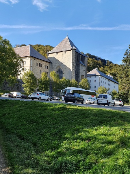
The monastery at Roncevalle where I ended up sleeping. It had but large dormitories.
- Photographer: Claus Nedergaard Jacobsen
- Date Taken: 2019:10:08 17:12:30
- GPS Location: 43.0087899N, -1.3186502E

Sign next to the monastery. This is via road, though, not the Camino.
- Photographer: Claus Nedergaard Jacobsen
- Date Taken: 2019:10:08 17:18:00
- GPS Location: 43.0079578N, -1.3194857E

My German friend, Stefan, with whom I drank a beer at Roncevalles. Well then another, then .. I think we stopped at 5. Boy, it was good. Stefan and I are still in contact.
- Photographer: Claus Nedergaard Jacobsen
- Date Taken: 2019:10:08 19:10:31
- GPS Location: 43.0085179N, -1.3195887E
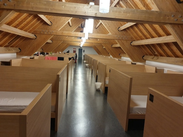
A dormitory at Roncevalles. 100 beds in each but lots of privacy. No gender separation. Excellent quality, excellent bathrooms. I think they have a total of more than 500 beds. Run by voluntaries. No complaints about my snoring....
- Photographer: Claus Nedergaard Jacobsen
- Date Taken: 2019:10:08 21:57:15
- GPS Location: 43.0102987N, -1.3193782E
Day 2, Wednesday, October 9

Day 2: A cross right outside Roncevalles
- Photographer: Claus Nedergaard Jacobsen
- Date Taken: 2019:10:09 08:31:49
- GPS Location: 43.0062058N, -1.3193744E

Right outside Roncevalles
- Photographer: Claus Nedergaard Jacobsen
- Date Taken: 2019:10:09 09:26:41
- GPS Location: 42.9896724N, -1.3430454E
Another cross right outside Roncevalles
- Photographer: Claus Nedergaard Jacobsen
- Date Taken: 2019:10:09 10:24:34
- GPS Location: 42.9799348N, -1.3866133E
Green colours at the beginning of the Camino, early October
- Photographer: Claus Nedergaard Jacobsen
- Date Taken: 2019:10:09 10:35:58
- GPS Location: 42.9777331N, -1.3953889E

- Photographer: Claus Nedergaard Jacobsen
- Date Taken: 2019:10:09 12:49:18
- GPS Location: 42.9610467N, -1.4503549E
Heading into Zubiri after 20 km. The guidebook recommended to stay here but I decided to continue a little bit ....
- Photographer: Claus Nedergaard Jacobsen
- Date Taken: 2019:10:09 15:11:46
- GPS Location: 42.9308663N, -1.499233E

A German (I think) hiking friend. Damn, forgot his name.
- Photographer: Claus Nedergaard Jacobsen
- Date Taken: 2019:10:09 15:11:59
- GPS Location: 42.9308663N, -1.499233E

A French lady who had dined with us last night at Roncevalles. I walked with her a while after Zubiri but lost her.
- Photographer: Claus Nedergaard Jacobsen
- Date Taken: 2019:10:09 15:57:31
- GPS Location: 42.9161663N, -1.5119403E

An old Church at Santa Lucia undergoing reconstruction
- Photographer: Claus Nedergaard Jacobsen
- Date Taken: 2019:10:09 16:24:02
- GPS Location: 42.909599N, -1.5212315E

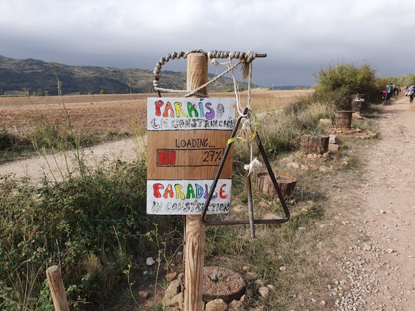
What it said on the sign
- Photographer: Claus Nedergaard Jacobsen
- Date Taken: 2019:10:09 16:25:06
- GPS Location: 42.911646N, -1.5255528E

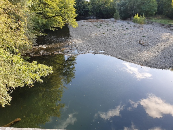
Running water. Can't get enough of it. River Arga after Zubiri
- Photographer: Claus Nedergaard Jacobsen
- Date Taken: 2019:10:09 17:28:04
- GPS Location: 42.89022N, -1.5576431E
Crossing the river Arga shortly before Zabaldika
- Photographer: Claus Nedergaard Jacobsen
- Date Taken: 2019:10:09 18:25:09
- GPS Location: 42.8597294N, -1.5739886E

Crossing the river Arga shortly before Zabaldika
- Photographer: Claus Nedergaard Jacobsen
- Date Taken: 2019:10:09 18:25:27
- GPS Location: 42.8603979N, -1.5742179E
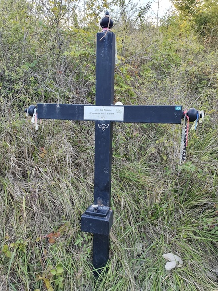
"Fin del Camino" - a life ended here. Must have been a beautiful ending, though
- Photographer: Claus Nedergaard Jacobsen
- Date Taken: 2019:10:09 18:32:36
- GPS Location: 42.857416N, -1.5778142E

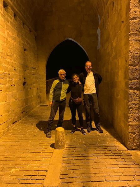
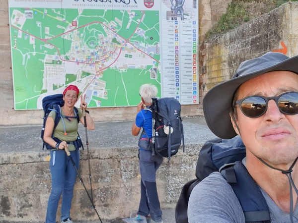
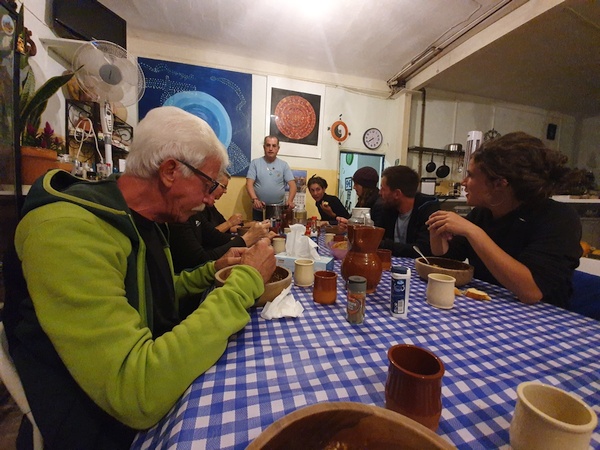
First gathering of the group - at Albergue Parroquial at Zabaldica
- Photographer: Fabrizio Ciappone
- Date Taken: 2019:10:09 20:30:35
- GPS Location: 42.8559436N, -1.5819013E
Day 3, Thursday, October 10
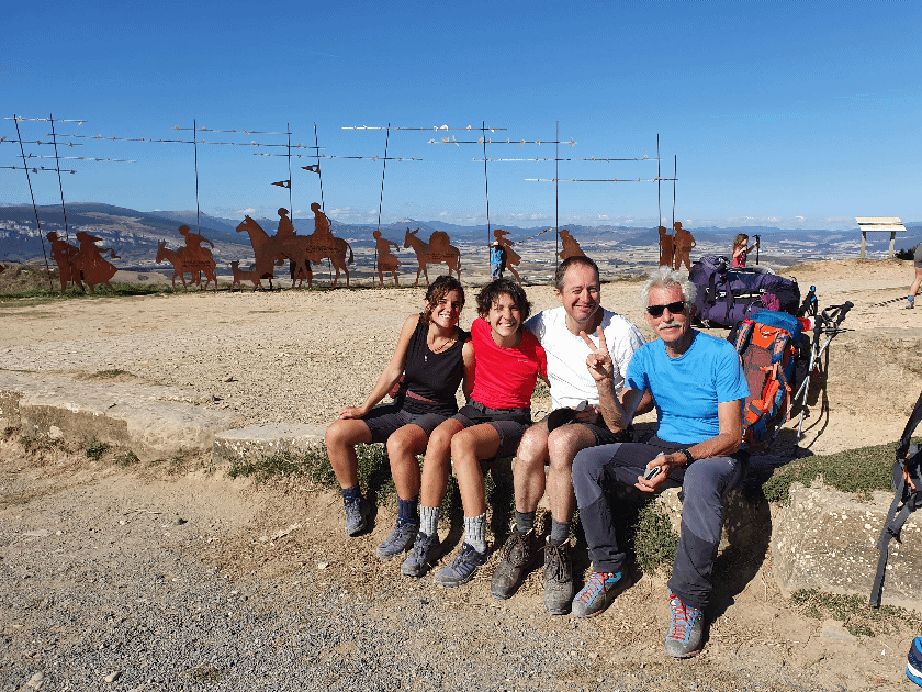
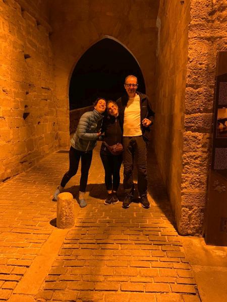
Eleonora, Carola, Claus and Fabrizio. This is the day when we formed a team. Elisabeth had continued.
- Photographer: Claus Nedergaard Jacobsen
- Date Taken: 2019:10:10 15:51:31
- GPS Location: 42.7758891N, -1.7129823E

Just outside the wonderful Albergue Parroquial at Zabaldica (hermanas del Sagrado Corazón)
- Photographer: Claus Nedergaard Jacobsen
- Date Taken: 2019:10:10 08:06:30
- GPS Location: 42.8559436N, -1.5819013E

Outside the wonderful Albergue Parroquial at Zabaldica (hermanas del Sagrado Corazón), where I first met Elisabeth, Fabricio, Eleonora and Carola. It was run by a Nun Order called "Sacre Coeur"
- Photographer: Claus Nedergaard Jacobsen
- Date Taken: 2019:10:10 08:06:48
- GPS Location: 42.8559436N, -1.5819013E

The wonderful Albergue Parroquial at Zabaldica (hermanas del Sagrado Corazón) where we were welcomed by nuns when arriving late, cold and hungry (after 36 km)
- Photographer: Claus Nedergaard Jacobsen
- Date Taken: 2019:10:10 08:07:15
- GPS Location: 42.8558638N, -1.5818817E

Day 3 - into Pamplona
- Photographer: Claus Nedergaard Jacobsen
- Date Taken: 2019:10:10 08:32:30
- GPS Location: 42.8408201N, -1.5868001E

Entering Pamplona via Batán Villava/Atarrabia
- Photographer: Claus Nedergaard Jacobsen
- Date Taken: 2019:10:10 08:50:54
- GPS Location: 42.8363834N, -1.6032968E

Parroquia de San Andrés in Pamplona
- Photographer: Claus Nedergaard Jacobsen
- Date Taken: 2019:10:10 08:56:44
- GPS Location: 42.8333246N, -1.6065411E

Chilly in the morning
- Photographer: Claus Nedergaard Jacobsen
- Date Taken: 2019:10:10 09:00:33
- GPS Location: 42.831307N, -1.6082696E

Puente de Magdalena in Pamplona. Early in the morning as you can tell from the shadows.
- Photographer: Claus Nedergaard Jacobsen
- Date Taken: 2019:10:10 09:38:35
- GPS Location: 42.8210641N, -1.6375594E
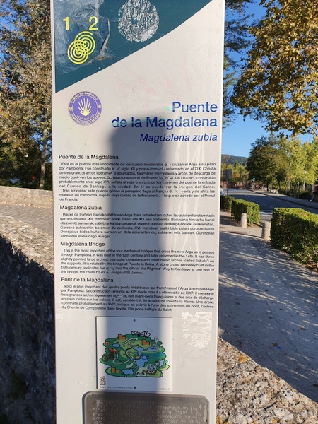
Puente de Magdalena in Pamplona. One of four bridges crossing river Arga but the most important one. Related to the one at Puenta de la Reina.
- Photographer: Claus Nedergaard Jacobsen
- Date Taken: 2019:10:10 09:38:48
- GPS Location: 42.8210641N, -1.6375594E

River Arga seen from Puenta de la Magdalena
- Photographer: Claus Nedergaard Jacobsen
- Date Taken: 2019:10:10 09:41:08
- GPS Location: 42.8210391N, -1.6379089E

River Arga seen from Puenta de la Magdalena
- Photographer: Claus Nedergaard Jacobsen
- Date Taken: 2019:10:10 09:41:24
- GPS Location: 42.8210391N, -1.6379089E

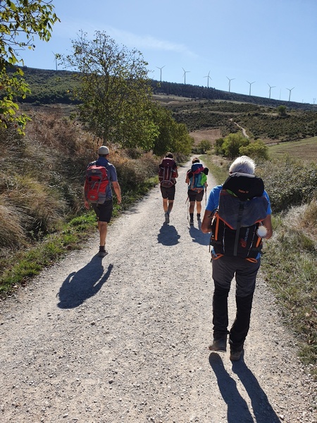
Just outside Pamplona. Lots of wind mills at the ridge in front.
- Photographer: Claus Nedergaard Jacobsen
- Date Taken: 2019:10:10 12:27:25
- GPS Location: 42.7793244N, -1.6868472E

Look back at Pamplona. I walked through fast and did not have time to watch much.
- Photographer: Claus Nedergaard Jacobsen
- Date Taken: 2019:10:10 13:10:33
- GPS Location: 42.7590256N, -1.7139314E

Look back at Pamplona. I walked through fast and did not have time to watch much.
- Photographer: Claus Nedergaard Jacobsen
- Date Taken: 2019:10:10 13:10:56
- GPS Location: 42.7599019N, -1.7008263E
Carola, Eleonora and Fabrizio and another hiker in front.
- Photographer: Claus Nedergaard Jacobsen
- Date Taken: 2019:10:10 15:05:12
- GPS Location: 42.7447622N, -1.7248983E

Approaching Alto Del Perdon. Mountains to the north. Plenty of farming.
- Photographer: Claus Nedergaard Jacobsen
- Date Taken: 2019:10:10 15:20:58
- GPS Location: 42.7391047N, -1.7334347E

Another spot with remembrance stones.
- Photographer: Claus Nedergaard Jacobsen
- Date Taken: 2019:10:10 15:27:17
- GPS Location: 42.7374644N, -1.7379383E

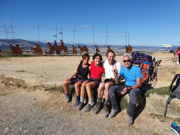
Close to Alto Del Perdón (I think - unprecise time)
- Photographer: Fabrizio Ciappone
- Date Taken: 2019:10:10 15:30:58
- GPS Location: 42.7358928N, -1.7424178E

Lots of wind mills when mounting Alto Del Perdón
- Photographer: Claus Nedergaard Jacobsen
- Date Taken: 2019:10:10 15:34:45
- GPS Location: 42.7358928N, -1.7424178E

Mirador Alto Del Perdón. Mountain of forgiveness.
- Photographer: Claus Nedergaard Jacobsen
- Date Taken: 2019:10:10 15:34:54
- GPS Location: 42.7358928N, -1.7424178E

El Camino del Viento. This place is also where winds cross.
- Photographer: Claus Nedergaard Jacobsen
- Date Taken: 2019:10:10 15:40:11
- GPS Location: 42.7358823N, -1.7426054E

Elizabeth and Fabrizio at Alto Del Perdón.
- Photographer: Claus Nedergaard Jacobsen
- Date Taken: 2019:10:10 15:40:19
- GPS Location: 42.7358823N, -1.7426054E

Mirador Alto Del Perdón
- Photographer: Claus Nedergaard Jacobsen
- Date Taken: 2019:10:10 15:43:15
- GPS Location: 42.7358377N, -1.7424068E
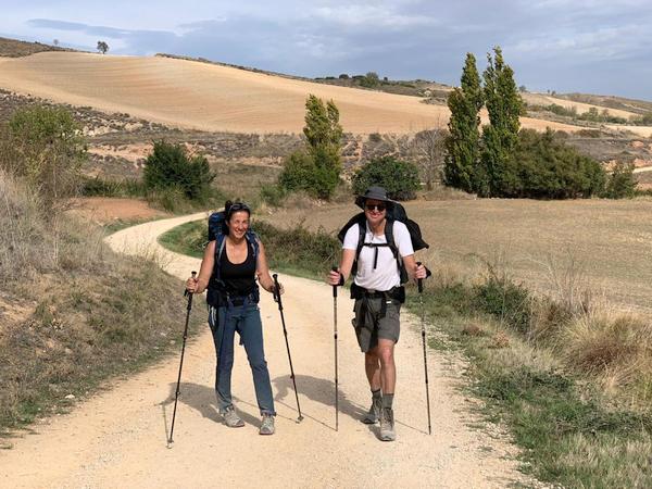
Eleonora, Carola, Claus and Fabrizio. This is the day when we formed a team. Elisabeth had continued.
- Photographer: Claus Nedergaard Jacobsen
- Date Taken: 2019:10:10 15:51:31
- GPS Location: 42.7758891N, -1.7129823E

Eleonora, Carola, Claus and Fabrizio. This is the day when we formed a team. Elisabeth had continued.
- Photographer: Claus Nedergaard Jacobsen
- Date Taken: 2019:10:10 15:51:44
- GPS Location: 42.7758891N, -1.7129823E

A German man hiked with his two daughters. There was always a trail of women around who wanted to help
- Photographer: Claus Nedergaard Jacobsen
- Date Taken: 2019:10:10 16:05:56
- GPS Location: 42.7356597N, -1.7425228E

A statue for Saint Mary. Where we caught up with Elisabeth
- Photographer: Claus Nedergaard Jacobsen
- Date Taken: 2019:10:10 16:49:22
- GPS Location: 42.7135977N, -1.7570907E
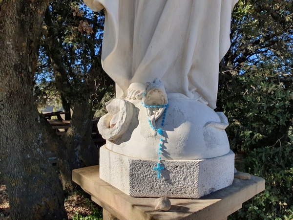
Saint Mary steps on the snake
- Photographer: Claus Nedergaard Jacobsen
- Date Taken: 2019:10:10 16:54:17
- GPS Location: 42.7135597N, -1.7570947E

Fabrizio, Carola and Eleonora
- Photographer: Claus Nedergaard Jacobsen
- Date Taken: 2019:10:10 17:10:36
- GPS Location: 42.7057768N, -1.7603058E
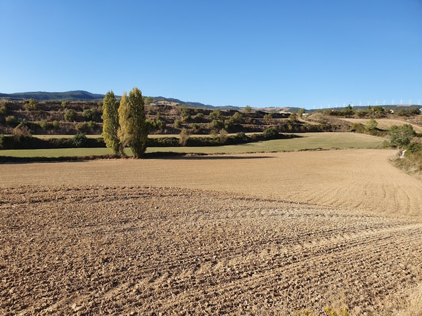
Farmland. Lots of it.
- Photographer: Claus Nedergaard Jacobsen
- Date Taken: 2019:10:10 17:15:32
- GPS Location: 42.7031018N, -1.7607768E

Looking back at Alto Del Perdón. Beautiful day.
- Photographer: Claus Nedergaard Jacobsen
- Date Taken: 2019:10:10 17:15:45
- GPS Location: 42.6975631N, -1.7853805E

Now we walked the first 100 km.
- Photographer: Claus Nedergaard Jacobsen
- Date Taken: 2019:10:10 17:33:20
- GPS Location: 42.6929533N, -1.7686192E

Lots of snails.
- Photographer: Claus Nedergaard Jacobsen
- Date Taken: 2019:10:10 17:49:07
- GPS Location: 42.6854926N, -1.7756417E

Iglesia de San Juan Bautista - In Obanos shortly before Puenta de la Reina.
- Photographer: Claus Nedergaard Jacobsen
- Date Taken: 2019:10:10 18:06:27
- GPS Location: 42.6793249N, -1.7861035E

Iglesia de San Juan Bautista - In Obanos shortly before Puenta de la Reina.
- Photographer: Claus Nedergaard Jacobsen
- Date Taken: 2019:10:10 18:10:22
- GPS Location: 42.6792754N, -1.7866198E

Having dinner in Puenta de la Reina. Was this the first red wine that Fabizio introduced to us?
- Photographer: Claus Nedergaard Jacobsen
- Date Taken: 2019:10:10 20:57:39
- GPS Location: 42.6723719N, -1.8138282E
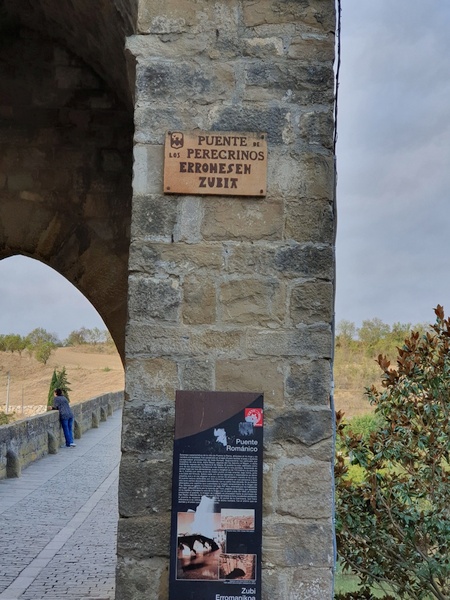
Puente Románico at the outskirts of Puenta la Reina. Crosses river Arga.
- Photographer: Fabrizio Ciappone
- Date Taken: 2019:10:10 21:00:26
- GPS Location: 42.67N, -1.82E

Puente Románico at the outskirts of Puenta la Reina. Crosses river Arga.
- Photographer: Fabrizio Ciappone
- Date Taken: 2019:10:10 21:00:26
- GPS Location: 42.670124N, -1.8202487E
Puente Románico at the outskirts of Puenta la Reina. Crosses river Arga.
- Photographer: Fabrizio Ciappone
- Date Taken: 2019:10:10 21:00:26
- GPS Location: 42.670124N, -1.8202487E
Day 4, Friday, October 11
Day 4 in Puenta de la Reina. Time to by walking sticks.
- Photographer: Claus Nedergaard Jacobsen
- Date Taken: 2019:10:11 08:42:44
- GPS Location: 42.6723501N, -1.8135393E
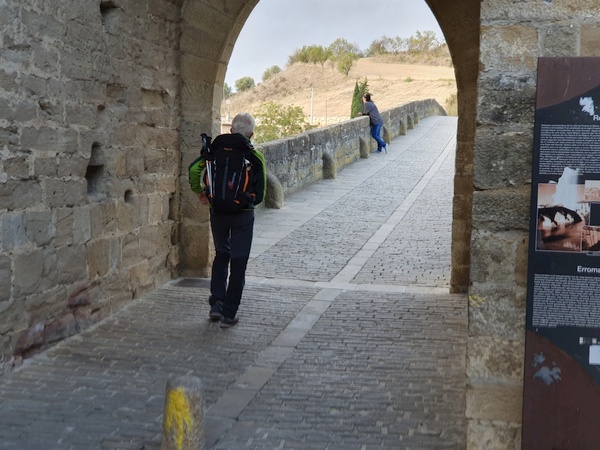
Puente Románico at the outskirts of Puenta la Reina. Crosses river Arga.
- Photographer: Claus Nedergaard Jacobsen
- Date Taken: 2019:10:11 09:01:47
- GPS Location: 42.6714211N, -1.8181593E
Puente Románico at the outskirts of Puenta la Reina. Crosses river Arga.
- Photographer: Claus Nedergaard Jacobsen
- Date Taken: 2019:10:11 09:01:53
- GPS Location: 42.6714211N, -1.8181593E
Puente Románico at the outskirts of Puenta la Reina. Crosses river Arga.
- Photographer: Claus Nedergaard Jacobsen
- Date Taken: 2019:10:11 09:03:07
- GPS Location: 42.671204N, -1.8186837E

Entering Cirauqui
- Photographer: Claus Nedergaard Jacobsen
- Date Taken: 2019:10:11 10:20:19
- GPS Location: 42.6748452N, -1.8857448E

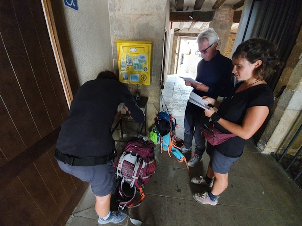
Having our pilgrim passports stamped at Cirauqui
- Photographer: Claus Nedergaard Jacobsen
- Date Taken: 2019:10:11 10:36:58
- GPS Location: 42.6754279N, -1.8912752E
Having our pilgrim passports stamped at Cirauqui
- Photographer: Claus Nedergaard Jacobsen
- Date Taken: 2019:10:11 10:37:21
- GPS Location: 42.6754279N, -1.8912752E
A couple of kilometers after Cirauqui we could have gone for this funny cafe. But we opted for a detour to find ...? But we did not find it unfortunately.
- Photographer: Claus Nedergaard Jacobsen
- Date Taken: 2019:10:11 11:16:33
- GPS Location: 42.6791616N, -1.9095736E

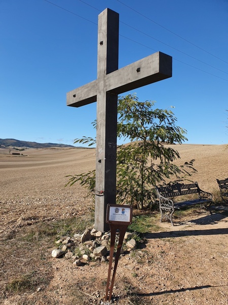
At this place, close to Lorca, a Dane lost his life in 2011. The cross was erected by the Danish Camino Pilgrims.
- Photographer: Claus Nedergaard Jacobsen
- Date Taken: 2019:10:11 13:01:09
- GPS Location: 42.6800289N, -1.9381284E

At this place, close to Lorca, a Dane lost his life in 2011. The cross was erected by the Danish Camino Pilgrims.
- Photographer: Claus Nedergaard Jacobsen
- Date Taken: 2019:10:11 13:01:19
- GPS Location: 42.6766261N, -1.9277881E

Beautiful crossing near Lorca. Watch the light.
- Photographer: Claus Nedergaard Jacobsen
- Date Taken: 2019:10:11 13:04:18
- GPS Location: 42.680029N, -1.9381285E

Strange way to serve a pizza - with a tiny hammer. We saw that several times.
- Photographer: Claus Nedergaard Jacobsen
- Date Taken: 2019:10:11 13:52:20
- GPS Location: 42.668919N, -1.9678182E

Eleonora and Fabrizio inspecting a field of sunflowers shortly after Lorca.
- Photographer: Claus Nedergaard Jacobsen
- Date Taken: 2019:10:11 14:57:13
- GPS Location: 42.6646046N, -1.9647407E
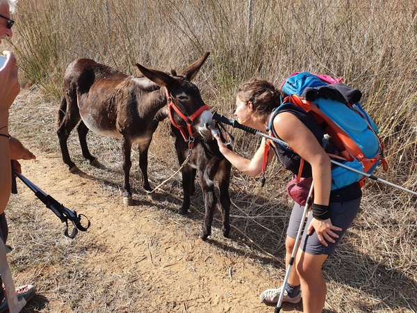
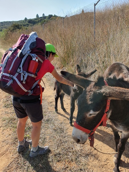
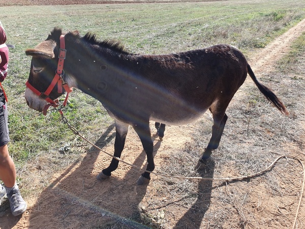
Eleonora and Carola were crazy with this little donkey and her foal. Shortly after Lorca.
- Photographer: Claus Nedergaard Jacobsen
- Date Taken: 2019:10:11 16:24:26
- GPS Location: 42.6617599N, -2.0119357E
Eleonora and Carola were crazy with this little donkey and her foal. Shortly after Lorca.
- Photographer: Claus Nedergaard Jacobsen
- Date Taken: 2019:10:11 16:25:49
- GPS Location: 42.6617599N, -2.0119357E

Eleonora and Carola were crazy with this little donkey and her foal. Shortly after Lorca.
- Photographer: Claus Nedergaard Jacobsen
- Date Taken: 2019:10:11 16:26:02
- GPS Location: 42.6617599N, -2.0119357E
Eleonora and Carola were crazy with this little donkey and her foal. Shortly after Lorca.
- Photographer: Claus Nedergaard Jacobsen
- Date Taken: 2019:10:11 16:26:55
- GPS Location: 42.661796N, -2.0118735E
Day 5, Saturday, October 12
My goodness, they really had a spring of wine. Fabrizio was right. Don't forget to turn on the sound.

Elisabeth and Claus shortly before Estella
- Photographer: Fabrizio Ciappone
- Date Taken: 2019:10:12 03:37:00
- GPS Location: 42.672373N, -1.9958757E
Elisabeth and Claus shortly before Estella
- Photographer: Fabrizio Ciappone
- Date Taken: 2019:10:12 03:37:00
- GPS Location: 42.672373N, -1.9958757E

Day 5: In Estella. A church named San Pedro close to Palace of the Kings of Navarre.
- Photographer: Claus Nedergaard Jacobsen
- Date Taken: 2019:10:12 08:36:03
- GPS Location: 42.6693495N, -2.0293619E

Walking through Estella.
- Photographer: Claus Nedergaard Jacobsen
- Date Taken: 2019:10:12 08:36:12
- GPS Location: 42.6693495N, -2.0293619E

In Ayegui shortly after Estella
- Photographer: Claus Nedergaard Jacobsen
- Date Taken: 2019:10:12 09:07:09
- GPS Location: 42.6544193N, -2.040767E

The famous Fountain of Wine that Fabrizio told us of but that we did not believe in, until we saw it.
- Photographer: Fabrizio Ciappone
- Date Taken: 2019:10:12 09:15:18
- GPS Location: 42.650979N, -2.0439232E
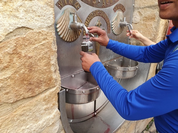
The famous Fountain of Wine that Fabrizio told us of but that we did not believe in, until we saw it.
- Photographer: Claus Nedergaard Jacobsen
- Date Taken: 2019:10:12 09:15:46
- GPS Location: 42.650979N, -2.0439232E

The famous Fountain of Wine that Fabrizio told us of but that we did not believe in, until we saw it.
- Photographer: Claus Nedergaard Jacobsen
- Date Taken: 2019:10:12 09:16:57
- GPS Location: 42.6508569N, -2.0436738E

Bodegas Irache: The famous Fountain of Wine that Fabrizio told us of but that we did not believe in, until we saw it.
- Photographer: Claus Nedergaard Jacobsen
- Date Taken: 2019:10:12 09:17:27
- GPS Location: 42.6508569N, -2.0436738E

It true: A fountain of Wine. Just outside Estella.
- Photographer: Claus Nedergaard Jacobsen
- Date Taken: 2019:10:12 09:21:50
- GPS Location: 42.6508569N, -2.0436738E
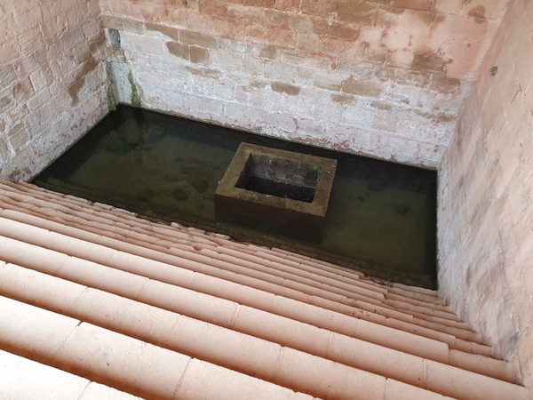
Fuente Medieval close to Castillo de Monjardin
- Photographer: Claus Nedergaard Jacobsen
- Date Taken: 2019:10:12 11:10:32
- GPS Location: 42.6122945N, -2.1089749E

Fuente Medieval. Castillo de Monjardin in the background
- Photographer: Claus Nedergaard Jacobsen
- Date Taken: 2019:10:12 11:11:00
- GPS Location: 42.6122945N, -2.1089749E
Iglesia San Andres close to Castillo de Monjardin
- Photographer: Claus Nedergaard Jacobsen
- Date Taken: 2019:10:12 11:15:27
- GPS Location: 42.6290458N, -2.1035107E

A sign seen anywhere along the Camino - in different variations.
- Photographer: Claus Nedergaard Jacobsen
- Date Taken: 2019:10:12 11:27:50
- GPS Location: 42.6206819N, -2.1027241E
This is how the Camino is marked through the town Los Arcos - and in other places.
- Photographer: Claus Nedergaard Jacobsen
- Date Taken: 2019:10:12 14:16:29
- GPS Location: 42.5702222N, -2.1922463E

Dead streets in Los Arcos.
- Photographer: Claus Nedergaard Jacobsen
- Date Taken: 2019:10:12 14:16:50
- GPS Location: 42.5701337N, -2.1921494E

Elisabeth and Claus having just crossed Rio de San Pedro. Close to Torres del Rio
- Photographer: Fabrizio Ciappone
- Date Taken: 2019:10:12 15:37:00
- GPS Location: 42.562751N, -2.1920957E

Elisabeth and Claus having just crossed Rio de San Pedro. Close to Torres del Rio
- Photographer: Fabrizio Ciappone
- Date Taken: 2019:10:12 15:37:00
- GPS Location: 42.562751N, -2.1920957E

Elisabeth and Claus having just crossed Rio de San Pedro. Close to Torres del Rio
- Photographer: Fabrizio Ciappone
- Date Taken: 2019:10:12 15:37:03
- GPS Location: 42.562751N, -2.1920957E

Fabrizio and Elisabeth having just crossed Rio de San Pedro. Close to Torres del Rio.
- Photographer: Claus Nedergaard Jacobsen
- Date Taken: 2019:10:12 15:37:41
- GPS Location: 42.5628618N, -2.2561536E

Entering Sansol on a windy day with lots of Lenticularis clouds
- Photographer: Claus Nedergaard Jacobsen
- Date Taken: 2019:10:12 15:52:30
- GPS Location: 42.5577778N, -2.2641667E

In Sansol. The Camino is really well marked almost everywhere.
- Photographer: Claus Nedergaard Jacobsen
- Date Taken: 2019:10:12 16:56:14
- GPS Location: 42.5522051N, -2.2664998E

In Sansol (WITH sun). Parroquia de San Andres
- Photographer: Claus Nedergaard Jacobsen
- Date Taken: 2019:10:12 17:04:59
- GPS Location: 42.5507382N, -2.2698497E

Parroquia de San Andres in Torres del Rio.
- Photographer: Claus Nedergaard Jacobsen
- Date Taken: 2019:10:12 19:04:59
- GPS Location: 42.5519877N, -2.2713724E
Fabrizio's wine suggestion in Torres del Rio.
- Photographer: Claus Nedergaard Jacobsen
- Date Taken: 2019:10:12 19:56:14
- GPS Location: 42.5514557N, -2.2708253E

Fabrizio's wine suggestion in Torres del Rio.
- Photographer: Claus Nedergaard Jacobsen
- Date Taken: 2019:10:12 19:56:26
- GPS Location: 42.5514557N, -2.2708253E
Day 6, Sunday, October 13

Day 6: I think this is Torres del Rio seen from a distance.
- Photographer: Claus Nedergaard Jacobsen
- Date Taken: 2019:10:13 08:25:45
- GPS Location: 42.5451587N, -2.287483E

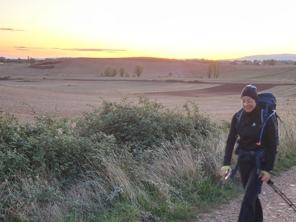
It is cold in the morning. We start out before the sun has risen. It is so wonderful when we finally get to see it. This photo is taken at 08:32 in the morning.
- Photographer: Claus Nedergaard Jacobsen
- Date Taken: 2019:10:13 08:32:11
- GPS Location: 42.5570791N, -2.2130604E

Look how the sun lightens the upper part of the landscape but it has not yet reached the lower part.
- Photographer: Claus Nedergaard Jacobsen
- Date Taken: 2019:10:13 08:45:12
- GPS Location: 42.5420604N, -2.2987509E
Elisabeth struggling with her first blisters. At this time she had already given up her boots and surrendered to sneakers. As did I for a while.
- Photographer: Claus Nedergaard Jacobsen
- Date Taken: 2019:10:13 09:38:55
- GPS Location: 42.5276188N, -2.3246746E
Entering Viana
- Photographer: Claus Nedergaard Jacobsen
- Date Taken: 2019:10:13 10:28:17
- GPS Location: 42.5172788N, -2.3544277E

Fabrizio (to the right) also entering Viana
- Photographer: Claus Nedergaard Jacobsen
- Date Taken: 2019:10:13 10:28:26
- GPS Location: 42.5172788N, -2.3544277E

This is where we entered the Rioja district
- Photographer: Claus Nedergaard Jacobsen
- Date Taken: 2019:10:13 12:44:41
- GPS Location: 42.4909836N, -2.4166013E

This is where we entered the Rioja district
- Photographer: Claus Nedergaard Jacobsen
- Date Taken: 2019:10:13 12:45:01
- GPS Location: 42.4906169N, -2.4156178E

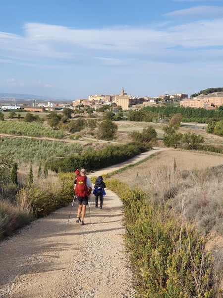
Entering Logrono. Fabrizio in front
- Photographer: Claus Nedergaard Jacobsen
- Date Taken: 2019:10:13 13:09:49
- GPS Location: 42.4824156N, -2.4342179E
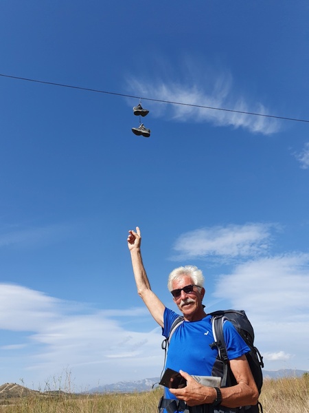
How on earth did the boots end up there?
- Photographer: Claus Nedergaard Jacobsen
- Date Taken: 2019:10:13 13:15:01
- GPS Location: 42.4789016N, -2.43635E

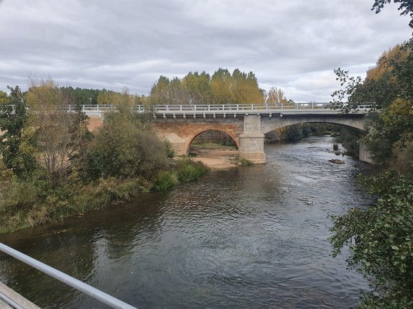
Puente de Piedra at the outskirts of Logrono. Crosses the river Ebro.
- Photographer: Claus Nedergaard Jacobsen
- Date Taken: 2019:10:13 13:44:23
- GPS Location: 42.4711035N, -2.4441242E
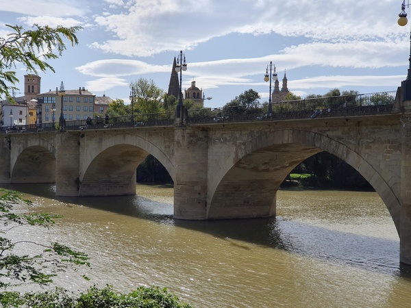
Puente de Piedra at the outskirts of Logrono. Crosses the river Ebro.
- Photographer: Claus Nedergaard Jacobsen
- Date Taken: 2019:10:13 13:44:42
- GPS Location: 42.4711035N, -2.4441242E

Misión Diocesena. Sign at church in Logrono.
- Photographer: Claus Nedergaard Jacobsen
- Date Taken: 2019:10:13 13:59:56
- GPS Location: 42.4677213N, -2.4474314E

A Church named Santiago el Real in Logrono
- Photographer: Claus Nedergaard Jacobsen
- Date Taken: 2019:10:13 14:00:41
- GPS Location: 42.4677541N, -2.4475159E

Lunch in Logrono. Elisabeth introduced us to Caña beers. Hard to beat habit.
- Photographer: Claus Nedergaard Jacobsen
- Date Taken: 2019:10:13 14:54:32
- GPS Location: 42.4668043N, -2.4492083E

Lunch in Logroño. Elisabeth introduced us to Caña beers. Hard to beat habit.
- Photographer: Claus Nedergaard Jacobsen
- Date Taken: 2019:10:13 14:54:34
- GPS Location: 42.4652087N, -2.4560557E
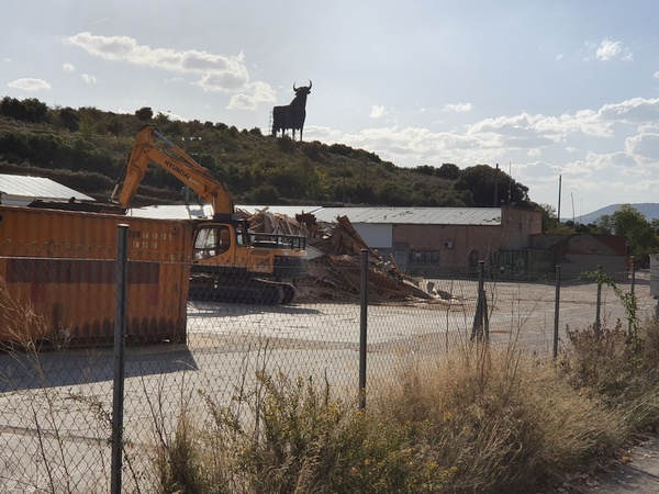
"The bull" located next to Highway A-12 close to Navarette. I am pretty sure, I saw it before, when I drove with my friends to fly gliders in Spain in 1988.
- Photographer: Claus Nedergaard Jacobsen
- Date Taken: 2019:10:13 17:06:25
- GPS Location: 42.4388242N, -2.5324451E

Botanique
- Photographer: Claus Nedergaard Jacobsen
- Date Taken: 2019:10:13 17:15:00
- GPS Location: 42.4381053N, -2.5379561E

Elizabeth entering Hospital de San Juan de Acre, the ruins of a medievel hospital (?) at Navarette.
- Photographer: Claus Nedergaard Jacobsen
- Date Taken: 2019:10:13 17:33:15
- GPS Location: 42.4349045N, -2.5510613E

Elizabeth entering Hospital de San Juan de Acre, the ruins of a medievel hospital (?) at Navarette.
- Photographer: Claus Nedergaard Jacobsen
- Date Taken: 2019:10:13 17:33:25
- GPS Location: 42.4349045N, -2.5510613E
Fabrizio entering Hospital de San Juan de Acre, the ruins of a medievel hospital (?) at Navarette.
- Photographer: Claus Nedergaard Jacobsen
- Date Taken: 2019:10:13 17:33:35
- GPS Location: 42.431156N, -2.5632931E

Claus at Hospital de San Juan de Acre, the ruins of a medieval hospital (?) at Navarette.
- Photographer: Elisabeth Cziep (AT)
- Date Taken: 2019:10:13 17:38:09
- GPS Location: 42.4349045N, -2.5510613E
The sign of a winery next to Hospital de San Juan de Acre at Navarette.
- Photographer: Claus Nedergaard Jacobsen
- Date Taken: 2019:10:13 17:41:07
- GPS Location: 42.4346149N, -2.5516835E

The Bull seen from another angle.
- Photographer: Claus Nedergaard Jacobsen
- Date Taken: 2019:10:13 17:54:24
- GPS Location: 42.4323961N, -2.5589175E
At the outskirts of Navarette close to 18:00 looking for a place to sleep - and dine
- Photographer: Claus Nedergaard Jacobsen
- Date Taken: 2019:10:13 17:54:50
- GPS Location: 42.4323961N, -2.5589175E
Day 7: Claus finally found coffee after at long drought.
- Photographer: Claus Nedergaard Jacobsen
- Date Taken: 2019:10:13 19:38:37
- GPS Location: 42.435021N, -2.6679517E

At 20:00. Moon is rising.
- Photographer: Claus Nedergaard Jacobsen
- Date Taken: 2019:10:13 20:03:14
- GPS Location: 42.4309081N, -2.5597113E

View of a Church from our Albergue for the night, La Casa Del Peregrino. I think this is where we almost managed to get locked out because we did not return before 20:00 hours.
- Photographer: Claus Nedergaard Jacobsen
- Date Taken: 2019:10:13 20:06:15
- GPS Location: 42.4306149N, -2.5598856E

Interior of Iglesia Nuestra Señora de la Asunción in Navarette
- Photographer: Claus Nedergaard Jacobsen
- Date Taken: 2019:10:13 20:19:32
- GPS Location: 42.4257827N, -2.556479E
Day 7, Monday, October 14

Day 7: Breakfast ticket at Navarette.
- Photographer: Claus Nedergaard Jacobsen
- Date Taken: 2019:10:14 08:01:20
- GPS Location: 42.4310627N, -2.5536917E
Day 7: Claus finally found coffee after at long drought.
- Photographer: Elisabeth Cziep (AT)
- Date Taken: 2019:10:14 09:53:07
- GPS Location: 42.435021N, -2.6679517E

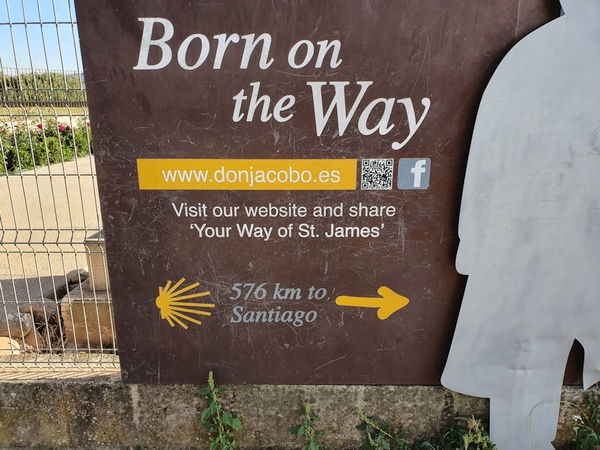
This sign said 593 km to go. But there were many contradicting signs.
- Photographer: Claus Nedergaard Jacobsen
- Date Taken: 2019:10:14 10:20:37
- GPS Location: 42.4126607N, -2.6345911E
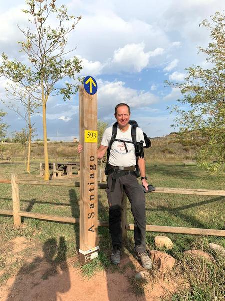
This sign said 593 km to go. But there were many contradicting signs.
- Photographer: Fabrizio Ciappone
- Date Taken: 2019:10:14 10:20:48
- GPS Location: 42.4126607N, -2.6345911E

Rioja district. Look how large the grapes are. Most had been harvested already but some fields were left. The grapes tasted wonderfully.
- Photographer: Claus Nedergaard Jacobsen
- Date Taken: 2019:10:14 10:42:59
- GPS Location: 42.4124921N, -2.645846E

Fabrizio and Elisabeth heading into thunderstorm ahead. Halfway between Logrono and Belorado.
- Photographer: Claus Nedergaard Jacobsen
- Date Taken: 2019:10:14 16:51:39
- GPS Location: 42.42474N, -2.874551E

In the ghost town of Ciriñuela at the strange albergue called Albergue Virgen de Guadelupe. For the first time we were all seated around the same table. It turned out to be quite nice.
- Photographer: Claus Nedergaard Jacobsen
- Date Taken: 2019:10:14 19:39:06
- GPS Location: 42.4127173N, -2.8943791E
In the ghost town of Ciriñuela at the strange albergue called Albergue Virgen de Guadelupe. For the first time we were all seated around the same table. It turned out to be quite nice. Eleonora and French Romain sitting next to each other. This is where they first met.
- Photographer: Claus Nedergaard Jacobsen
- Date Taken: 2019:10:14 19:39:11
- GPS Location: 42.4127173N, -2.8943791E
Day 8, Tuesday, October 15

Day 8: Breakfast table at Albergue Virgen de Guadelupoe in Ciriñuela - a more or less deserted ghost town.
- Photographer: Claus Nedergaard Jacobsen
- Date Taken: 2019:10:15 07:43:26
- GPS Location: 42.4127173N, -2.8943791E

Outside the strangely coloured and decorated Albergue Virgen de Guadelupe in Ciriñuela in the morning of Day 8. Fabrizio and Elisabeth preparing to leave.
- Photographer: Claus Nedergaard Jacobsen
- Date Taken: 2019:10:15 07:47:48
- GPS Location: 42.4127622N, -2.8942989E
Just outside Ciriñuela in the morning cold at 08:00. Elisabeth and Fabrizio
- Photographer: Claus Nedergaard Jacobsen
- Date Taken: 2019:10:15 08:00:17
- GPS Location: 42.4780353N, -2.9374177E

Just outside Ciriñuela in the morning cold at 08:06. The sun is starting to brighten the fields.
- Photographer: Claus Nedergaard Jacobsen
- Date Taken: 2019:10:15 08:06:47
- GPS Location: 42.4162805N, -2.9057742E

Just outside Ciriñuela in the morning cold at 08:06. The sun is starting to brighten the fields.
- Photographer: Claus Nedergaard Jacobsen
- Date Taken: 2019:10:15 08:07:05
- GPS Location: 42.4162832N, -2.9057732E

Elisabeth in the dark. But the sun is making its way over the horizon.
- Photographer: Claus Nedergaard Jacobsen
- Date Taken: 2019:10:15 08:20:17
- GPS Location: 42.4171609N, -2.8906899E
Elisabeth in the dark. But the sun is making its way over the horizon.
- Photographer: Claus Nedergaard Jacobsen
- Date Taken: 2019:10:15 08:20:24
- GPS Location: 42.4171609N, -2.8906899E

Sun is brightening the next village on the Camino, Santo Domingo de la Calzada
- Photographer: Claus Nedergaard Jacobsen
- Date Taken: 2019:10:15 08:31:49
- GPS Location: 42.4403146N, -2.9252424E

Sun is brightening the next village on the Camino, Santo Domingo de la Calzada
- Photographer: Claus Nedergaard Jacobsen
- Date Taken: 2019:10:15 08:39:55
- GPS Location: 42.429343N, -2.9263607E

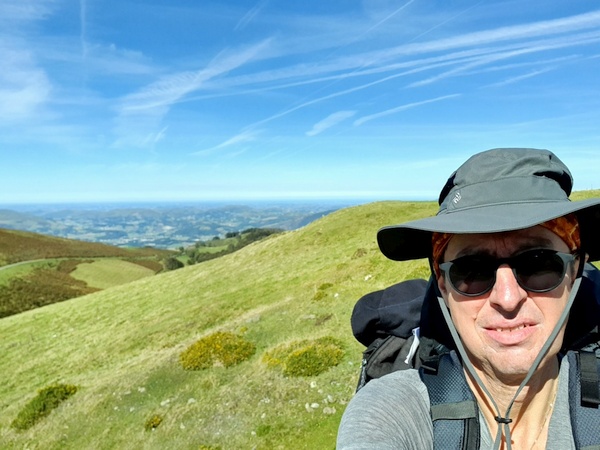
Yours truly caught in the sunrise. A rare sight.
- Photographer: Claus Nedergaard Jacobsen
- Date Taken: 2019:10:15 08:42:22
- GPS Location: 42.4293283N, -2.9263957E

Beautiful Camino sign at the entrance to Santo Domingo de la Calzada
- Photographer: Claus Nedergaard Jacobsen
- Date Taken: 2019:10:15 09:07:07
- GPS Location: 42.4392469N, -2.9442571E

Inside "Cathedral of Santo Domingo de la Calzada". This where they illustrate the story of the roasted rooster coming alive with live hens.
- Photographer: Claus Nedergaard Jacobsen
- Date Taken: 2019:10:15 09:50:40
- GPS Location: 42.443464N, -2.9580292E

Inside "Cathedral of Santo Domingo de la Calzada". This where they illustrate the story of the roasted rooster coming alive with live hens.
- Photographer: Claus Nedergaard Jacobsen
- Date Taken: 2019:10:15 09:50:44
- GPS Location: 42.443464N, -2.9580292E
Inside "Cathedral of Santo Domingo de la Calzada"
- Photographer: Claus Nedergaard Jacobsen
- Date Taken: 2019:10:15 09:53:10
- GPS Location: 42.4443663N, -2.9467855E

Inside "Cathedral of Santo Domingo de la Calzada"
- Photographer: Claus Nedergaard Jacobsen
- Date Taken: 2019:10:15 09:54:01
- GPS Location: 42.4443663N, -2.9467855E

Inside "Cathedral of Santo Domingo de la Calzada". They also had visualisation of the famous story built with LEGO figures.
- Photographer: Claus Nedergaard Jacobsen
- Date Taken: 2019:10:15 10:07:05
- GPS Location: 42.4415129N, -2.9533947E

Inside "Cathedral of Santo Domingo de la Calzada". They also had visualisation of the famous story built with LEGO figures. The innocent man hanged but still alive.
- Photographer: Claus Nedergaard Jacobsen
- Date Taken: 2019:10:15 10:08:02
- GPS Location: 42.4414913N, -2.9533656E

Inside "Cathedral of Santo Domingo de la Calzada". They also had visualisation of the famous story built with LEGO figures. The judge eating his rooster.
- Photographer: Claus Nedergaard Jacobsen
- Date Taken: 2019:10:15 10:08:30
- GPS Location: 42.4414913N, -2.9533656E

Inside "Cathedral of Santo Domingo de la Calzada". "The rooster and the hen"
- Photographer: Claus Nedergaard Jacobsen
- Date Taken: 2019:10:15 10:09:17
- GPS Location: 42.4415179N, -2.9534411E

Inside "Cathedral of Santo Domingo de la Calzada" in the art museum. The innocent man hanged but still alive.
- Photographer: Claus Nedergaard Jacobsen
- Date Taken: 2019:10:15 10:12:00
- GPS Location: 42.443464N, -2.9580292E

People bringing the story of the innocent man hanged to the judge. "If this is true, then these roosters could as well be alive...."
- Photographer: Claus Nedergaard Jacobsen
- Date Taken: 2019:10:15 10:12:11
- GPS Location: 42.443464N, -2.9580292E

The innocent man being salvaged.
- Photographer: Claus Nedergaard Jacobsen
- Date Taken: 2019:10:15 10:12:37
- GPS Location: 42.443464N, -2.9580292E

Another portal into "Cathedral of Santo Domingo de la Calzada".
- Photographer: Claus Nedergaard Jacobsen
- Date Taken: 2019:10:15 10:17:28
- GPS Location: 42.4410795N, -2.9542136E
Beautful cross and benches 1 km outside Santa Domingo de la Calzada
- Photographer: Claus Nedergaard Jacobsen
- Date Taken: 2019:10:15 10:59:40
- GPS Location: 42.4503769N, -2.9904862E

Fabrizio and Claus near Santa Domingo de la Calzada
- Photographer: Elisabeth Cziep (AT)
- Date Taken: 2019:10:15 11:02:51
- GPS Location: 42.4503769N, -2.9904862E

Entering Grañón where we had a lovely lunch.
- Photographer: Claus Nedergaard Jacobsen
- Date Taken: 2019:10:15 11:48:46
- GPS Location: 42.4515301N, -3.0247872E

Outdoor lunch place in Grañón. Wonderful sunshine. We do not think the Peugeot was able to move.
- Photographer: Claus Nedergaard Jacobsen
- Date Taken: 2019:10:15 12:35:46
- GPS Location: 42.4513627N, -3.0249827E

Outdoor lunch place in Grañón. Wonderful sunshine. We do not think the Peugeot was able to move.
- Photographer: Claus Nedergaard Jacobsen
- Date Taken: 2019:10:15 12:35:46
- GPS Location: 42.4513627N, -3.0249827E
Day 9, Wednesday, October 16

Day 9: Elisabeth just outside Belorado at 08:36. She should be rested. She had princess bed with purple linen last night. (Fabrizio, Elisabeth and I decided to go for small hotel rather than an albergue). We all had our clothes cleaned and dried. Wonderful
- Photographer: Claus Nedergaard Jacobsen
- Date Taken: 2019:10:16 08:36:08
- GPS Location: 42.417665N, -3.2058662E

Looking at Lenticularis clouds
- Photographer: Claus Nedergaard Jacobsen
- Date Taken: 2019:10:16 09:20:33
- GPS Location: 42.4121005N, -3.245619E
Just outside Tosantos. Looking at Ermita De La Virgen De La Peña
- Photographer: Claus Nedergaard Jacobsen
- Date Taken: 2019:10:16 09:21:48
- GPS Location: 42.4117728N, -3.2461175E

Believe this place is called San Roque (1 km west of Tosantos). Nice well
- Photographer: Claus Nedergaard Jacobsen
- Date Taken: 2019:10:16 09:44:06
- GPS Location: 42.4045122N, -3.2620409E

Another nice well in San Roque
- Photographer: Claus Nedergaard Jacobsen
- Date Taken: 2019:10:16 09:44:19
- GPS Location: 42.4045721N, -3.2619576E

The alter in Iglesia Parroquial (San Roque)
- Photographer: Claus Nedergaard Jacobsen
- Date Taken: 2019:10:16 09:47:16
- GPS Location: 42.4045721N, -3.2619576E

I think I wanted to catch the clouds in this photo but I failed.
- Photographer: Claus Nedergaard Jacobsen
- Date Taken: 2019:10:16 11:48:34
- GPS Location: 42.3878445N, -3.3094643E

Nice hippie/indian place called "Oasis Del Peregrino" in the middle of a forest 6 km after Villafranca. Nice music too. The hippie lady said you could pay what you wanted for the coffee.
- Photographer: Claus Nedergaard Jacobsen
- Date Taken: 2019:10:16 13:02:03
- GPS Location: 42.3695687N, -3.375018E

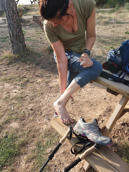
Time for some blister repair
- Photographer: Claus Nedergaard Jacobsen
- Date Taken: 2019:10:16 13:06:59
- GPS Location: 42.3695377N, -3.3751099E

Time for some blister repair
- Photographer: Claus Nedergaard Jacobsen
- Date Taken: 2019:10:16 13:07:02
- GPS Location: 42.3695377N, -3.3751099E

Nice hippie/indian place called "Oasis Del Peregrino" in the middle of a forest 6 km after Villafranca. Nice music too. The hippie lady said you could pay what you wanted for the coffee. Ivana has joined.
- Photographer: Claus Nedergaard Jacobsen
- Date Taken: 2019:10:16 13:07:35
- GPS Location: 42.369537N, -3.3751103E
Nice countryside. Could be Denmark.
- Photographer: Claus Nedergaard Jacobsen
- Date Taken: 2019:10:16 14:07:40
- GPS Location: 42.3776847N, -3.423669E

Beautiful lonely tree
- Photographer: Claus Nedergaard Jacobsen
- Date Taken: 2019:10:16 16:10:31
- GPS Location: 42.3719016N, -3.4638617E

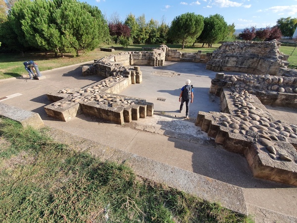
Entering Atapuerca, a place with stone age remains
- Photographer: Claus Nedergaard Jacobsen
- Date Taken: 2019:10:16 16:19:05
- GPS Location: 42.389608N, -3.5188261E
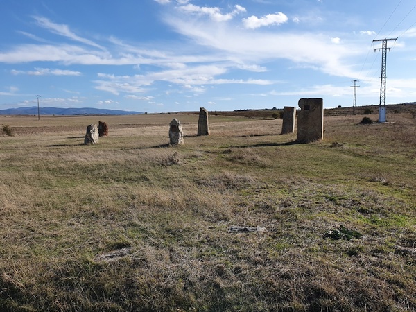
Outside Atapuerca. Stone age monuments
- Photographer: Claus Nedergaard Jacobsen
- Date Taken: 2019:10:16 16:49:44
- GPS Location: 42.3735851N, -3.4995855E

More about the stone age findings
- Photographer: Claus Nedergaard Jacobsen
- Date Taken: 2019:10:16 16:50:25
- GPS Location: 42.3738252N, -3.5002287E

Another place with a lot of stone age monuments, stone circles etc. This cross is probably later. Called Vertice Matagrande. The aree is called Espiral de Piedras, I believe
- Photographer: Claus Nedergaard Jacobsen
- Date Taken: 2019:10:16 17:46:51
- GPS Location: 42.379999N, -3.5323024E

Vertice Matagrande. The aree is called Espiral de Piedras, I believe
- Photographer: Fabrizio Ciappone
- Date Taken: 2019:10:16 17:47:01
- GPS Location: 42.379999N, -3.5323024E

Magic circle in Espiral de Piedras, stone age area
- Photographer: Claus Nedergaard Jacobsen
- Date Taken: 2019:10:16 17:49:38
- GPS Location: 42.3796659N, -3.5342678E

Espiral de Piedras (I believe)
- Photographer: Claus Nedergaard Jacobsen
- Date Taken: 2019:10:16 17:49:48
- GPS Location: 42.3796659N, -3.5342678E

Pilgrim monument
- Photographer: Claus Nedergaard Jacobsen
- Date Taken: 2019:10:16 17:51:36
- GPS Location: 42.379154N, -3.5355133E

Hiking into the sunset at Villalval and Cardeñuela
- Photographer: Claus Nedergaard Jacobsen
- Date Taken: 2019:10:16 18:16:59
- GPS Location: 42.3723498N, -3.5537677E
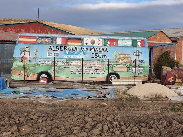
Nice way to attract attention to an albergue. We decided to go for it.
- Photographer: Claus Nedergaard Jacobsen
- Date Taken: 2019:10:16 18:31:03
- GPS Location: 42.3636233N, -3.5558289E

At Albergue Vía minera. Nice common dinner. Elisabeth is having painful ancles.
- Photographer: Claus Nedergaard Jacobsen
- Date Taken: 2019:10:16 19:09:17
- GPS Location: 42.3597221N, -3.5594444E
Great beer at Albergue Vía minera
- Photographer: Claus Nedergaard Jacobsen
- Date Taken: 2019:10:16 19:11:19
- GPS Location: 42.3599532N, -3.5592789E

Great beer at Albergue Vía minera
- Photographer: Claus Nedergaard Jacobsen
- Date Taken: 2019:10:16 19:11:32
- GPS Location: 42.3599532N, -3.5592789E
Day 10, Thursday, October 17
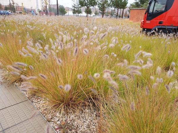
Day 10: Entering Burgos. Nice grass flowers. Not sure of their name. We have some in Denmark whose name translates into "Lamp Brush"
- Photographer: Claus Nedergaard Jacobsen
- Date Taken: 2019:10:17 10:08:16
- GPS Location: 42.3467551N, -3.662308E

Entering Burgos in rain.
- Photographer: Claus Nedergaard Jacobsen
- Date Taken: 2019:10:17 10:09:29
- GPS Location: 42.3467453N, -3.6639757E

Autumn has begun. Rain and only 11° in Burgos
- Photographer: Claus Nedergaard Jacobsen
- Date Taken: 2019:10:17 10:21:42
- GPS Location: 42.3484714N, -3.6738884E
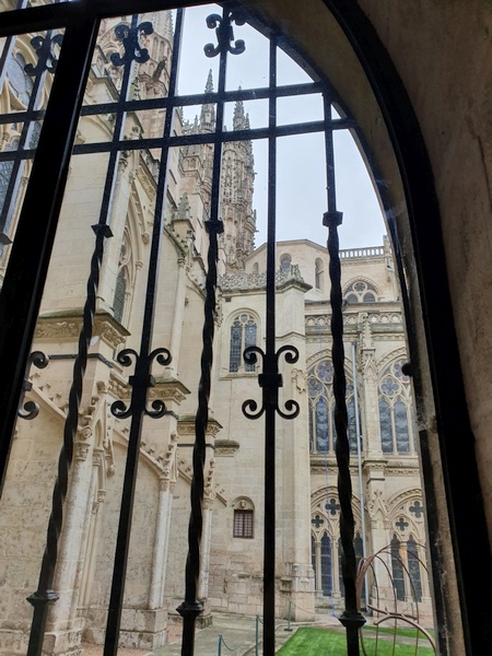
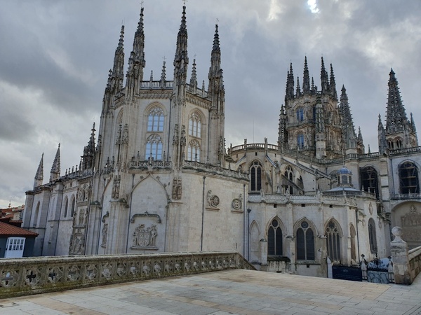
Outside the impressive cathedral in Burgos. It is much more impressive from other angles - and from within. We spent several hours there. Elisabeth decided to stop here to have her ancles heal.
- Photographer: Claus Nedergaard Jacobsen
- Date Taken: 2019:10:17 11:11:01
- GPS Location: 42.3399582N, -3.7031147E

Outside the impressive cathedral in Burgos. It is much more impressive from other angles - and from within
- Photographer: Claus Nedergaard Jacobsen
- Date Taken: 2019:10:17 11:12:14
- GPS Location: 42.3401428N, -3.7033978E
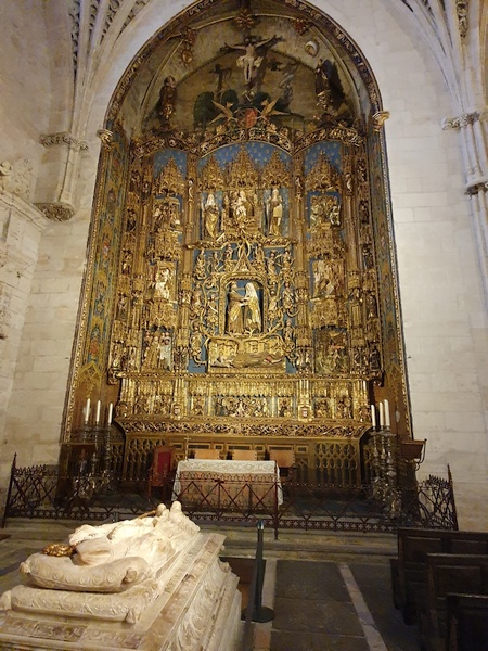
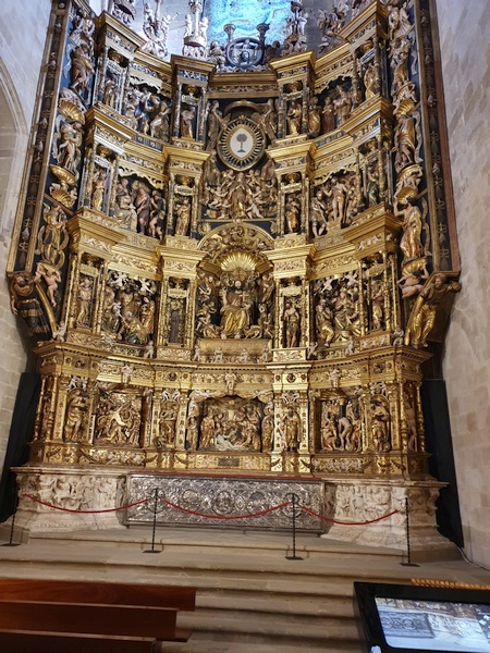
One altar within the Burgos Cathedral
- Photographer: Claus Nedergaard Jacobsen
- Date Taken: 2019:10:17 12:45:46
- GPS Location: 42.3407067N, -3.7047089E

An impressive staircase inside Burgos Cathedral. Was used in a well known movie.
- Photographer: Claus Nedergaard Jacobsen
- Date Taken: 2019:10:17 12:48:46
- GPS Location: 42.3407149N, -3.7045864E

Beautful Silvery inside Burgos Cathedral
- Photographer: Claus Nedergaard Jacobsen
- Date Taken: 2019:10:17 12:52:03
- GPS Location: 42.3407618N, -3.7045135E
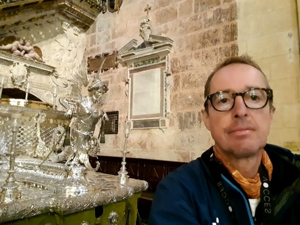
Yours truly next to the silvery
- Photographer: Claus Nedergaard Jacobsen
- Date Taken: 2019:10:17 12:52:24
- GPS Location: 42.3407618N, -3.7045135E
Another altarpiece inside Burgos Cathedral. The church is literally dozens of churches inside each other
- Photographer: Claus Nedergaard Jacobsen
- Date Taken: 2019:10:17 13:04:54
- GPS Location: 42.3407471N, -3.7044137E

Look at the aisle in the Burgos Cathedral
- Photographer: Claus Nedergaard Jacobsen
- Date Taken: 2019:10:17 13:26:14
- GPS Location: 42.3406043N, -3.7040519E
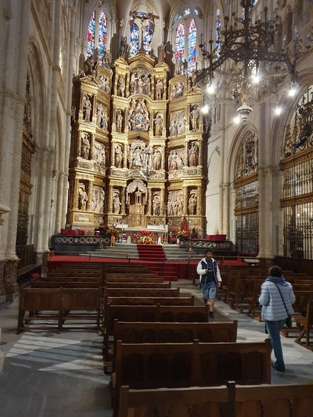
Burgos Cathedral
- Photographer: Claus Nedergaard Jacobsen
- Date Taken: 2019:10:17 13:58:07
- GPS Location: 42.3407355N, -3.7035398E

It is hard to get to see all of the cathedral of Burgos. This model helped grasp its magnificence
- Photographer: Claus Nedergaard Jacobsen
- Date Taken: 2019:10:17 13:58:16
- GPS Location: 42.3407355N, -3.7035398E
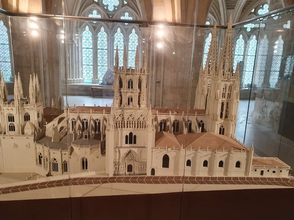
It is hard to get to see all of the cathedral of Burgos. This model helped grasp its magnificence
- Photographer: Claus Nedergaard Jacobsen
- Date Taken: 2019:10:17 13:58:26
- GPS Location: 42.3407355N, -3.7035398E
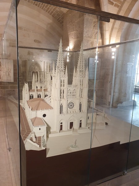
It is hard to get to see all of the cathedral of Burgos. This model helped grasp its magnificence
- Photographer: Claus Nedergaard Jacobsen
- Date Taken: 2019:10:17 13:58:36
- GPS Location: 42.3407355N, -3.7035398E

It is hard to get to see all of the cathedral of Burgos. This model helped grasp its magnificence. Look at all the details - the yards - the aisles etc. So impressive
- Photographer: Claus Nedergaard Jacobsen
- Date Taken: 2019:10:17 13:58:45
- GPS Location: 42.3407355N, -3.7035398E

One yard with Burgos Cathedral
- Photographer: Claus Nedergaard Jacobsen
- Date Taken: 2019:10:17 14:03:14
- GPS Location: 42.3404418N, -3.7039156E
One yard with Burgos Cathedral. A glimpse of the towers
- Photographer: Claus Nedergaard Jacobsen
- Date Taken: 2019:10:17 14:03:31
- GPS Location: 42.3404418N, -3.7039156E

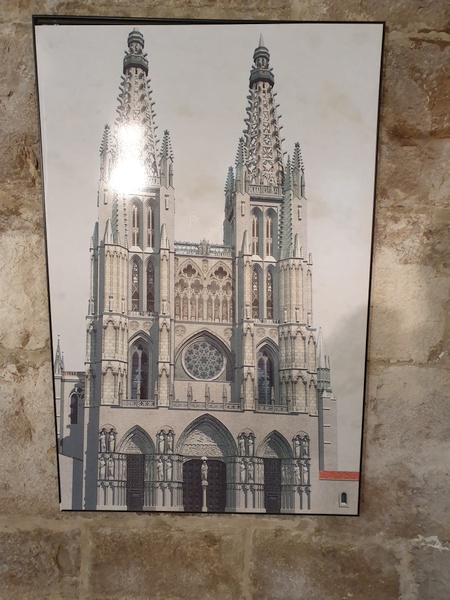
An external view of the towers of the Burgos Cathedral
- Photographer: Claus Nedergaard Jacobsen
- Date Taken: 2019:10:17 14:09:34
- GPS Location: 42.340194N, -3.7052016E
"The last supper". This is where we said goodbye to Elisabeth, Eleonora and Carola in Burgos. But they caught up with us later.
- Photographer: Claus Nedergaard Jacobsen
- Date Taken: 2019:10:17 14:31:20
- GPS Location: 42.3422043N, -3.7039028E
Finally an external view of the Burgos Cathedral where you get an idea of its splendor.
- Photographer: Claus Nedergaard Jacobsen
- Date Taken: 2019:10:17 14:39:49
- GPS Location: 42.3417884N, -3.7039529E
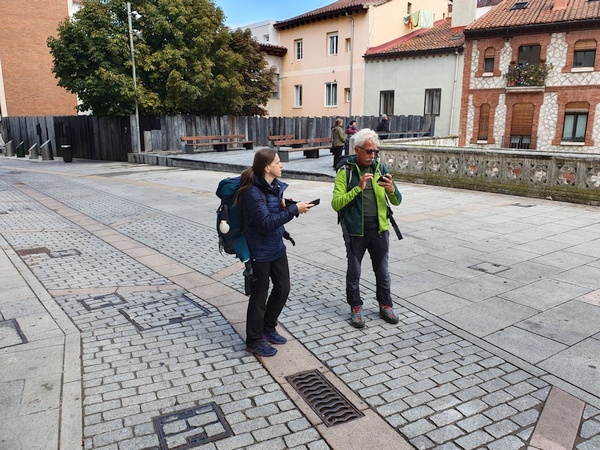
Ivana and Fabrizio trying to find their way out of Burgos
- Photographer: Claus Nedergaard Jacobsen
- Date Taken: 2019:10:17 14:39:53
- GPS Location: 42.3417884N, -3.7039529E

Ivana and Fabrizio trying to find their way out of Burgos. Still in front of the Cathedral
- Photographer: Claus Nedergaard Jacobsen
- Date Taken: 2019:10:17 14:40:08
- GPS Location: 42.3417884N, -3.7039529E

I bet this is the wine that Fabrizio thought we should try that night in Tardajos
- Photographer: Claus Nedergaard Jacobsen
- Date Taken: 2019:10:17 19:58:39
- GPS Location: 42.3567108N, -3.8183077E
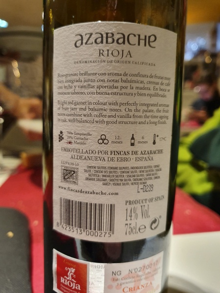
I bet this is the wine that Fabrizio thought we should try that night in Tardajos
- Photographer: Claus Nedergaard Jacobsen
- Date Taken: 2019:10:17 19:59:01
- GPS Location: 42.3567108N, -3.8183077E
Day 11, Friday, October 18

Day 11: Beautiful wall painting in a small village shortly after Tardajos (Rabé de las Calzadas)
- Photographer: Claus Nedergaard Jacobsen
- Date Taken: 2019:10:18 08:39:21
- GPS Location: 42.339649N, -3.8350743E
Day 11: Beautiful wall painting in a small village shortly after Tardajos (Rabé de las Calzadas)
- Photographer: Claus Nedergaard Jacobsen
- Date Taken: 2019:10:18 08:40:35
- GPS Location: 42.3402535N, -3.8358977E

Day 11: Beautiful wall painting in a small village shortly after Tardajos (Rabé de las Calzadas)
- Photographer: Claus Nedergaard Jacobsen
- Date Taken: 2019:10:18 08:40:39
- GPS Location: 42.3402535N, -3.8358977E

Day 11: Beautiful wall painting in a small village shortly after Tardajos (Rabé de las Calzadas)
- Photographer: Claus Nedergaard Jacobsen
- Date Taken: 2019:10:18 08:41:01
- GPS Location: 42.3402535N, -3.8358977E

Day 11: Religious message in a small village shortly after Tardajos (Rabé de las Calzadas)
- Photographer: Claus Nedergaard Jacobsen
- Date Taken: 2019:10:18 08:45:02
- GPS Location: 42.34N, -3.836E
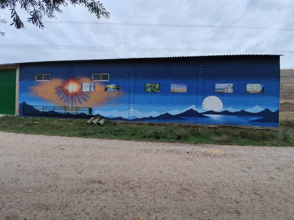
Day 11: Beautiful wall painting in a small village shortly after Tardajos (Rabé de las Calzadas)
- Photographer: Claus Nedergaard Jacobsen
- Date Taken: 2019:10:18 08:45:36
- GPS Location: 42.3404316N, -3.8405942E

Day 11: Beautiful wall painting in a small village shortly after Tardajos (Rabé de las Calzadas)
- Photographer: Claus Nedergaard Jacobsen
- Date Taken: 2019:10:18 08:46:19
- GPS Location: 42.3404821N, -3.8408619E

Beautful piece of the Camino - headed for Hornillos.
- Photographer: Claus Nedergaard Jacobsen
- Date Taken: 2019:10:18 09:32:19
- GPS Location: 42.3409634N, -3.8974185E

Iglesia San Román in Hornillos del Camino
- Photographer: Claus Nedergaard Jacobsen
- Date Taken: 2019:10:18 10:20:09
- GPS Location: 42.3385434N, -3.9262967E
Heading into Hontanas
- Photographer: Claus Nedergaard Jacobsen
- Date Taken: 2019:10:18 12:29:51
- GPS Location: 42.3125199N, -4.0394856E

Confused in Hontanas - looking for water, I believe
- Photographer: Claus Nedergaard Jacobsen
- Date Taken: 2019:10:18 13:26:17
- GPS Location: 42.312674N, -4.0432316E

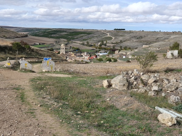
Ruins of a 15th century monastery near 3 km before Castrojeriz
- Photographer: Claus Nedergaard Jacobsen
- Date Taken: 2019:10:18 14:24:48
- GPS Location: 42.2930207N, -4.0987146E

Castrojeriz castle at the top. The church is called Collegiate of Santa María del Manzano
- Photographer: Claus Nedergaard Jacobsen
- Date Taken: 2019:10:18 14:47:37
- GPS Location: 42.2922491N, -4.1244637E

Collegiate of Santa María del Manzano
- Photographer: Claus Nedergaard Jacobsen
- Date Taken: 2019:10:18 15:39:07
- GPS Location: 42.2925934N, -4.1283119E

Bunk beds in the albergue part of a hotel in Castrojeriz called A CIEN LEGUAS.
- Photographer: Claus Nedergaard Jacobsen
- Date Taken: 2019:10:18 16:12:11
- GPS Location: 42.2887828N, -4.1337572E

Ivana at A CIEN LEGUAS. She was not feeling well
- Photographer: Claus Nedergaard Jacobsen
- Date Taken: 2019:10:18 16:12:17
- GPS Location: 42.2887828N, -4.1337572E
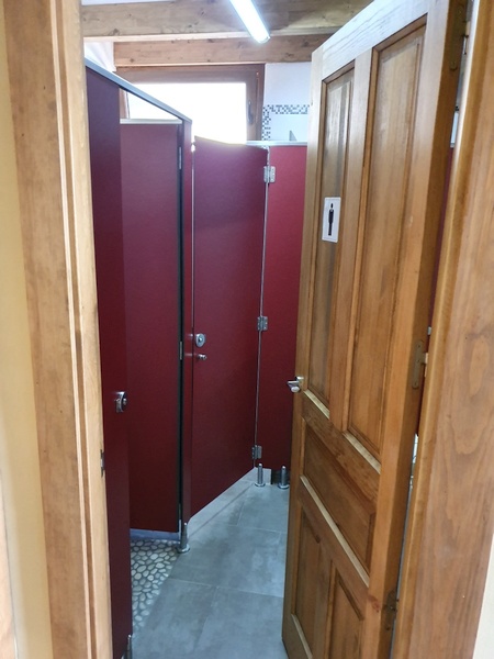
How the bathrooms looked.
- Photographer: Claus Nedergaard Jacobsen
- Date Taken: 2019:10:18 16:12:44
- GPS Location: 42.2888952N, -4.1352238E

More bunk beds at A CIEN LEGUAS
- Photographer: Claus Nedergaard Jacobsen
- Date Taken: 2019:10:18 16:12:56
- GPS Location: 42.2888952N, -4.1352238E
Day 12, Saturday, October 19

Day 13: Fabrizio and a decent climb ahead just after Castrojeriz. Ivana stayed behind to recover.
- Photographer: Claus Nedergaard Jacobsen
- Date Taken: 2019:10:19 08:26:51
- GPS Location: 42.2910125N, -4.1650166E

View from "Alto de Mostelares" behind against the valley with Castrojeriz in the middle. Strange geological phenomena. Look at all the wind mills at the opposing side.
- Photographer: Claus Nedergaard Jacobsen
- Date Taken: 2019:10:19 08:46:44
- GPS Location: 42.2873406N, -4.179036E

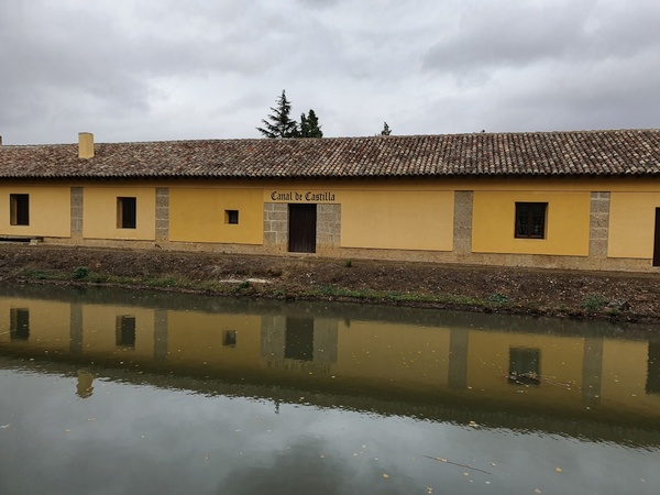
Along "Canal de Castilla", a long straight walk with very little variation.
- Photographer: Claus Nedergaard Jacobsen
- Date Taken: 2019:10:19 11:53:43
- GPS Location: 42.2652365N, -4.3595072E
Canal house close to Fromista
- Photographer: Claus Nedergaard Jacobsen
- Date Taken: 2019:10:19 12:32:22
- GPS Location: 42.2644939N, -4.3971021E

I was about to jump into the canal for a refreshning bath when this tourist boat showed up.
- Photographer: Claus Nedergaard Jacobsen
- Date Taken: 2019:10:19 12:32:55
- GPS Location: 42.2644939N, -4.3971021E

Very impressive canal lock at Fromista
- Photographer: Claus Nedergaard Jacobsen
- Date Taken: 2019:10:19 12:35:50
- GPS Location: 42.2643131N, -4.3977503E

Only Fabrizio and Claus left. Dinner somewhere in Villalcázar de Sirga.
- Photographer: Claus Nedergaard Jacobsen
- Date Taken: 2019:10:19 20:54:10
- GPS Location: 42.3161317N, -4.5454598E

At an albergue called Casa Aurea in Villalcázar de Sirga. Glad I am not a girl having to put my behind there to pee.
- Photographer: Claus Nedergaard Jacobsen
- Date Taken: 2019:10:19 21:48:54
- GPS Location: 42.3160937N, -4.5454598E

At an albergue called Casa Aurea in Villalcázar de Sirga. Unisex bathroom - but very little privacy behind those doors.
- Photographer: Claus Nedergaard Jacobsen
- Date Taken: 2019:10:19 21:49:13
- GPS Location: 42.3160937N, -4.5454598E
Day 13, Sunday, October 20
Day 14: Another day with soaking rain. Took a photo of myself through a window in Carrión de los Condes.
- Photographer: Claus Nedergaard Jacobsen
- Date Taken: 2019:10:20 09:24:33
- GPS Location: 42.3374564N, -4.6028451E

Soaking wet, 10 km after Carrión de los Condes. Second day in a row with rain all day rain.
- Photographer: Claus Nedergaard Jacobsen
- Date Taken: 2019:10:20 12:09:06
- GPS Location: 42.3334272N, -4.7488539E

Funny sign near Ermita de la Dehesa
- Photographer: Claus Nedergaard Jacobsen
- Date Taken: 2019:10:20 16:06:18
- GPS Location: 42.3349787N, -4.8222744E
Day 14, Monday, October 21
Belgian psychologist Eric van der Straaten sings to us at El Burgo Ranero. Don't forget to turn on the sound.

Funny hobbit houses at Moratinos, Palencia. They are, however, food storage
- Photographer: Claus Nedergaard Jacobsen
- Date Taken: 2019:10:21 09:13:42
- GPS Location: 42.3607945N, -4.9254105E

Funny, knitted protection for trees in Moratinos, Palencia
- Photographer: Claus Nedergaard Jacobsen
- Date Taken: 2019:10:21 09:15:47
- GPS Location: 42.3606166N, -4.9267441E

Funny, knitted protection for trees in Moratinos, Palencia
- Photographer: Claus Nedergaard Jacobsen
- Date Taken: 2019:10:21 09:16:19
- GPS Location: 42.3605243N, -4.926401E

Portal at Monasterio Real de San Benito in Sahagún
- Photographer: Claus Nedergaard Jacobsen
- Date Taken: 2019:10:21 11:47:53
- GPS Location: 42.3705285N, -5.0336773E

Church tower in El Burgo Ranero that looks exactly like the one we have at home in Denmark
- Photographer: Claus Nedergaard Jacobsen
- Date Taken: 2019:10:21 18:57:14
- GPS Location: 42.4226064N, -5.2209787E

Church tower in El Burgo Ranero that looks exactly like the one we have at home in Denmark
- Photographer: Claus Nedergaard Jacobsen
- Date Taken: 2019:10:21 18:57:34
- GPS Location: 42.4226064N, -5.2209787E

Dormitory at our albergue in El Burgo Ranero. Not the best we had met.
- Photographer: Claus Nedergaard Jacobsen
- Date Taken: 2019:10:21 19:23:21
- GPS Location: 42.4233789N, -5.2185659E

Upstairs view of our albergue in El Burgo Ranero. Not the best we had met.
- Photographer: Claus Nedergaard Jacobsen
- Date Taken: 2019:10:21 19:23:35
- GPS Location: 42.4233789N, -5.2185659E

Claus in El Burgo Ranero (I think). All the guitars
- Photographer: Fabrizio Ciappone
- Date Taken: 2019:10:21 20:38:59
- GPS Location: 42.422428N, -5.221238E
Day 15, Tuesday, October 22

Day 15: A tiny airfield for UL-airplanes at Villamarco.
- Photographer: Claus Nedergaard Jacobsen
- Date Taken: 2019:10:22 09:21:24
- GPS Location: 42.4536586N, -5.2822674E
Day 15: A tiny airfield for UL-airplanes at Villamarco.
- Photographer: Claus Nedergaard Jacobsen
- Date Taken: 2019:10:22 09:21:32
- GPS Location: 42.4536586N, -5.2822674E

Mountains with snow to the north. Seen from Villamarco.
- Photographer: Claus Nedergaard Jacobsen
- Date Taken: 2019:10:22 09:37:53
- GPS Location: 42.466133N, -5.3146615E

Now it is my turn to have swollen ancles. Three days in a row with +35 km took their toll.
- Photographer: Claus Nedergaard Jacobsen
- Date Taken: 2019:10:22 12:04:06
- GPS Location: 42.4738572N, -5.3535641E
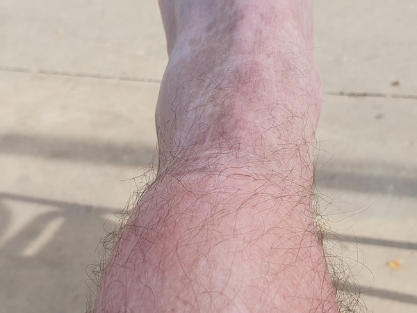
Now it is my turn to have swollen ancles. Three days in a row with +35 km took their toll. I had to walk really slowly.
- Photographer: Claus Nedergaard Jacobsen
- Date Taken: 2019:10:22 12:04:16
- GPS Location: 42.4738572N, -5.3535641E

Slow walking had its advantage. I met Irish Philomena, who is also a slow walker, and had an interesting conversation about the HBO Series "Vikings".
- Photographer: Claus Nedergaard Jacobsen
- Date Taken: 2019:10:22 13:02:55
- GPS Location: 42.4875933N, -5.3910513E

Street and church in Mansilla de las Mulas
- Photographer: Claus Nedergaard Jacobsen
- Date Taken: 2019:10:22 13:40:27
- GPS Location: 42.4985611N, -5.4162223E

Marketplace in Mansilla de las Mulas. This is where I gave in to my ancle pains and spent 3 hours drinking beer feeling sorry for myself
- Photographer: Claus Nedergaard Jacobsen
- Date Taken: 2019:10:22 13:42:07
- GPS Location: 42.4989447N, -5.4175647E

Crossing Rio Porma near Puente Villarente
- Photographer: Claus Nedergaard Jacobsen
- Date Taken: 2019:10:22 17:02:27
- GPS Location: 42.5411088N, -5.4490429E

Crossing Rio Porma near Puente Villarente. Mexican David whom we had actually met in the strange albergue in Cirueña 8 days earlier where he tried to sell oils with flavour to the girls.
- Photographer: Claus Nedergaard Jacobsen
- Date Taken: 2019:10:22 17:02:33
- GPS Location: 42.5411088N, -5.4490429E
Crossing Rio Porma near Puente Villarente.
- Photographer: Claus Nedergaard Jacobsen
- Date Taken: 2019:10:22 17:02:38
- GPS Location: 42.5411088N, -5.4490429E

Wine and dinner in Villarente at the best albergue that I found at all along the Camino, Albergue San Pelayo. So beautiful, so cosy. 3 Germans to the left, ??, Dieter, Birgit, ??, American girl from Oklahoma and a crazy Lithuanian guy who wanted to complete the Camino in 14 days. His feet looke like horror.
- Photographer: Claus Nedergaard Jacobsen
- Date Taken: 2019:10:22 19:54:55
- GPS Location: 42.5454327N, -5.4569859E

Albergue San Pelayo in Puente Villarente. So beautiful, so classy
- Photographer: Claus Nedergaard Jacobsen
- Date Taken: 2019:10:22 22:09:37
- GPS Location: 42.5454462N, -5.4569097E
Albergue San Pelayo in Puente Villarente. So beautiful, so classy
- Photographer: Claus Nedergaard Jacobsen
- Date Taken: 2019:10:22 22:09:47
- GPS Location: 42.5454462N, -5.4569097E
Albergue San Pelayo in Puente Villarente. So beautiful, so classy
- Photographer: Claus Nedergaard Jacobsen
- Date Taken: 2019:10:22 22:10:01
- GPS Location: 42.5454462N, -5.4569097E

Albergue San Pelayo in Puente Villarente. So beautiful, so classy. This is the reception desk.
- Photographer: Claus Nedergaard Jacobsen
- Date Taken: 2019:10:22 22:10:15
- GPS Location: 42.5454462N, -5.4569097E
Day 16, Wednesday, October 23
A little personal story about my encounter with the famous cathedral i León and what happened next. Don't forget to turn on the sound.

Albergue San Pelayo in Puente Villarente. So beautiful, so classy. No bunk beds but real beds.
- Photographer: Claus Nedergaard Jacobsen
- Date Taken: 2019:10:23 08:25:29
- GPS Location: 42.5455229N, -5.4569267E

Day 16: Breakfast in Puente Villarente. I found Jesus.
- Photographer: Claus Nedergaard Jacobsen
- Date Taken: 2019:10:23 09:18:24
- GPS Location: 42.5443361N, -5.457192E

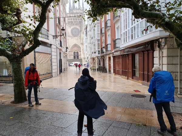
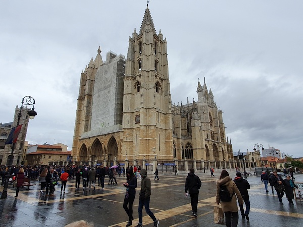
Day 16: Entering Leon.
- Photographer: Claus Nedergaard Jacobsen
- Date Taken: 2019:10:23 11:20:32
- GPS Location: 42.5912552N, -5.5638609E

"Las Cercas" in Burgos. The remains of a 14th century city wall
- Photographer: Claus Nedergaard Jacobsen
- Date Taken: 2019:10:23 12:14:32
- GPS Location: 42.5935672N, -5.567712E

Open square in Burgos
- Photographer: Claus Nedergaard Jacobsen
- Date Taken: 2019:10:23 12:27:39
- GPS Location: 42.5974543N, -5.5703485E

Theater street in Burgos. No wonder the pilgrims came home changed after all they had seen abroad
- Photographer: Claus Nedergaard Jacobsen
- Date Taken: 2019:10:23 12:28:34
- GPS Location: 42.5977686N, -5.5698064E
Burgos Cathedral. I paid to get in but we were all thrown out after 45 minutes. The loudspeaker announcement was in Spanish. Do not know what went on.
- Photographer: Claus Nedergaard Jacobsen
- Date Taken: 2019:10:23 12:35:40
- GPS Location: 42.5987499N, -5.5673152E

The inside of the Burgos Cathedral. Using new techniques, the architects were able to put windows in the walls and play with light. The story was amazing.
- Photographer: Claus Nedergaard Jacobsen
- Date Taken: 2019:10:23 13:04:01
- GPS Location: 42.5988212N, -5.5670982E
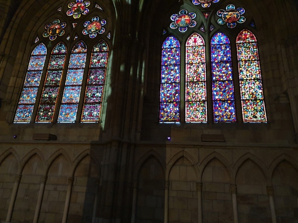
The inside of the Burgos Cathedral. Using new techniques, the architects were able to put windows in the walls and play with light. The story was amazing.
- Photographer: Claus Nedergaard Jacobsen
- Date Taken: 2019:10:23 13:04:08
- GPS Location: 42.5988212N, -5.5670982E

Beautiful aisles.
- Photographer: Claus Nedergaard Jacobsen
- Date Taken: 2019:10:23 13:07:08
- GPS Location: 42.5990642N, -5.5664863E

Beautiful aisles. Individual "crypts" (?)
- Photographer: Claus Nedergaard Jacobsen
- Date Taken: 2019:10:23 13:09:24
- GPS Location: 42.5990642N, -5.5664863E

One tiny church of many inside the Burgos Cathedral.
- Photographer: Claus Nedergaard Jacobsen
- Date Taken: 2019:10:23 13:10:41
- GPS Location: 42.5988212N, -5.5670982E

Lots of hidden symbols in this depiction of the crucifiction of Christ. A soldier blinded by his blood is one.
- Photographer: Claus Nedergaard Jacobsen
- Date Taken: 2019:10:23 13:22:09
- GPS Location: 42.5990642N, -5.5664863E

The letter that a boy from the mission school gave me: "May Love never leave you"
- Photographer: Claus Nedergaard Jacobsen
- Date Taken: 2019:10:23 13:44:29
- GPS Location: 42.5987499N, -5.5673152E

The letter that a boy from the mission school gave me: "May Love never leave you"
- Photographer: Claus Nedergaard Jacobsen
- Date Taken: 2019:10:23 13:44:29
- GPS Location: 42.5987499N, -5.5673152E
Day 17, Thursday, October 24

An albergue at the outskirts of Leon called "Albergue de Peregrinos D. Antonino y Dña. Cinia". All facilities, clean and everything but it was strange. No one wanted to talk. They all looked grouchy. I wonder if it was the pain in my face that turned them away? Here I was all alone. Could not keep up with Fabrizio any longer due to my bad ancle. Felt terrible.
- Photographer: Claus Nedergaard Jacobsen
- Date Taken: 2019:10:24 07:34:03
- GPS Location: 42.5785148N, -5.639232E

Day 17: Crazy day. Could not find the Camino again. Walked for many kilometers and resorted to using GPS. Here I am some 12 km SW of Leon.
- Photographer: Claus Nedergaard Jacobsen
- Date Taken: 2019:10:24 10:02:31
- GPS Location: 42.5202872N, -5.6813671E

300 km left. Getting closer.
- Photographer: Claus Nedergaard Jacobsen
- Date Taken: 2019:10:24 13:12:36
- GPS Location: 42.4727974N, -5.7610134E

Funny 2-D Bell tower in Villabante
- Photographer: Claus Nedergaard Jacobsen
- Date Taken: 2019:10:24 14:57:21
- GPS Location: 42.4627466N, -5.8370696E

Funny 2-D Bell tower in Villabante
- Photographer: Claus Nedergaard Jacobsen
- Date Taken: 2019:10:24 14:57:55
- GPS Location: 42.4627167N, -5.8367896E

Beautiful stone paved road and bridge inÓrbigo
- Photographer: Claus Nedergaard Jacobsen
- Date Taken: 2019:10:24 15:52:23
- GPS Location: 42.4639357N, -5.8774947E

Órbigo. Autumn colours starting to show.
- Photographer: Claus Nedergaard Jacobsen
- Date Taken: 2019:10:24 15:52:40
- GPS Location: 42.4639277N, -5.8775538E

Just outside Órbigo. Still a bad ancle and all alone. But beautiful scenery. Wanted to make it to Astorga but I realised that I could not make it.
- Photographer: Claus Nedergaard Jacobsen
- Date Taken: 2019:10:24 17:00:50
- GPS Location: 42.4639277N, -5.8775538E

Beautiful colours in Albergue Parroquial de Santibáñez.
- Photographer: Claus Nedergaard Jacobsen
- Date Taken: 2019:10:24 17:52:41
- GPS Location: 42.4584363N, -5.9301233E
Day 18, Friday, October 25

Day 18: Breakfast with Birgit and Dieter at Albergue Parroquial de Santibáñez. We spoke German.
- Photographer: Claus Nedergaard Jacobsen
- Date Taken: 2019:10:25 08:59:11
- GPS Location: 42.4584382N, -5.9301253E
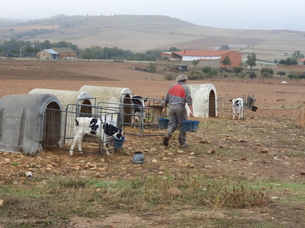
Day 18: Just outside Santibáñez de Valdeiglesias. A farmer feeding his calfs.
- Photographer: Claus Nedergaard Jacobsen
- Date Taken: 2019:10:25 09:29:02
- GPS Location: 42.4599276N, -5.9336036E
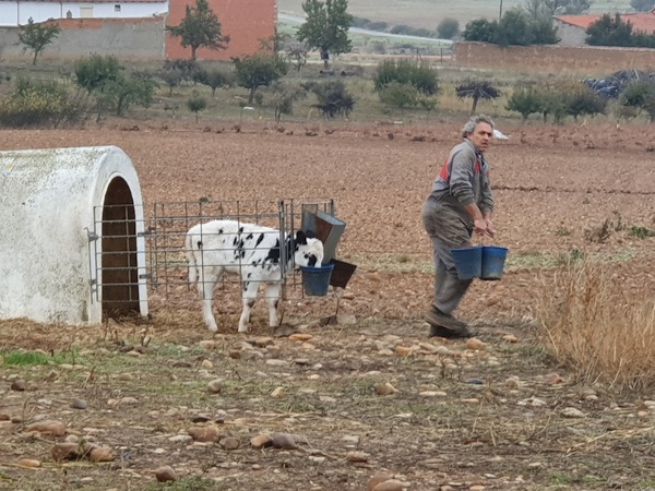
Day 18: Just outside Santibáñez de Valdeiglesias. A farmer feeding his calfs.
- Photographer: Claus Nedergaard Jacobsen
- Date Taken: 2019:10:25 09:29:10
- GPS Location: 42.4599276N, -5.9336036E
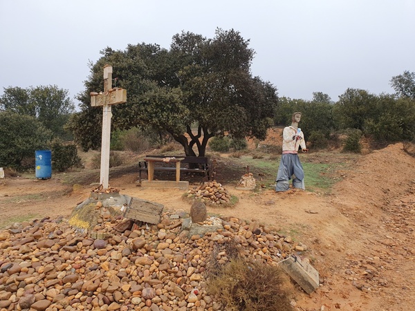
Day 18: Just outside Santibáñez de Valdeiglesias. Elvis lives!
- Photographer: Claus Nedergaard Jacobsen
- Date Taken: 2019:10:25 09:41:16
- GPS Location: 42.4654229N, -5.9430596E

Day 18: Just outside Santibáñez de Valdeiglesias. Elvis lives!
- Photographer: Claus Nedergaard Jacobsen
- Date Taken: 2019:10:25 09:41:46
- GPS Location: 42.4646063N, -5.9441084E

Day 18: Just outside Santibáñez de Valdeiglesias. A hiker from Ukraine ahead. The only one I met from that continent.
- Photographer: Claus Nedergaard Jacobsen
- Date Taken: 2019:10:25 09:45:05
- GPS Location: 42.4659067N, -5.9457017E
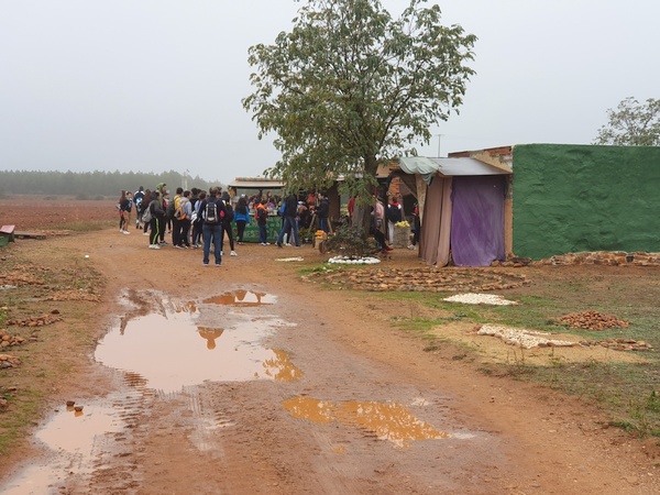
Somewhere in the middle betweenÓrbigo and Astorga. Free fruit and breakfast. A lot of pupils were lining up for food. They must have had a day of from school. I do not know why
- Photographer: Claus Nedergaard Jacobsen
- Date Taken: 2019:10:25 10:24:54
- GPS Location: 42.4500827N, -5.9880498E

Somewhere in the middle betweenÓrbigo and Astorga. A lot of pupils on the Camino.
- Photographer: Claus Nedergaard Jacobsen
- Date Taken: 2019:10:25 10:42:06
- GPS Location: 42.4545921N, -6.0012714E

Somewhere in the middle betweenÓrbigo and Astorga. A lot of pupils on the Camino.
- Photographer: Claus Nedergaard Jacobsen
- Date Taken: 2019:10:25 10:42:12
- GPS Location: 42.4545921N, -6.0012714E

Somewhere in the middle betweenÓrbigo and Astorga. A lot of pupils on the Camino.
- Photographer: Claus Nedergaard Jacobsen
- Date Taken: 2019:10:25 10:44:05
- GPS Location: 42.4541179N, -6.0007518E

Just before Astorga. A bridge over the rails. OMG, what a construction.
- Photographer: Claus Nedergaard Jacobsen
- Date Taken: 2019:10:25 11:39:23
- GPS Location: 42.45N, -6.05E

A church in Astorga, Iglesia de San Francisco. Walked in to look and suddenly a service started. I thought it was unpolite to leave. That is how I experienced my first Catholic Service.
- Photographer: Claus Nedergaard Jacobsen
- Date Taken: 2019:10:25 11:54:45
- GPS Location: 42.4531735N, -6.0513255E

Plaza España. Ayuntamiento de Astorga. City Hall.
- Photographer: Claus Nedergaard Jacobsen
- Date Taken: 2019:10:25 12:33:08
- GPS Location: 42.4544731N, -6.0532043E

Palace of Gaudì Astorga. Bishop's palace designed by Antonio Gaudi, completed in 1913 and used as a religious art museum.
- Photographer: Claus Nedergaard Jacobsen
- Date Taken: 2019:10:25 12:39:12
- GPS Location: 42.4573352N, -6.0555724E

La Catedral de Santa María de Astorga
- Photographer: Claus Nedergaard Jacobsen
- Date Taken: 2019:10:25 12:39:18
- GPS Location: 42.4573352N, -6.0555724E

Beautiful Albergue at the outskirts of Astorga.
- Photographer: Claus Nedergaard Jacobsen
- Date Taken: 2019:10:25 15:20:59
- GPS Location: 42.4591504N, -6.1076294E

On the road again. 2 km outside Astorga. Finally dry weather again after 3 days with soaking rain.
- Photographer: Claus Nedergaard Jacobsen
- Date Taken: 2019:10:25 15:29:57
- GPS Location: 42.4440632N, -6.0386382E

2 km outside Astorga. Beautiful road, beautiful weather and a beautiful hiker.
- Photographer: Claus Nedergaard Jacobsen
- Date Taken: 2019:10:25 15:33:57
- GPS Location: 42.4576113N, -6.0717253E

Probably Santa Catalina de Somoza
- Photographer: Claus Nedergaard Jacobsen
- Date Taken: 2019:10:25 15:53:51
- GPS Location: 42.4549713N, -6.1404273E
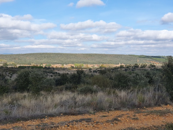
View towards Castrillo de los Polvazares. Shortly before Santa Catalina de Somoza
- Photographer: Claus Nedergaard Jacobsen
- Date Taken: 2019:10:25 15:53:58
- GPS Location: 42.4549704N, -6.1404288E

Shortly before Santa Catalina de Somoza
- Photographer: Claus Nedergaard Jacobsen
- Date Taken: 2019:10:25 15:54:06
- GPS Location: 42.4549726N, -6.1404292E
Day 19, Saturday, October 26

Day 19: Albergue El Caminante in Santa Catalina de Somoza. French Janine (who only spoke French) and British Elizabeth ("Liz") who spoke 4 - 5 languages including Spanish.
- Photographer: Claus Nedergaard Jacobsen
- Date Taken: 2019:10:26 08:16:12
- GPS Location: 42.4552067N, -6.1581772E
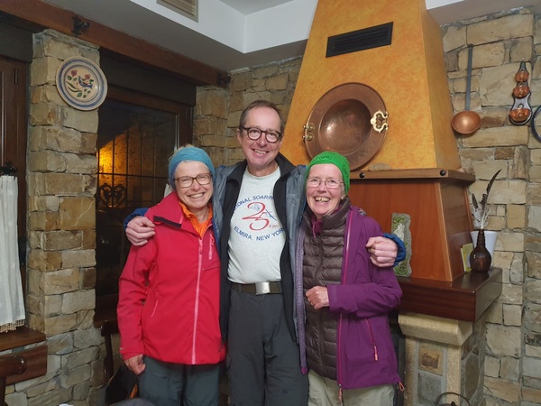
Day 19: Albergue El Caminante in Santa Catalina de Somoza. French Janine (who only spoke French), Claus and British Elizabeth ("Liz") who spoke 4 - 5 languages including Spanish. It was Liz' idea that this picture should be labelled "Europe before Brexit"
- Photographer: Claus Nedergaard Jacobsen
- Date Taken: 2019:10:26 08:16:40
- GPS Location: 42.4552067N, -6.1581772E

Day 19: Beautiful morning scenery just outside Santa Catalina de Somoza
- Photographer: Claus Nedergaard Jacobsen
- Date Taken: 2019:10:26 08:48:11
- GPS Location: 42.4560112N, -6.1643962E
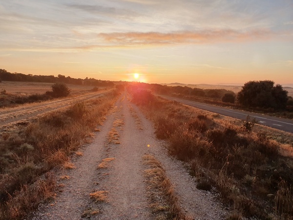
Day 19: Watching the sun rise behind me on a beautiful morning just outside Santa Catalina de Somoza
- Photographer: Claus Nedergaard Jacobsen
- Date Taken: 2019:10:26 08:58:22
- GPS Location: 42.4580294N, -6.1747304E
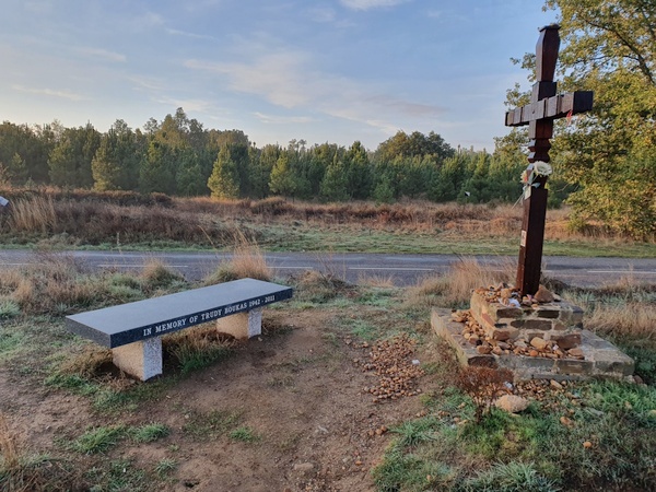
Another life that ended on the Camino. One wonders if it is dangerous or people just decide to walk there in times of trouble?
- Photographer: Claus Nedergaard Jacobsen
- Date Taken: 2019:10:26 09:17:25
- GPS Location: 42.4610629N, -6.1958275E

Day 19: Watching the sun rise behind me on a beautiful morning just outside Santa Catalina de Somoza
- Photographer: Claus Nedergaard Jacobsen
- Date Taken: 2019:10:26 09:25:30
- GPS Location: 42.4618179N, -6.2041284E

The Camino cannot give you what you want. But it does provide you of what you need.
- Photographer: Claus Nedergaard Jacobsen
- Date Taken: 2019:10:26 09:26:25
- GPS Location: 42.4619818N, -6.2046351E

Funny bar in El Ganso
- Photographer: Claus Nedergaard Jacobsen
- Date Taken: 2019:10:26 09:29:23
- GPS Location: 42.4628225N, -6.2071193E
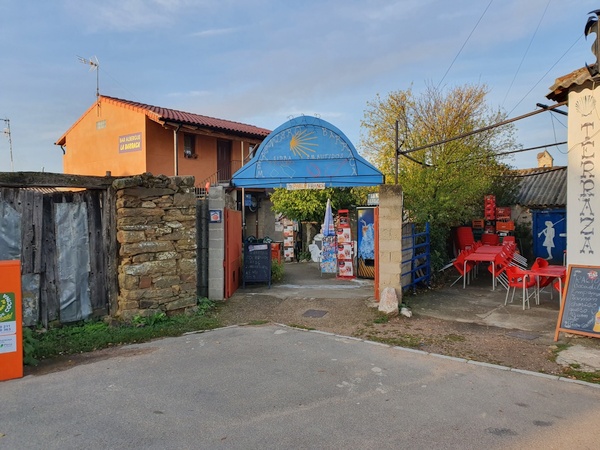
Another funny bar in El Ganso.
- Photographer: Claus Nedergaard Jacobsen
- Date Taken: 2019:10:26 09:29:31
- GPS Location: 42.4628225N, -6.2071193E
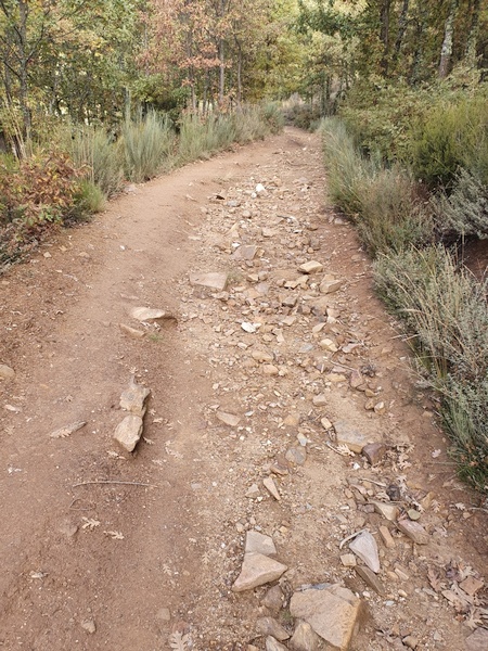
2 km west of Rabanal del Camino: The Camino gets rocky
- Photographer: Claus Nedergaard Jacobsen
- Date Taken: 2019:10:26 12:08:34
- GPS Location: 42.4894415N, -6.3185857E

On day 19 we got into the mountains on a beautiful sunny day. The camera had to get out again and again. This is the first of many times. 1 km east of Foncebadón
- Photographer: Claus Nedergaard Jacobsen
- Date Taken: 2019:10:26 12:25:51
- GPS Location: 42.4704735N, -6.2533595E
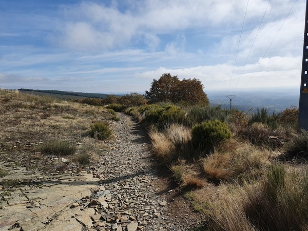
Rocky road
- Photographer: Claus Nedergaard Jacobsen
- Date Taken: 2019:10:26 12:25:59
- GPS Location: 42.4896783N, -6.3305429E
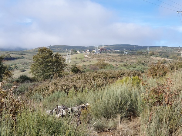
Into the mountains at Foncebadón
- Photographer: Claus Nedergaard Jacobsen
- Date Taken: 2019:10:26 12:27:32
- GPS Location: 42.4917559N, -6.3443771E

Mountain cows at Foncebadón
- Photographer: Claus Nedergaard Jacobsen
- Date Taken: 2019:10:26 12:34:34
- GPS Location: 42.4910364N, -6.3379969E

Casa de Comidas in Foncebadón. Wonderful medieval restaurant where I had my dinner. The servants were dressed in beautiful gowns - the women, that is.
- Photographer: Claus Nedergaard Jacobsen
- Date Taken: 2019:10:26 14:12:43
- GPS Location: 42.4912092N, -6.3414893E

Casa Comidas. Did not catch the women in their beautiful dresses. Only this garcon.
- Photographer: Claus Nedergaard Jacobsen
- Date Taken: 2019:10:26 14:12:47
- GPS Location: 42.4912248N, -6.3415715E

The outside of Casa de Comidas in Foncebadón.
- Photographer: Claus Nedergaard Jacobsen
- Date Taken: 2019:10:26 14:13:07
- GPS Location: 42.4912248N, -6.3415715E
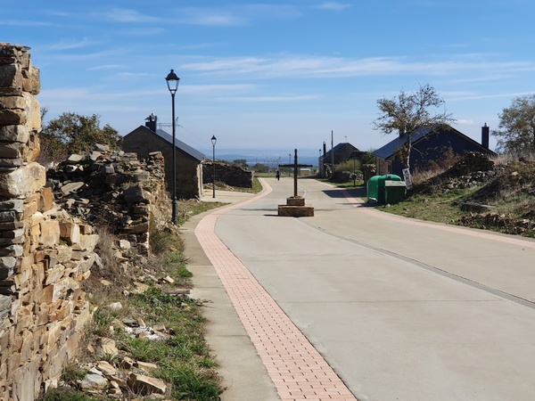
Foncebadón. Cross in the middle of the road
- Photographer: Claus Nedergaard Jacobsen
- Date Taken: 2019:10:26 14:13:21
- GPS Location: 42.4912248N, -6.3415715E
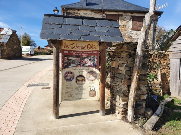
Casa de Comidas - menu card
- Photographer: Claus Nedergaard Jacobsen
- Date Taken: 2019:10:26 14:13:27
- GPS Location: 42.4912248N, -6.3415715E
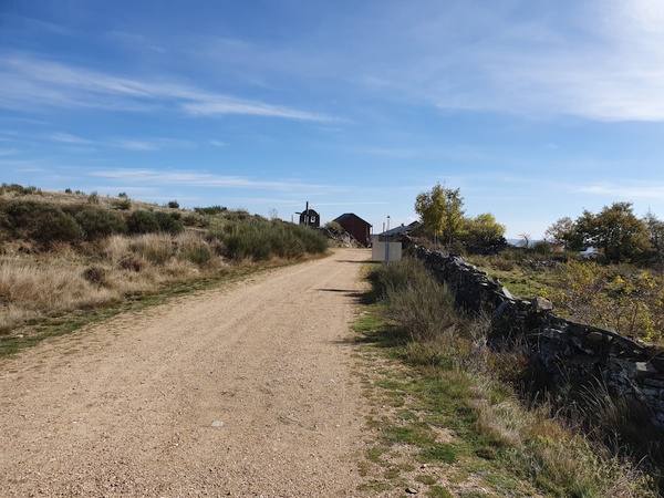
More scenery seen from Foncebadón
- Photographer: Claus Nedergaard Jacobsen
- Date Taken: 2019:10:26 14:19:51
- GPS Location: 42.4924852N, -6.3452393E

More scenery seen from Foncebadón
- Photographer: Claus Nedergaard Jacobsen
- Date Taken: 2019:10:26 14:19:54
- GPS Location: 42.4924852N, -6.3452393E

I knew it would come somewhere but not when: The Cruz de Ferro. All of a sudden, it was there, 1,5 km after Foncebadón. I had to ask the lady in front, if it was really it.
- Photographer: Claus Nedergaard Jacobsen
- Date Taken: 2019:10:26 14:38:44
- GPS Location: 42.4889529N, -6.361137E

The stone I had brought from home to leave at Cruz de Ferro.
- Photographer: Claus Nedergaard Jacobsen
- Date Taken: 2019:10:26 14:43:44
- GPS Location: 42.4889207N, -6.3612943E

The stone I had brought from home to leave at Cruz de Ferro.
- Photographer: Claus Nedergaard Jacobsen
- Date Taken: 2019:10:26 14:44:05
- GPS Location: 42.4917559N, -6.3443771E

The stone I had brought from home to leave at Cruz de Ferro. "Claus Ulla". Well, they said the stone should represent something you do not need any longer. I hope not.
- Photographer: Claus Nedergaard Jacobsen
- Date Taken: 2019:10:26 14:44:18
- GPS Location: 42.4917559N, -6.3443771E

Cruz de Ferro
- Photographer: Claus Nedergaard Jacobsen
- Date Taken: 2019:10:26 14:45:29
- GPS Location: 42.488861N, -6.3614746E
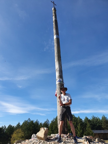
Claus in front of Cruz de Ferro. Finally time for the shorts again - but not a very good picture.
- Photographer: Claus Nedergaard Jacobsen
- Date Taken: 2019:10:26 14:47:39
- GPS Location: 42.488846N, -6.361392E

Description of Cruz de Ferro. Every pilgrim brings a stone from home to leave here. Over time the pile has grown 7 meter tall.
- Photographer: Claus Nedergaard Jacobsen
- Date Taken: 2019:10:26 14:51:33
- GPS Location: 42.4889328N, -6.3616532E

More beautiful scenery 1 km after Cruz de Ferro
- Photographer: Claus Nedergaard Jacobsen
- Date Taken: 2019:10:26 15:06:44
- GPS Location: 42.488583N, -6.3768618E
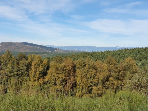
More beautiful scenery 1 km after Cruz de Ferro
- Photographer: Claus Nedergaard Jacobsen
- Date Taken: 2019:10:26 15:06:46
- GPS Location: 42.488583N, -6.3768618E

More beautiful scenery 1 km after Cruz de Ferro
- Photographer: Claus Nedergaard Jacobsen
- Date Taken: 2019:10:26 15:06:59
- GPS Location: 42.488583N, -6.3768618E
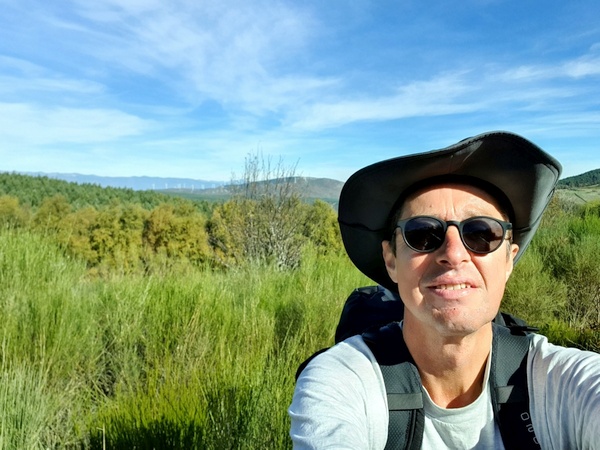
More beautiful scenery 1 km after Cruz de Ferro
- Photographer: Claus Nedergaard Jacobsen
- Date Taken: 2019:10:26 15:08:33
- GPS Location: 42.4884447N, -6.3769922E
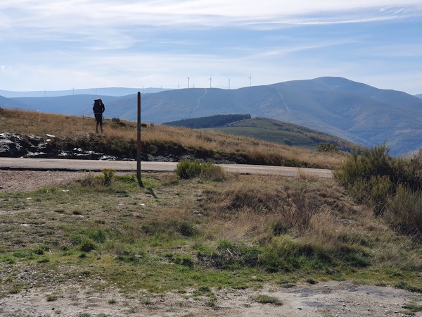
More beautiful scenery 1 km after Cruz de Ferro
- Photographer: Claus Nedergaard Jacobsen
- Date Taken: 2019:10:26 15:14:09
- GPS Location: 42.4876125N, -6.3812661E

How the Camino looks 2 km after Cruz de Ferro
- Photographer: Claus Nedergaard Jacobsen
- Date Taken: 2019:10:26 15:18:15
- GPS Location: 42.4882582N, -6.3841882E
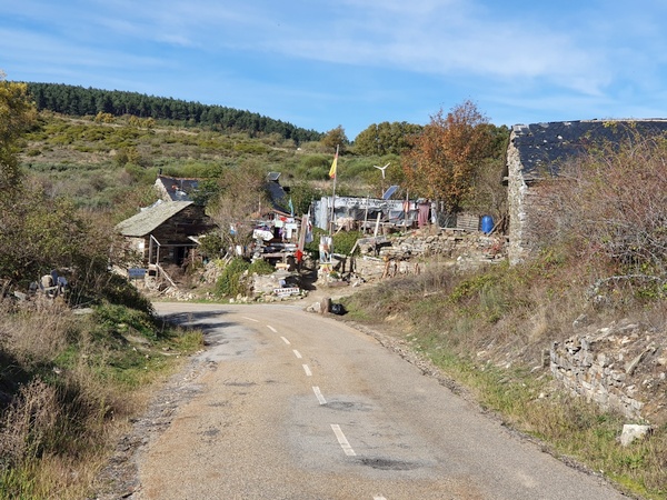
A crazy place offering prayers, healing etc at Manjarin 2 km after Cruz de Ferro. "No photos", it said, but I wonder if it was to protect the visitors. I wanted coffee but I did not want to go in there and get caught in a sales trick.
- Photographer: Claus Nedergaard Jacobsen
- Date Taken: 2019:10:26 15:22:02
- GPS Location: 42.4899993N, -6.3864504E
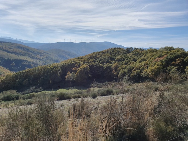
More scenery
- Photographer: Claus Nedergaard Jacobsen
- Date Taken: 2019:10:26 15:26:23
- GPS Location: 42.4899885N, -6.3900823E

More scenery
- Photographer: Claus Nedergaard Jacobsen
- Date Taken: 2019:10:26 15:26:30
- GPS Location: 42.4899885N, -6.3900823E
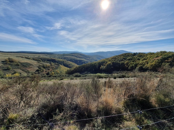
Mountain hiking at Manjarin. Over 1500 meter altitude.
- Photographer: Claus Nedergaard Jacobsen
- Date Taken: 2019:10:26 15:26:41
- GPS Location: 42.4897978N, -6.390601E

Mountain hiking at Manjarin. Over 1500 meter altitude.
- Photographer: Claus Nedergaard Jacobsen
- Date Taken: 2019:10:26 15:28:43
- GPS Location: 42.490054N, -6.3916088E

Mountain hiking at Manjarin. Over 1500 meter altitude.
- Photographer: Claus Nedergaard Jacobsen
- Date Taken: 2019:10:26 15:30:10
- GPS Location: 42.4906367N, -6.3923827E

Mountain hiking at Manjarin. Over 1500 meter altitude.
- Photographer: Claus Nedergaard Jacobsen
- Date Taken: 2019:10:26 15:30:15
- GPS Location: 42.4906367N, -6.3923827E

Mountain hiking at Manjarin. Over 1500 meter altitude.
- Photographer: Claus Nedergaard Jacobsen
- Date Taken: 2019:10:26 15:59:52
- GPS Location: 42.4920748N, -6.3982509E
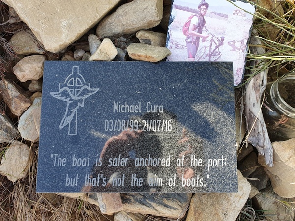
A remembrance sign for another pilgrim whose life ended here. A young one. And a slogan worth remembering.
- Photographer: Claus Nedergaard Jacobsen
- Date Taken: 2019:10:26 16:13:21
- GPS Location: 42.4897978N, -6.390601E

Mountain hiking at Manjarin. Over 1500 meter altitude.
- Photographer: Claus Nedergaard Jacobsen
- Date Taken: 2019:10:26 16:28:38
- GPS Location: 42.4887666N, -6.4188656E
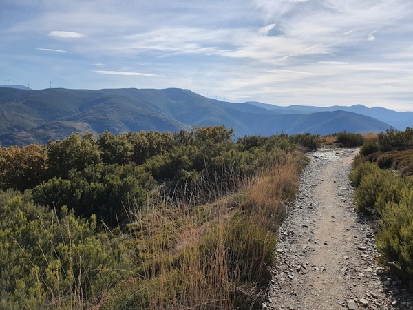
Mountain hiking at Manjarin. Over 1500 meter altitude.
- Photographer: Claus Nedergaard Jacobsen
- Date Taken: 2019:10:26 16:28:50
- GPS Location: 42.4886141N, -6.4189496E

Mountain hiking at Manjarin. Over 1500 meter altitude.
- Photographer: Claus Nedergaard Jacobsen
- Date Taken: 2019:10:26 16:31:05
- GPS Location: 42.4884116N, -6.4207062E

Mountain hiking at Manjarin. Over 1500 meter altitude.
- Photographer: Claus Nedergaard Jacobsen
- Date Taken: 2019:10:26 16:52:15
- GPS Location: 42.4911791N, -6.4370867E

Mountain hiking at Manjarin. Over 1500 meter altitude.
- Photographer: Claus Nedergaard Jacobsen
- Date Taken: 2019:10:26 16:52:22
- GPS Location: 42.4911791N, -6.4370867E

Mountain hiking at Manjarin. Over 1500 meter altitude.
- Photographer: Claus Nedergaard Jacobsen
- Date Taken: 2019:10:26 16:52:30
- GPS Location: 42.4938937N, -6.441521E

Molinaseca in the valley below. Still at 1500 meter altitude. Day 19 and 20 provided the best sceneries of the entire camino.
- Photographer: Claus Nedergaard Jacobsen
- Date Taken: 2019:10:26 16:55:48
- GPS Location: 42.4915513N, -6.4398651E

Mountain hiking close to El Acebo de San Miguel
- Photographer: Claus Nedergaard Jacobsen
- Date Taken: 2019:10:26 16:55:55
- GPS Location: 42.4915513N, -6.4398651E
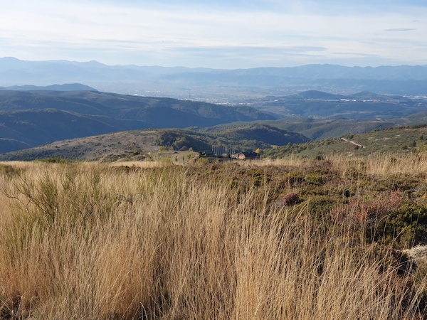
El Acebo de San Miguel where I wanted to sleep over for the night. At 1400 meter approx. Walking downhill was very painful for the ancles.
- Photographer: Claus Nedergaard Jacobsen
- Date Taken: 2019:10:26 17:20:41
- GPS Location: 42.497057N, -6.4520716E

Downhill from some 1500 meter to some 1400 meter to get to El Acebo de San Miguel. Painful for the ancles.
- Photographer: Claus Nedergaard Jacobsen
- Date Taken: 2019:10:26 17:20:52
- GPS Location: 42.4971001N, -6.4521332E

El Acebo de San Miguel
- Photographer: Claus Nedergaard Jacobsen
- Date Taken: 2019:10:26 17:25:37
- GPS Location: 42.4971001N, -6.4521333E

Austrian after-skiing atmosphere in El Acebo de San Miguel
- Photographer: Claus Nedergaard Jacobsen
- Date Taken: 2019:10:26 17:31:33
- GPS Location: 42.4977928N, -6.4559777E
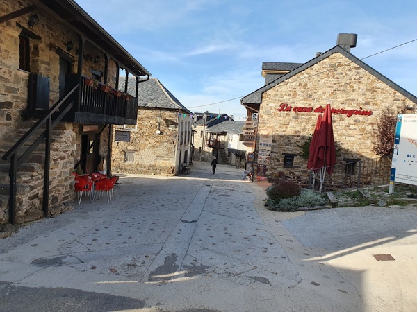
El Acebo de San Miguel
- Photographer: Claus Nedergaard Jacobsen
- Date Taken: 2019:10:26 17:31:43
- GPS Location: 42.4977928N, -6.4559777E

El Acebo de San Miguel
- Photographer: Claus Nedergaard Jacobsen
- Date Taken: 2019:10:26 17:32:59
- GPS Location: 42.4977928N, -6.4559777E
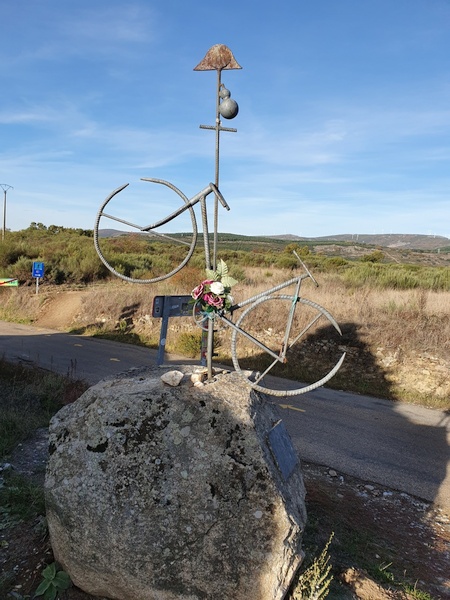
The sign of another pilgrim whose life ended here prematurely.
- Photographer: Claus Nedergaard Jacobsen
- Date Taken: 2019:10:26 17:40:34
- GPS Location: 42.5012423N, -6.4593353E

The albergue for this night. Combined hotel, albergue, fitness center, aqua center and more.
- Photographer: Claus Nedergaard Jacobsen
- Date Taken: 2019:10:26 17:41:58
- GPS Location: 42.5010497N, -6.4600385E
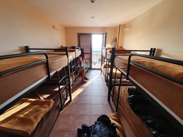
My room for this night. Austrian Frans catching up on the news
- Photographer: Claus Nedergaard Jacobsen
- Date Taken: 2019:10:26 17:56:45
- GPS Location: 42.5010353N, -6.4600936E

Beautiful view from the balcony at Albergue La Casa Del Peregrino
- Photographer: Claus Nedergaard Jacobsen
- Date Taken: 2019:10:26 17:57:04
- GPS Location: 42.5010353N, -6.4600936E

Laundry facilities at Albergue La Casa Del Peregrino could be worse
- Photographer: Claus Nedergaard Jacobsen
- Date Taken: 2019:10:26 18:37:18
- GPS Location: 42.5010776N, -6.4601463E
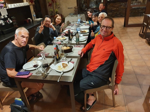
Pilgrim Dinner at Albergue La Casa Del Peregrino. To the left Franz from Holland, Joseph and AYoung (Koreans who could actually speak English). To the right: Claus, German Beatrix, KayHo from Korea, Irene from Italy and an American guy whose name I have forgotten. It was Irene's 26 year birthday and we all sang birthday songs to her in our own language.
- Photographer: Claus Nedergaard Jacobsen
- Date Taken: 2019:10:26 19:51:55
- GPS Location: 42.5010734N, -6.4601021E

Birthday party. From left to right: ?? from the US, Irene from Italy, Kayho from Korea, Beatrix from Germany, Claus, Frans from Holland, Ayoung and Joseph from Korea.
- Photographer: Claus Nedergaard Jacobsen
- Date Taken: 2019:10:26 19:52:10
- GPS Location: 42.5010734N, -6.4601021E
Day 20, Sunday, October 27

Day 20: Shortly after El Acebo de San Miguel. The camino turned into solid rock. My ancles were still in pain and downhill walking was difficult
- Photographer: Claus Nedergaard Jacobsen
- Date Taken: 2019:10:27 11:18:10
- GPS Location: 42.52N, -6.45E

Beautiful autumn colours showing up shortly after El Acebo de San Miguel
- Photographer: Claus Nedergaard Jacobsen
- Date Taken: 2019:10:27 11:43:10
- GPS Location: 42.5306559N, -6.5020017E

Molinaseca ahead
- Photographer: Claus Nedergaard Jacobsen
- Date Taken: 2019:10:27 11:55:55
- GPS Location: 42.5312541N, -6.5108289E

Rocky downhill path.
- Photographer: Claus Nedergaard Jacobsen
- Date Taken: 2019:10:27 12:12:53
- GPS Location: 42.5348791N, -6.5149979E

Ermita de Nuestra Señora de las Angustias in Molinaseca
- Photographer: Claus Nedergaard Jacobsen
- Date Taken: 2019:10:27 12:16:49
- GPS Location: 42.5358608N, -6.5172175E

Iglesia de San Nicolás in Molinaseca
- Photographer: Claus Nedergaard Jacobsen
- Date Taken: 2019:10:27 12:16:54
- GPS Location: 42.5358608N, -6.5172175E

Iglesia de San Nicolás in Molinaseca
- Photographer: Claus Nedergaard Jacobsen
- Date Taken: 2019:10:27 12:20:07
- GPS Location: 42.5379014N, -6.518911E

Rio Meruelo in Molinaseca
- Photographer: Claus Nedergaard Jacobsen
- Date Taken: 2019:10:27 12:20:14
- GPS Location: 42.537536N, -6.5181205E

Castillo de los Templarios, Castillo de Ponferrada. This is where I got away from the Camino due to construction and had to spend hours to find it again.
- Photographer: Claus Nedergaard Jacobsen
- Date Taken: 2019:10:27 15:00:35
- GPS Location: 42.543009N, -6.5931162E

Castillo de los Templarios, Castillo de Ponferrada. This is where I got away from the Camino due to construction and had to spend hours to find it again.
- Photographer: Claus Nedergaard Jacobsen
- Date Taken: 2019:10:27 15:00:51
- GPS Location: 42.5426493N, -6.5933295E

Beautiful river called Sil in Ponferrada.
- Photographer: Claus Nedergaard Jacobsen
- Date Taken: 2019:10:27 15:13:12
- GPS Location: 42.5438454N, -6.5952122E

Castillo de los Templarios, Castillo de Ponferrada. This is where I got away from the Camino due to construction and had to spend hours to find it again.
- Photographer: Claus Nedergaard Jacobsen
- Date Taken: 2019:10:27 15:13:29
- GPS Location: 42.5432789N, -6.5946571E
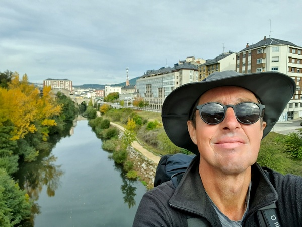
River Sil in Ponferrada
- Photographer: Claus Nedergaard Jacobsen
- Date Taken: 2019:10:27 15:13:58
- GPS Location: 42.5438427N, -6.5952228E
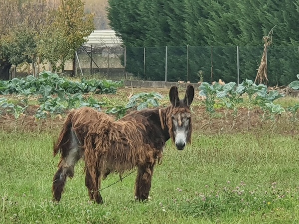
While looking for the camino outside Ponferrada, I came across this donkey who appeared to have never seen a hiker before
- Photographer: Claus Nedergaard Jacobsen
- Date Taken: 2019:10:27 16:36:55
- GPS Location: 42.5718337N, -6.6227562E
Day 21, Monday, October 28
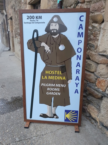
Day 21: Finally found the camino again. I was the only pilgrim in this albergue in Camponaraya. Yet, they gave me a full menu and a full bottle of wine.
- Photographer: Claus Nedergaard Jacobsen
- Date Taken: 2019:10:28 08:59:11
- GPS Location: 42.5796153N, -6.6688651E

Day 21: Wall painting in Cacabelos. The text says: "Humanity is suffering from its uncontrolled progress"
- Photographer: Claus Nedergaard Jacobsen
- Date Taken: 2019:10:28 09:58:44
- GPS Location: 42.6000126N, -6.7249421E

Day 21: Wall painting in Cacabelos. The text says: "Humanity is suffering from its uncontrolled progress
- Photographer: Claus Nedergaard Jacobsen
- Date Taken: 2019:10:28 09:59:06
- GPS Location: 42.5998363N, -6.7249178E
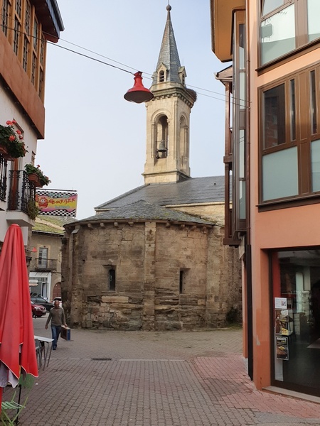
Parroquia de Santa María in Cacabelos
- Photographer: Claus Nedergaard Jacobsen
- Date Taken: 2019:10:28 10:00:29
- GPS Location: 42.5997878N, -6.7253246E

River Cúa in Cacabelos
- Photographer: Claus Nedergaard Jacobsen
- Date Taken: 2019:10:28 10:04:10
- GPS Location: 42.6001822N, -6.7257695E
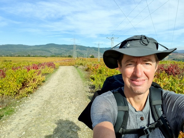
Later this morning the sun broke through and I got to experience these beautfiful wine fields near Villafranca del Bierzo. Still in the mountains and everything was so beautiful and solemn.
- Photographer: Claus Nedergaard Jacobsen
- Date Taken: 2019:10:28 10:54:45
- GPS Location: 42.6091326N, -6.7569976E

Later this morning the sun broke through and I got to experience these beautfiful wine fields near Villafranca del Bierzo. Still in the mountains and everything was so beautiful and solemn.
- Photographer: Claus Nedergaard Jacobsen
- Date Taken: 2019:10:28 11:21:58
- GPS Location: 42.6100574N, -6.7727852E

Later this morning the sun broke through and I got to experience these beautfiful wine fields near Villafranca del Bierzo. Still in the mountains and everything was so beautiful and solemn.
- Photographer: Claus Nedergaard Jacobsen
- Date Taken: 2019:10:28 11:23:08
- GPS Location: 42.6100641N, -6.7729619E

Later this morning the sun broke through and I got to experience these beautfiful wine fields near Villafranca del Bierzo. Still in the mountains and everything was so beautiful and solemn.
- Photographer: Claus Nedergaard Jacobsen
- Date Taken: 2019:10:28 11:35:45
- GPS Location: 42.6066439N, -6.7827839E
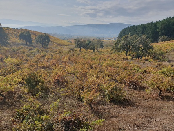
Later this morning the sun broke through and I got to experience these beautfiful wine fields near Villafranca del Bierzo. Still in the mountains and everything was so beautiful and solemn.
- Photographer: Claus Nedergaard Jacobsen
- Date Taken: 2019:10:28 11:39:44
- GPS Location: 42.6050812N, -6.7850164E
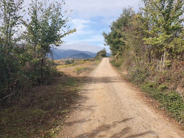
Solemn road near Villafranca del Bierzo
- Photographer: Claus Nedergaard Jacobsen
- Date Taken: 2019:10:28 11:42:17
- GPS Location: 42.6050317N, -6.7849102E

Near Villafranca del Bierzo
- Photographer: Claus Nedergaard Jacobsen
- Date Taken: 2019:10:28 11:43:01
- GPS Location: 42.6046401N, -6.7875243E

Near Villafranca del Bierzo
- Photographer: Claus Nedergaard Jacobsen
- Date Taken: 2019:10:28 11:54:06
- GPS Location: 42.6046401N, -6.7875243E

Near Villafranca del Bierzo. Autumn colours
- Photographer: Claus Nedergaard Jacobsen
- Date Taken: 2019:10:28 12:00:03
- GPS Location: 42.6044815N, -6.8040724E

Iglesia de San Francisco in Villafranca del Bierzo
- Photographer: Claus Nedergaard Jacobsen
- Date Taken: 2019:10:28 12:03:43
- GPS Location: 42.6044846N, -6.806786E
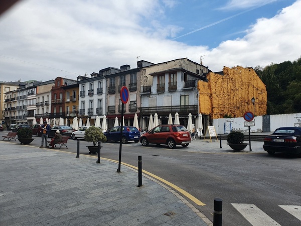
Funny wall in Villafranca del Bierzo
- Photographer: Claus Nedergaard Jacobsen
- Date Taken: 2019:10:28 12:54:14
- GPS Location: 42.6062886N, -6.8095339E

Rio Burbia in Villafranca del Bierzo
- Photographer: Claus Nedergaard Jacobsen
- Date Taken: 2019:10:28 13:18:35
- GPS Location: 42.6085543N, -6.8113698E

Orange trees (or lemon?) next to river Burbia in Villafranca del Bierzo
- Photographer: Claus Nedergaard Jacobsen
- Date Taken: 2019:10:28 13:20:08
- GPS Location: 42.6075022N, -6.8133296E

River Burbia in Villafranca del Bierzo
- Photographer: Claus Nedergaard Jacobsen
- Date Taken: 2019:10:28 13:23:10
- GPS Location: 42.6046237N, -6.812492E
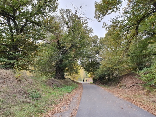
Road in Trabadelo. An old woman collecting chestnuts. Many people did this.
- Photographer: Claus Nedergaard Jacobsen
- Date Taken: 2019:10:28 16:18:25
- GPS Location: 42.64N, -6.87E
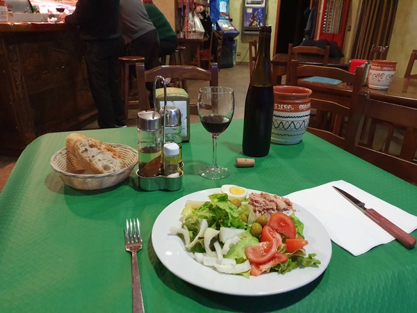
Pilgrim menu that night at Trabadelo. The mixed salad was great everywhere. Notice the full bottle of wine.
- Photographer: Claus Nedergaard Jacobsen
- Date Taken: 2019:10:28 20:11:16
- GPS Location: 42.6478484N, -6.8758243E
Day 22, Tuesday, October 29

Day 22: Outside Trabadelo. On this day I wanted to take an alternative route into the mountains but with this cloud ceiling that would have meant zero visibility. Took the low route instead - but it turned out great later
- Photographer: Claus Nedergaard Jacobsen
- Date Taken: 2019:10:29 10:16:43
- GPS Location: 42.6553669N, -6.8921869E

In La Portela de Valcarce. I believe this bar/hostal appeared in a Danish TV-series on the Camino. Recognized it.
- Photographer: Claus Nedergaard Jacobsen
- Date Taken: 2019:10:29 10:45:38
- GPS Location: 42.6601014N, -6.9178859E

In Ambasmestas: Another great-looking albergue, "Casa del Pescador" with its own little lake and right next to Rio Valcarce
- Photographer: Claus Nedergaard Jacobsen
- Date Taken: 2019:10:29 10:58:45
- GPS Location: 42.6639634N, -6.9268421E

In Vega de Valcarce. Clouds have lifted. Looks much better ahead.
- Photographer: Claus Nedergaard Jacobsen
- Date Taken: 2019:10:29 11:16:30
- GPS Location: 42.6640879N, -6.9426608E

In Vega de Valcarce. Clouds have lifted. Looks much better ahead. Look at those beautiful autumn colours
- Photographer: Claus Nedergaard Jacobsen
- Date Taken: 2019:10:29 12:39:18
- GPS Location: 42.6722161N, -6.9752964E

With Australian Robyn close to La Faba. Enjoying the autumn colours
- Photographer: Claus Nedergaard Jacobsen
- Date Taken: 2019:10:29 13:15:47
- GPS Location: 42.6799929N, -7.0041818E

With Australian Robyn close to La Faba. Climbing into the mountains
- Photographer: Claus Nedergaard Jacobsen
- Date Taken: 2019:10:29 13:21:48
- GPS Location: 42.67N, -7E

With Australian Robyn close to La Faba. Climbing into the mountains
- Photographer: Claus Nedergaard Jacobsen
- Date Taken: 2019:10:29 13:32:09
- GPS Location: 42.6799929N, -7.0041818E

Claus and Australian Roby at La Faba. Robyn came here to walk the camino every year. This was her 7th time. And she started somewhere in France so, she already walked more than 1000 km.
- Photographer: Claus Nedergaard Jacobsen
- Date Taken: 2019:10:29 13:39:26
- GPS Location: 42.7061331N, -7.0066714E

Claus and Australian Roby at La Faba. Robyn came here to walk the camino every year. This was her 7th time. And she started somewhere in France so, she already walked more than 1000 km.
- Photographer: Claus Nedergaard Jacobsen
- Date Taken: 2019:10:29 13:39:34
- GPS Location: 42.7061331N, -7.0066714E

Shortly after La Faba. Now it gets really beautiful. This is probably THE best day of the entire camino walk.
- Photographer: Claus Nedergaard Jacobsen
- Date Taken: 2019:10:29 13:56:00
- GPS Location: 42.690466N, -7.0148902E

Shortly after La Faba. Now it gets really beautiful. This is probably THE best day of the entire camino walk.
- Photographer: Claus Nedergaard Jacobsen
- Date Taken: 2019:10:29 13:56:19
- GPS Location: 42.7061331N, -7.0066714E

Shortly after La Faba. Now it gets really beautiful. This is probably THE best day of the entire camino walk. Look at those colours
- Photographer: Claus Nedergaard Jacobsen
- Date Taken: 2019:10:29 13:56:37
- GPS Location: 42.690497N, -7.0149308E
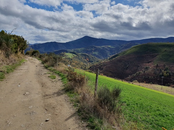
Shortly after La Faba. Now it gets really beautiful. This is probably THE best day of the entire camino walk. Look at those colours
- Photographer: Claus Nedergaard Jacobsen
- Date Taken: 2019:10:29 14:03:02
- GPS Location: 42.6933652N, -7.0178207E

Shortly after La Faba. Now it gets really beautiful. This is probably THE best day of the entire camino walk. Look at those colours
- Photographer: Claus Nedergaard Jacobsen
- Date Taken: 2019:10:29 14:03:08
- GPS Location: 42.6933652N, -7.0178207E

Shortly after La Faba. Now it gets really beautiful. This is probably THE best day of the entire camino walk. Look at those colours
- Photographer: Claus Nedergaard Jacobsen
- Date Taken: 2019:10:29 14:05:21
- GPS Location: 42.6945375N, -7.0183585E

Shortly after La Faba. Now it gets really beautiful. This is probably THE best day of the entire camino walk. Look at those colours
- Photographer: Claus Nedergaard Jacobsen
- Date Taken: 2019:10:29 14:05:28
- GPS Location: 42.6937148N, -6.9959245E

Shortly after La Faba. Now it gets really beautiful. This is probably THE best day of the entire camino walk. Look at those colours
- Photographer: Claus Nedergaard Jacobsen
- Date Taken: 2019:10:29 14:27:39
- GPS Location: 42.7061331N, -7.0066714E

Shortly after La Faba. Now it gets really beautiful. This is probably THE best day of the entire camino walk. Look at those colours
- Photographer: Claus Nedergaard Jacobsen
- Date Taken: 2019:10:29 14:32:46
- GPS Location: 42.7062771N, -7.0301543E

Shortly after La Faba. Now it gets really beautiful. This is probably THE best day of the entire camino walk. Look at those colours
- Photographer: Claus Nedergaard Jacobsen
- Date Taken: 2019:10:29 14:33:13
- GPS Location: 42.7061331N, -7.0066714E

Day 22: Entering Galicia
- Photographer: Claus Nedergaard Jacobsen
- Date Taken: 2019:10:29 14:35:54
- GPS Location: 42.7059249N, -7.0313905E
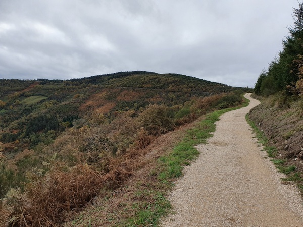
Climb to O'Cebreiro. But I did not know yet what to expect
- Photographer: Claus Nedergaard Jacobsen
- Date Taken: 2019:10:29 14:44:54
- GPS Location: 42.7071688N, -7.037013E

Climb to O'Cebreiro. But I did not know yet what to expect
- Photographer: Claus Nedergaard Jacobsen
- Date Taken: 2019:10:29 14:45:13
- GPS Location: 42.6764097N, -6.9754432E

Another, older cross, in remembrance of a pilgrim - I think?
- Photographer: Claus Nedergaard Jacobsen
- Date Taken: 2019:10:29 14:51:20
- GPS Location: 42.7075422N, -7.0426323E

Bronze statue close to O'Cebreiro
- Photographer: Claus Nedergaard Jacobsen
- Date Taken: 2019:10:29 14:52:06
- GPS Location: 42.707626N, -7.0426166E

O'Cebreiro at some 1500 meter altitude. Chilly, medieval and extremely interesting
- Photographer: Claus Nedergaard Jacobsen
- Date Taken: 2019:10:29 14:53:46
- GPS Location: 42.7N, -7.04E

An american and an argentian pilgrim next to the bar where I had coffee. When I turned from this photo - there was Elisabeth! She had caught up with me. So amazed.
- Photographer: Claus Nedergaard Jacobsen
- Date Taken: 2019:10:29 15:16:58
- GPS Location: 42.7078421N, -7.0437758E
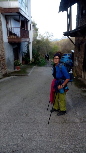
German Birgit that I met with Dieter in Leon. They sent me this photo. Not sure, where it is taken.
- Photographer: Claus Nedergaard Jacobsen
- Date Taken: 2019:10:29 18:26:32

German Dieter that I met with Birgit in Leon. They sent me this photo. Not sure, where it is taken.
- Photographer: Claus Nedergaard Jacobsen
- Date Taken: 2019:10:29 18:26:42

Evening, day 22, at Liñares, Albergue Linar do Rei a few kilometers after O'Cebreiro. No restaurant, but Italian Margharita cooked Pasta al Dente for us. From left: Korean CheHun (I think), Taiwanese Luby, Austrian Elizabeth and Italian Margharita. Despite her young age of 30, Luby has already vistited 36 countries including Denmark and spoke English extremely well.
- Photographer: Claus Nedergaard Jacobsen
- Date Taken: 2019:10:29 18:35:55
- GPS Location: 42.6991325N, -7.074404E
Day 23, Wednesday, October 30

Day 23: Claus at the monument Alto de San Roque 500 meters from Liñares, where we slept last night.
- Photographer: Claus Nedergaard Jacobsen
- Date Taken: 2019:10:30 08:32:43
- GPS Location: 42.6985841N, -7.0842413E

Day 23: The monument Alto de San Roque 500 meters from Liñares, where we slept last night.
- Photographer: Claus Nedergaard Jacobsen
- Date Taken: 2019:10:30 08:34:01
- GPS Location: 42.6987075N, -7.0839243E

Unnamed church? Close to a place named "Hospital"
- Photographer: Claus Nedergaard Jacobsen
- Date Taken: 2019:10:30 09:38:15
- GPS Location: 42.7057574N, -7.1081378E

Not the same weather as yesterday but still a great view
- Photographer: Claus Nedergaard Jacobsen
- Date Taken: 2019:10:30 09:38:21
- GPS Location: 42.7114109N, -7.1220496E

Iglesia de San Juan in Fonfría
- Photographer: Claus Nedergaard Jacobsen
- Date Taken: 2019:10:30 10:28:04
- GPS Location: 42.7312733N, -7.1571033E

More beautiful scenery. But we have moved from summer into autumn
- Photographer: Claus Nedergaard Jacobsen
- Date Taken: 2019:10:30 11:04:56
- GPS Location: 42.7433038N, -7.1815516E
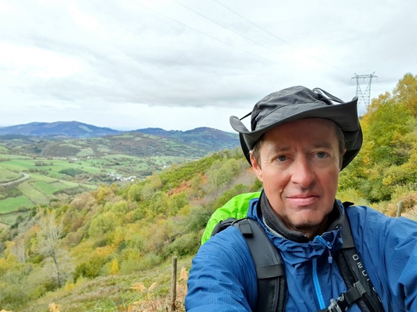
Scenery some 5 km before Triacastela
- Photographer: Claus Nedergaard Jacobsen
- Date Taken: 2019:10:30 11:05:12
- GPS Location: 42.7436724N, -7.1863655E

Margharita and Claus in Triacastela where we had lunch. Margharita staid. I continued. Look how we wear rain cover.
- Photographer: Claus Nedergaard Jacobsen
- Date Taken: 2019:10:30 13:15:06
- GPS Location: 42.756019N, -7.2356377E

Could be a Danish forest in autumn. Close to Lastres.
- Photographer: Claus Nedergaard Jacobsen
- Date Taken: 2019:10:30 14:58:44
- GPS Location: 42.7388257N, -7.295469E

More streaming water (Rio Sarria, I believe). Close to Lastres.
- Photographer: Claus Nedergaard Jacobsen
- Date Taken: 2019:10:30 15:00:40
- GPS Location: 42.7404155N, -7.2963233E

Church with no name? Close to Loureiro
- Photographer: Claus Nedergaard Jacobsen
- Date Taken: 2019:10:30 15:25:15
- GPS Location: 42.7498714N, -7.3032278E

Todays target: Samos Monastery. It is also an albergue but I chose not to sleep over there but in another albergue in Samos. Elisabeth had chosen another route and I was on my own again.
- Photographer: Claus Nedergaard Jacobsen
- Date Taken: 2019:10:30 15:38:10
- GPS Location: 42.7337345N, -7.3226793E

Samos
- Photographer: Claus Nedergaard Jacobsen
- Date Taken: 2019:10:30 15:42:58
- GPS Location: 42.73138N, -7.3241788E

Samos
- Photographer: Claus Nedergaard Jacobsen
- Date Taken: 2019:10:30 15:44:07
- GPS Location: 42.7313746N, -7.3243147E
Day 24, Thursday, October 31

Val de Samos Albergue. No restaurant but a great kitchen. There was a restaurant next door. Unfortunately there was no warm water.
- Photographer: Claus Nedergaard Jacobsen
- Date Taken: 2019:10:31 08:08:02
- GPS Location: 42.7309602N, -7.3268786E

Val de Samos Albergue. Reception
- Photographer: Claus Nedergaard Jacobsen
- Date Taken: 2019:10:31 08:08:13
- GPS Location: 42.7309602N, -7.3268786E

Day 24: Samos Monastery. Unfortunately it did not open until later, so I never got to see it inside.
- Photographer: Claus Nedergaard Jacobsen
- Date Taken: 2019:10:31 08:10:35
- GPS Location: 42.7308942N, -7.3268716E

Another end of camino. Very recent too.
- Photographer: Claus Nedergaard Jacobsen
- Date Taken: 2019:10:31 10:31:28
- GPS Location: 42.7607594N, -7.35354E

An albergue passed on the way, Pousada de Raquel. Next to Aquiada
- Photographer: Claus Nedergaard Jacobsen
- Date Taken: 2019:10:31 11:11:25
- GPS Location: 42.792523N, -7.3670182E
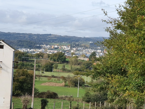
Could be Sarria?
- Photographer: Claus Nedergaard Jacobsen
- Date Taken: 2019:10:31 11:18:34
- GPS Location: 42.7740727N, -7.3774803E
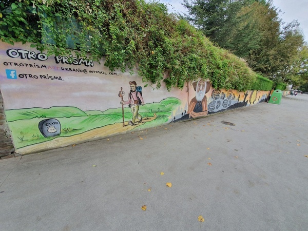
Street painting in Sarria
- Photographer: Claus Nedergaard Jacobsen
- Date Taken: 2019:10:31 12:09:51
- GPS Location: 42.7761888N, -7.4118542E
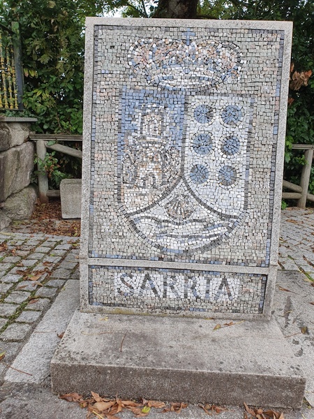
Sarria
- Photographer: Claus Nedergaard Jacobsen
- Date Taken: 2019:10:31 12:20:04
- GPS Location: 42.777455N, -7.4177633E

Scenic view in Sarria
- Photographer: Claus Nedergaard Jacobsen
- Date Taken: 2019:10:31 12:20:23
- GPS Location: 42.777455N, -7.4177633E

View over Sarria
- Photographer: Claus Nedergaard Jacobsen
- Date Taken: 2019:10:31 12:20:49
- GPS Location: 42.777455N, -7.4177633E
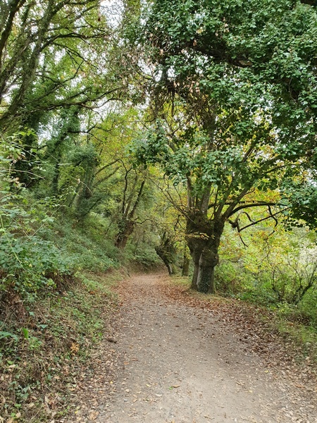
Walking through autumn forest just after Sarria
- Photographer: Claus Nedergaard Jacobsen
- Date Taken: 2019:10:31 12:46:57
- GPS Location: 42.7724592N, -7.4328682E
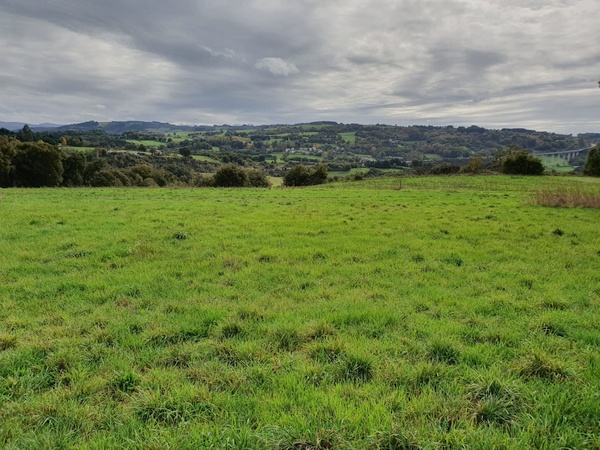
Beautiful green grass just after Sarria
- Photographer: Claus Nedergaard Jacobsen
- Date Taken: 2019:10:31 12:56:37
- GPS Location: 42.7704615N, -7.4381464E
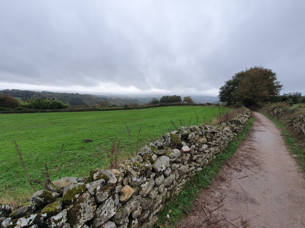
Close to Ferreiros
- Photographer: Claus Nedergaard Jacobsen
- Date Taken: 2019:10:31 15:51:56
- GPS Location: 42.7841585N, -7.5250306E

Milestone at Mirallos
- Photographer: Claus Nedergaard Jacobsen
- Date Taken: 2019:10:31 16:09:56
- GPS Location: 42.7843721N, -7.5393171E

100 km milestone at A Pena
- Photographer: Claus Nedergaard Jacobsen
- Date Taken: 2019:10:31 16:13:05
- GPS Location: 42.7848903N, -7.5419151E

100 km milestone at A Pena
- Photographer: Claus Nedergaard Jacobsen
- Date Taken: 2019:10:31 16:13:12
- GPS Location: 42.7848903N, -7.5419151E

Funny way to carve a decoration into stone. At Mercadoiro
- Photographer: Claus Nedergaard Jacobsen
- Date Taken: 2019:10:31 16:33:07
- GPS Location: 42.787881N, -7.5726315E

At Albergue De Mercadoiro, one of the better. Lots of wine. From left: German Suzanne, Claus, Italian Elia, French Carola, German Heike and German Steffi. The German girls got very silly and maybe they forgot I understand German. That would explain my pink colour
- Photographer: Claus Nedergaard Jacobsen
- Date Taken: 2019:10:31 19:25:52
- GPS Location: 42.7885868N, -7.568705E
Day 25, Friday, November 1

Day 25: Just outside Mercadoiro.Could be Portomarin ahead
- Photographer: Claus Nedergaard Jacobsen
- Date Taken: 2019:11:01 08:46:05
- GPS Location: 42.7911046N, -7.5821027E

Just outside Portomarin. The lake ahead is part of the river Minho (?)
- Photographer: Claus Nedergaard Jacobsen
- Date Taken: 2019:11:01 09:46:32
- GPS Location: 42.796686N, -7.6097216E

Rocky and slippery passage near Portomarin. This is where I teamed up with Elia. We also passed a brazillian pilgrim in bathing sandals.
- Photographer: Claus Nedergaard Jacobsen
- Date Taken: 2019:11:01 09:59:24
- GPS Location: 42.8007553N, -7.6170239E

Rocky and slippery passage near Portomarin. This is where I teamed up with Elia. We also passed a brazillian pilgrim in bathing sandals.
- Photographer: Claus Nedergaard Jacobsen
- Date Taken: 2019:11:01 09:59:32
- GPS Location: 42.8007553N, -7.6170239E

Ponto Nova de Portomarin
- Photographer: Claus Nedergaard Jacobsen
- Date Taken: 2019:11:01 10:04:56
- GPS Location: 42.8027432N, -7.6150495E

Dried out riverbed near Portomain (Rio Minho)
- Photographer: Claus Nedergaard Jacobsen
- Date Taken: 2019:11:01 10:11:22
- GPS Location: 42.8063148N, -7.6185278E

German girl showing an alternative way to carry your belongings
- Photographer: Claus Nedergaard Jacobsen
- Date Taken: 2019:11:01 11:56:32
- GPS Location: 42.8216613N, -7.7112912E
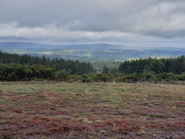
Scenic view near Castromaior
- Photographer: Claus Nedergaard Jacobsen
- Date Taken: 2019:11:01 13:05:38
- GPS Location: 42.8340942N, -7.7183445E
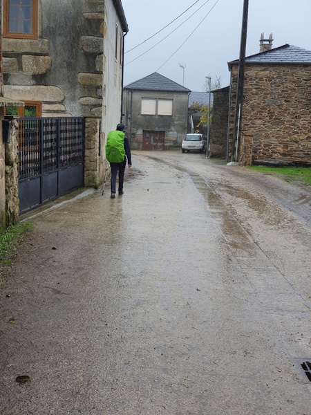
Walking in rain through Ligonde. The camera does not catch the drops very well. The lady in front is Swiss and began her journey in Switzerland.
- Photographer: Claus Nedergaard Jacobsen
- Date Taken: 2019:11:01 14:18:33
- GPS Location: 42.8569978N, -7.778389E
Day 26, Saturday, November 2

Day 26: Parroquia católica San Julián. Elia and I were invited in and got a stamp in our passport
- Photographer: Claus Nedergaard Jacobsen
- Date Taken: 2019:11:02 09:15:33
- GPS Location: 42.8742802N, -7.9042463E

Colourful but poisoneous salamanders hiding in the leaves. Elia knew everything. So impressed by him.
- Photographer: Claus Nedergaard Jacobsen
- Date Taken: 2019:11:02 09:45:42
- GPS Location: 42.8789404N, -7.930572E

American Landon to the left and Italian Elia entering Furelos
- Photographer: Claus Nedergaard Jacobsen
- Date Taken: 2019:11:02 11:13:29
- GPS Location: 42.91N, -8E

Landon before the bridge into Furelos
- Photographer: Claus Nedergaard Jacobsen
- Date Taken: 2019:11:02 11:13:40
- GPS Location: 42.9080559N, -7.9982905E

Italian Elia and American Landon from New Orleans having octopus in Furelos.
- Photographer: Claus Nedergaard Jacobsen
- Date Taken: 2019:11:02 11:43:16
- GPS Location: 42.9133327N, -8.0125467E

Octopus. I do not have to try that again. I prefer to pet them under water
- Photographer: Claus Nedergaard Jacobsen
- Date Taken: 2019:11:02 11:43:27
- GPS Location: 42.9133327N, -8.0125467E

The first of many "Horreos". A place to store food safely away from mice. Over time, the horreos grew into something artistical to display the wealth of the owner. Near Rivadiso
- Photographer: Claus Nedergaard Jacobsen
- Date Taken: 2019:11:02 14:59:38
- GPS Location: 42.9290706N, -8.1306128E

Landon walking through Rivadiso.
- Photographer: Claus Nedergaard Jacobsen
- Date Taken: 2019:11:02 14:59:47
- GPS Location: 42.9290706N, -8.1306128E

A Calzada. The cows found their own way home from the fields.
- Photographer: Claus Nedergaard Jacobsen
- Date Taken: 2019:11:02 16:57:16
- GPS Location: 42.9257934N, -8.2225763E

A Calzada. The cows found their own way home from the fields.
- Photographer: Claus Nedergaard Jacobsen
- Date Taken: 2019:11:02 16:57:34
- GPS Location: 42.9257934N, -8.2225763E

A Calzada. The cows found their own way home from the fields.
- Photographer: Claus Nedergaard Jacobsen
- Date Taken: 2019:11:02 16:57:47
- GPS Location: 42.9248594N, -8.2105327E
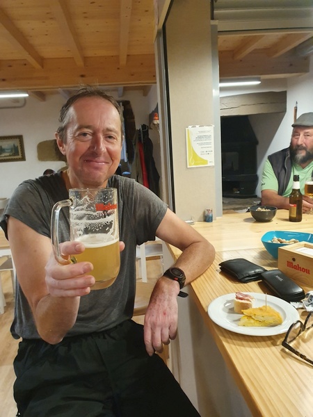
At Albergue A Ponte de Ferreiros in Outeiro. All soaked up from rain. But the beer was worth it.
- Photographer: Claus Nedergaard Jacobsen
- Date Taken: 2019:11:02 17:39:10
- GPS Location: 42.9160255N, -8.2430572E

From Elia. Not sure where and when. But definitely rain and autumn colours
- Photographer: Elia Lamberti (IT)
- Date Taken: 2019:11:02 18:05:19
- GPS Location: 43N, -8.2E

At Albergue A Ponte de Ferreiros in Outeiro. Great mixed salad (only the first of three dishes for a standard pilgrim meal at 10 - 12 Euros, wine and bread included). Elia had some salad
- Photographer: Claus Nedergaard Jacobsen
- Date Taken: 2019:11:02 19:52:54
- GPS Location: 42.9160255N, -8.2430572E

At Albergue A Ponte de Ferreiros in Outeiro. Main dish - chicken with frites.
- Photographer: Claus Nedergaard Jacobsen
- Date Taken: 2019:11:02 20:13:12
- GPS Location: 42.9160255N, -8.2430572E
Day 27, Sunday, November 3
Arrival in Santiago de Compostella and the following days. Don't forget to turn on the sound.
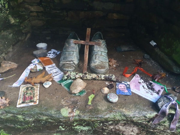
Day 27: Another memorial point shortly after Outeiro.
- Photographer: Claus Nedergaard Jacobsen
- Date Taken: 2019:11:03 09:28:41
- GPS Location: 42.92N, -8.285E

Another memorial point close to A Salceda
- Photographer: Claus Nedergaard Jacobsen
- Date Taken: 2019:11:03 09:29:12
- GPS Location: 42.9256308N, -8.2852467E

Elia enjoying about the only glimpse of sun we had on that day. Close to A Salceda with only 20 km to Santiago.
- Photographer: Claus Nedergaard Jacobsen
- Date Taken: 2019:11:03 09:34:42
- GPS Location: 42.9254404N, -8.2852558E

Highlight of the morning: Cafe con leche and a croissant chocolat. At O Pino.
- Photographer: Claus Nedergaard Jacobsen
- Date Taken: 2019:11:03 10:17:22
- GPS Location: 42.9197917N, -8.1652523E

Diving under the road
- Photographer: Claus Nedergaard Jacobsen
- Date Taken: 2019:11:03 10:50:07
- GPS Location: 42.9184493N, -8.337745E

This could be a Danish forest in the autumn. But we are 15 km from Santiago
- Photographer: Claus Nedergaard Jacobsen
- Date Taken: 2019:11:03 11:12:52
- GPS Location: 42.9159929N, -8.3576207E

Beautiful wall paintings in O Pedrouzo
- Photographer: Claus Nedergaard Jacobsen
- Date Taken: 2019:11:03 11:16:25
- GPS Location: 42.908075N, -8.363403E
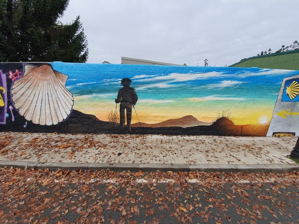
Beautiful wall paintings in O Pedrouzo. Look at all the leaves too. We have really walked into autumn.
- Photographer: Claus Nedergaard Jacobsen
- Date Taken: 2019:11:03 11:16:53
- GPS Location: 42.9110569N, -8.3589903E

Closed bar. We are really at the end of the season.
- Photographer: Claus Nedergaard Jacobsen
- Date Taken: 2019:11:03 11:19:10
- GPS Location: 42.9077645N, -8.3647721E
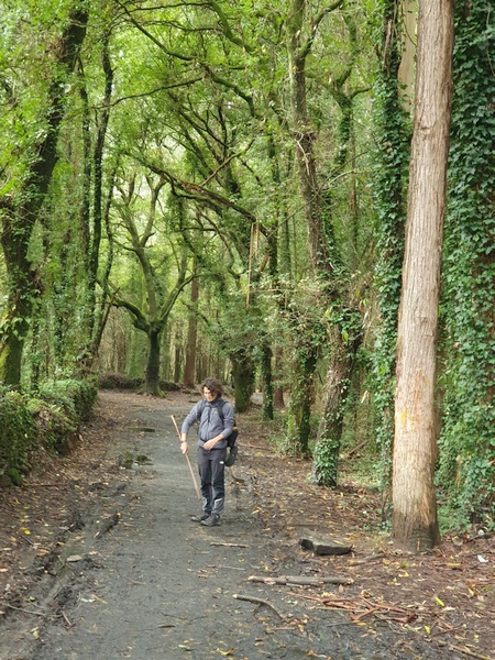
More Danish-like forest near O Pedrouzo.
- Photographer: Claus Nedergaard Jacobsen
- Date Taken: 2019:11:03 11:20:50
- GPS Location: 42.9N, -8.36E

Elia at huge fern plants (Danish: "Bregne"). They could be found in Denmark too.
- Photographer: Claus Nedergaard Jacobsen
- Date Taken: 2019:11:03 12:14:54
- GPS Location: 42.9N, -8.36E

Last day: It is ok to have a Cerveza con Limone in the middle of the day. We have just passed the airport of Santiago and we are within 10 km. Kind of sad.
- Photographer: Claus Nedergaard Jacobsen
- Date Taken: 2019:11:03 13:17:39
- GPS Location: 42.8998283N, -8.436928E

Walking into Santiago in rain
- Photographer: Claus Nedergaard Jacobsen
- Date Taken: 2019:11:03 15:43:47
- GPS Location: 42.8873249N, -8.5028797E
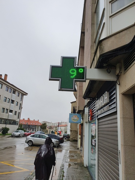
Walking into Santiago in rain and only 9° C. Cold and wet. Elia in front
- Photographer: Claus Nedergaard Jacobsen
- Date Taken: 2019:11:03 16:16:09
- GPS Location: 42.88546N, -8.5308477E
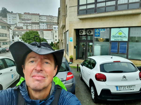
Claus in front of the albergue where we chose to stay before proceding to the cathedral, La Credencial.
- Photographer: Claus Nedergaard Jacobsen
- Date Taken: 2019:11:03 16:18:03
- GPS Location: 42.8849983N, -8.5319443E

View of Santiago from outside our albergue. Hardly anything to see
- Photographer: Claus Nedergaard Jacobsen
- Date Taken: 2019:11:03 16:18:18
- GPS Location: 42.8851285N, -8.53199E

Later that night we went into the city to watch the Cathedral at night. Our first glimpse of it. No other pilgrims around.
- Photographer: Claus Nedergaard Jacobsen
- Date Taken: 2019:11:03 19:46:35
- GPS Location: 42.8806106N, -8.5457855E

Later that night we went into the city to watch the Cathedral at night. Our first glimpse of it. No other pilgrims around.
- Photographer: Claus Nedergaard Jacobsen
- Date Taken: 2019:11:03 19:47:38
- GPS Location: 42.8806514N, -8.5454291E

Dinner in town with Fabricio, Elisabeth, Elia and other pilgrims that we had met at the camino.
- Photographer: Claus Nedergaard Jacobsen
- Date Taken: 2019:11:03 20:11:12
- GPS Location: 42.8784477N, -8.5456225E

Dinner in town with Fabricio, Elisabeth, Elia and other pilgrims that we had met at the camino.
- Photographer: Claus Nedergaard Jacobsen
- Date Taken: 2019:11:03 20:11:51
- GPS Location: 42.8784477N, -8.5456225E

Dinner in town with Fabricio, Elisabeth, Elia and other pilgrims that we had met at the camino.
- Photographer: Claus Nedergaard Jacobsen
- Date Taken: 2019:11:03 20:11:53
- GPS Location: 42.8784477N, -8.5456225E

Dinner in town with Fabricio, Elisabeth, Elia and other pilgrims that we had met at the camino.
- Photographer: Fabrizio Ciappone
- Date Taken: 2019:11:03 20:15:28
- GPS Location: 42.8784477N, -8.5456225E
Postludium - the days after

Day 28: The cathedral of Santiago was being renovated. It was possible to get in but almost everything was covered in plastic.
- Photographer: Claus Nedergaard Jacobsen
- Date Taken: 2019:11:04 10:25:29
- GPS Location: 42.8812257N, -8.5444999E
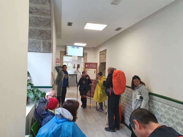
Waiting in line for our pilgrim document
- Photographer: Claus Nedergaard Jacobsen
- Date Taken: 2019:11:04 11:15:36
- GPS Location: 42.8822311N, -8.5468608E

The square in front of the Cathedral where the pilgrims gather
- Photographer: Claus Nedergaard Jacobsen
- Date Taken: 2019:11:04 11:54:42
- GPS Location: 42.8807613N, -8.5456476E

A park in Santiago. I went for a walk
- Photographer: Claus Nedergaard Jacobsen
- Date Taken: 2019:11:04 13:36:59
- GPS Location: 42.8766941N, -8.5466867E

A park in Santiago. I went for a walk
- Photographer: Claus Nedergaard Jacobsen
- Date Taken: 2019:11:04 13:37:27
- GPS Location: 42.8766941N, -8.5466867E

Romain, Carola and Eleonora and more arriving to the Cathedral on Nov. 4. Very emotional moment
- Photographer: Claus Nedergaard Jacobsen
- Date Taken: 2019:11:04 15:31:14
- GPS Location: 42.8808793N, -8.5454986E

Romain, Carola and Eleonora and more arriving to the Cathedral on Nov. 4. Very emotional
- Photographer: Claus Nedergaard Jacobsen
- Date Taken: 2019:11:04 15:31:23
- GPS Location: 42.8808779N, -8.5454925E

Pilgrims hugging in front of the Cathedral
- Photographer: Claus Nedergaard Jacobsen
- Date Taken: 2019:11:04 15:33:35
- GPS Location: 42.8806091N, -8.5457623E
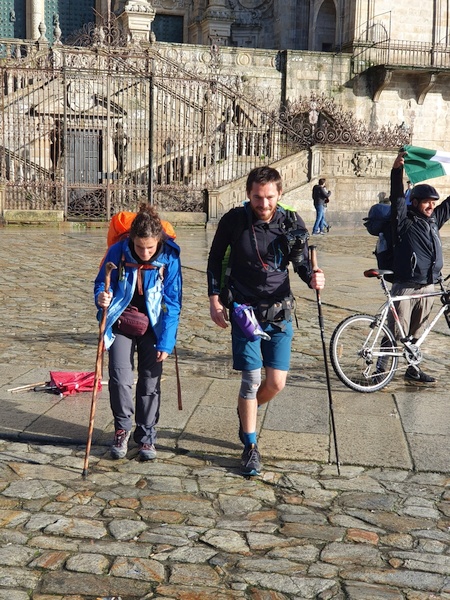
Eleonora and Romain posing for the cameras
- Photographer: Claus Nedergaard Jacobsen
- Date Taken: 2019:11:04 15:39:51
- GPS Location: 42.880551N, -8.5457488E

A German girl imposing the hunchback of Notre Dame
- Photographer: Claus Nedergaard Jacobsen
- Date Taken: 2019:11:04 15:40:13
- GPS Location: 42.8805403N, -8.5457292E

A German girl imposing the hunchback of Notre Dame
- Photographer: Claus Nedergaard Jacobsen
- Date Taken: 2019:11:04 15:40:17
- GPS Location: 42.8806619N, -8.5456071E

Korean girl posing
- Photographer: Claus Nedergaard Jacobsen
- Date Taken: 2019:11:04 15:40:47
- GPS Location: 42.8805315N, -8.545707E

Eleonora and Carola hugging in front of the Cathedral
- Photographer: Claus Nedergaard Jacobsen
- Date Taken: 2019:11:04 15:42:41
- GPS Location: 42.8805251N, -8.5456771E
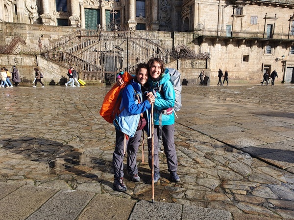
Eleonora and Carola hugging in front of the Cathedral
- Photographer: Claus Nedergaard Jacobsen
- Date Taken: 2019:11:04 15:44:28
- GPS Location: 42.8805001N, -8.545673E

A Korean biker posing
- Photographer: Claus Nedergaard Jacobsen
- Date Taken: 2019:11:04 15:46:39
- GPS Location: 42.8805202N, -8.5457356E

The group that just arrived assembled for chocolate with churros and beer. The third guy from the right is a Danish sailor
- Photographer: Claus Nedergaard Jacobsen
- Date Taken: 2019:11:04 16:33:53
- GPS Location: 42.8787906N, -8.5444953E
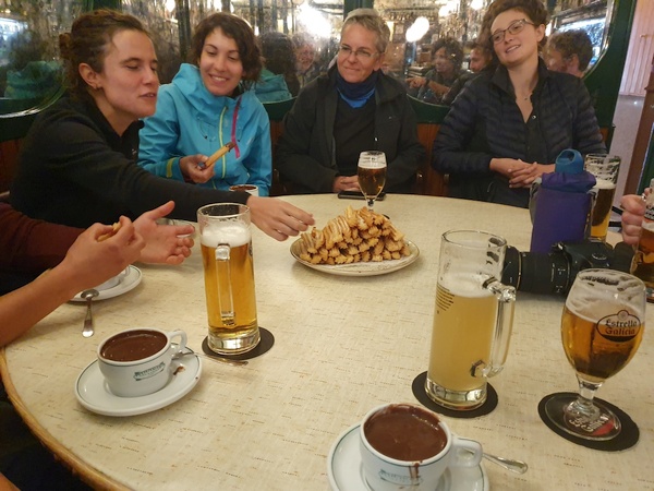
The group that just arrived assembled for churros with chocolate and beer. It was delicious
- Photographer: Claus Nedergaard Jacobsen
- Date Taken: 2019:11:04 16:35:25
- GPS Location: 42.878784N, -8.5444875E

I lit a candle in the Cathedral.
- Photographer: Claus Nedergaard Jacobsen
- Date Taken: 2019:11:05 14:59:04
- GPS Location: 42.8806067N, -8.5444894E
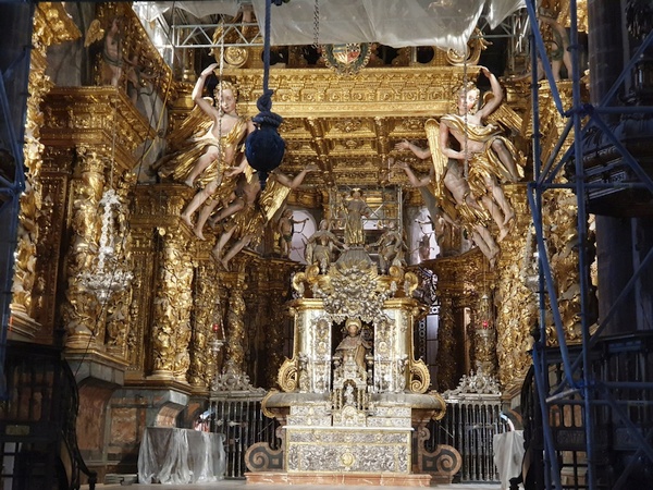
Altarpiece inside the Cathedral
- Photographer: Claus Nedergaard Jacobsen
- Date Taken: 2019:11:05 15:02:51
- GPS Location: 42.8806073N, -8.5445912E

The Cathedral seen from another angle
- Photographer: Claus Nedergaard Jacobsen
- Date Taken: 2019:11:05 15:41:47
- GPS Location: 42.880386N, -8.5437121E

Margharita just arrived at the Cathedral on Nov 5. Her own picture.
- Photographer: Margharita Palomba (IT)
- Date Taken: 2019:11:05 15:59:32
- GPS Location: 42.8805251N, -8.5456771E

A park in Santiago
- Photographer: Claus Nedergaard Jacobsen
- Date Taken: 2019:11:05 17:21:48
- GPS Location: 42.8773628N, -8.5460709E

Bar in Santiago. Still possible to sit outside on Nov. 5
- Photographer: Claus Nedergaard Jacobsen
- Date Taken: 2019:11:05 17:22:00
- GPS Location: 42.877399N, -8.5460495E

Bar in Santiago. Still possible to sit outside on Nov. 5
- Photographer: Claus Nedergaard Jacobsen
- Date Taken: 2019:11:05 17:22:05
- GPS Location: 42.877399N, -8.5460495E

Nov 6: Claus having breakfast. Not too happy about my haircut.
- Photographer: Claus Nedergaard Jacobsen
- Date Taken: 2019:11:06 10:48:37
- GPS Location: 42.8832856N, -8.5432773E

Beautiful decoration of Cafe con leche
- Photographer: Claus Nedergaard Jacobsen
- Date Taken: 2019:11:06 11:00:08
- GPS Location: 42.8832611N, -8.5433657E

Entrance to Iglesia de San Francisco where the pilgrim mass was held (because the cathedral was being renovated). This is where I met Ivana again.
- Photographer: Claus Nedergaard Jacobsen
- Date Taken: 2019:11:06 11:25:17
- GPS Location: 42.8831564N, -8.5446225E

Entrance to Iglesia de San Francisco where the pilgrim mass was held (because the cathedral was being renovated). This is where I met Ivana again.
- Photographer: Claus Nedergaard Jacobsen
- Date Taken: 2019:11:06 11:25:33
- GPS Location: 42.8830191N, -8.5454637E

Altarpiece in Iglesia de San Francisco
- Photographer: Claus Nedergaard Jacobsen
- Date Taken: 2019:11:06 11:39:27
- GPS Location: 42.8830596N, -8.5450009E
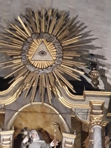
The very top of the altar. The symbol that was mentioned in a David Browne book.
- Photographer: Claus Nedergaard Jacobsen
- Date Taken: 2019:11:06 12:00:08
- GPS Location: 42.8830596N, -8.5450009E

Pilgrims lining up for supper. So did I. We did not have wine, only bread. But the minister had wine. Strange.
- Photographer: Claus Nedergaard Jacobsen
- Date Taken: 2019:11:06 12:36:54
- GPS Location: 42.8830596N, -8.5450009E

View of the Cathedral from a local park
- Photographer: Claus Nedergaard Jacobsen
- Date Taken: 2019:11:06 13:19:50
- GPS Location: 42.8782158N, -8.5479375E

A walk in a local park
- Photographer: Claus Nedergaard Jacobsen
- Date Taken: 2019:11:06 13:26:14
- GPS Location: 42.8782054N, -8.5489141E

Igrexa de Santa Susana in the city park of Santiago
- Photographer: Claus Nedergaard Jacobsen
- Date Taken: 2019:11:06 13:31:17
- GPS Location: 42.8771055N, -8.5478969E

Bustour to Finisterre and Muxia. Here we stopped at Ponte Maceira where there is an old water driven mill
- Photographer: Claus Nedergaard Jacobsen
- Date Taken: 2019:11:07 10:43:25
- GPS Location: 42.91N, -8.69E

Ponto Maceira at river Tambre. Powerful water flow
- Photographer: Claus Nedergaard Jacobsen
- Date Taken: 2019:11:07 10:44:39
- GPS Location: 42.91N, -8.69E

Ponto Maceira at river Tambre. Powerful water flow
- Photographer: Claus Nedergaard Jacobsen
- Date Taken: 2019:11:07 10:48:02
- GPS Location: 42.905187N, -8.6942953E

Ponto Maceira at river Tambre. Powerful water flow. Mill house to the left
- Photographer: Claus Nedergaard Jacobsen
- Date Taken: 2019:11:07 10:48:10
- GPS Location: 42.905187N, -8.6942953E
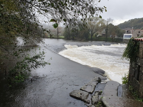
Ponto Maceira at river Tambre. Powerful water flow
- Photographer: Claus Nedergaard Jacobsen
- Date Taken: 2019:11:07 10:49:41
- GPS Location: 42.905N, -8.694E
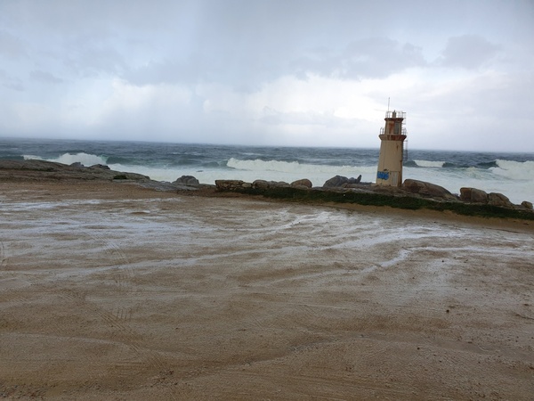
At Faro de Muxia. Soaking rain and strong waves. Glad I was in a bus on not on foot.
- Photographer: Claus Nedergaard Jacobsen
- Date Taken: 2019:11:07 11:54:50
- GPS Location: 43.112623N, -9.2191997E

Virxe da Barca sanctuary at Muxia where we took shelter from the rain
- Photographer: Claus Nedergaard Jacobsen
- Date Taken: 2019:11:07 11:55:21
- GPS Location: 43.1126232N, -9.2193219E
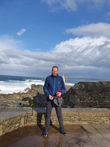
Claus in front of Faro de Muxia.
- Photographer: Claus Nedergaard Jacobsen
- Date Taken: 2019:11:07 12:07:16
- GPS Location: 43.0920449N, -9.2215805E

Faro de Muxia. Something about this stone being named "the vessel of Santa Maria"
- Photographer: Claus Nedergaard Jacobsen
- Date Taken: 2019:11:07 12:08:09
- GPS Location: 43.0920449N, -9.2215805E
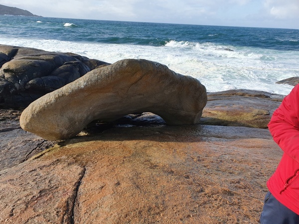
I think, this is supposed to be the sail.
- Photographer: Claus Nedergaard Jacobsen
- Date Taken: 2019:11:07 12:10:12
- GPS Location: 43.1122571N, -9.2204185E

And this is boat of the vessel of Saint Maria. If you can move it, you are innocent. Nobody can.
- Photographer: Claus Nedergaard Jacobsen
- Date Taken: 2019:11:07 12:10:22
- GPS Location: 43.1122571N, -9.2204185E
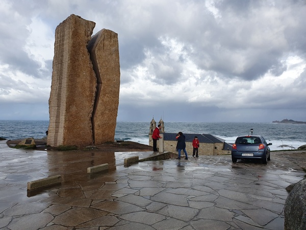
This is a symbol - as far as I remember - to commemorate the cleaing up of one of worst oil spill disasters in the world
- Photographer: Claus Nedergaard Jacobsen
- Date Taken: 2019:11:07 12:16:54
- GPS Location: 43.1110553N, -9.2193421E

Muxia
- Photographer: Claus Nedergaard Jacobsen
- Date Taken: 2019:11:07 12:17:05
- GPS Location: 43.1110553N, -9.2193421E

Muxia
- Photographer: Claus Nedergaard Jacobsen
- Date Taken: 2019:11:07 12:17:09
- GPS Location: 43.1110553N, -9.2193421E

Muxia
- Photographer: Claus Nedergaard Jacobsen
- Date Taken: 2019:11:07 12:17:12
- GPS Location: 43.0988365N, -9.2156945E

Virxe da Barca sanctuary at Muxia
- Photographer: Claus Nedergaard Jacobsen
- Date Taken: 2019:11:07 12:17:39
- GPS Location: 43.0988365N, -9.2156945E

Claus at the milestone next to commemoration mark
- Photographer: Claus Nedergaard Jacobsen
- Date Taken: 2019:11:07 12:24:36
- GPS Location: 43.1111458N, -9.2193539E

Claus at the milestone next to commemoration mark
- Photographer: Claus Nedergaard Jacobsen
- Date Taken: 2019:11:07 12:25:03
- GPS Location: 43.0920449N, -9.2215805E

Claus at Finisterre. Here the milestone also read "0,00 km"
- Photographer: Claus Nedergaard Jacobsen
- Date Taken: 2019:11:07 13:14:14
- GPS Location: 42.9378589N, -9.1914627E

Vaca de Fisterra
- Photographer: Claus Nedergaard Jacobsen
- Date Taken: 2019:11:07 13:16:51
- GPS Location: 42.882603N, -9.2719077E

Vaca de Fisterra from another angle
- Photographer: Claus Nedergaard Jacobsen
- Date Taken: 2019:11:07 13:21:44
- GPS Location: 42.8828788N, -9.2716241E

Pilgrim memorial at Finisterre
- Photographer: Claus Nedergaard Jacobsen
- Date Taken: 2019:11:07 13:36:19
- GPS Location: 42.8812118N, -9.2715954E

Waterfall at Ezaro
- Photographer: Claus Nedergaard Jacobsen
- Date Taken: 2019:11:07 16:13:23
- GPS Location: 42.9124923N, -9.1178798E

Claus selfie with the waterfall at Ezaro as background
- Photographer: Claus Nedergaard Jacobsen
- Date Taken: 2019:11:07 16:16:53
- GPS Location: 42.9107115N, -9.1350654E

Harbour at Ezaro. Looks like Norway
- Photographer: Claus Nedergaard Jacobsen
- Date Taken: 2019:11:07 16:29:00
- GPS Location: 42.9124602N, -9.122971E

Sign leading to the largest Horreo of all. Food storage
- Photographer: Claus Nedergaard Jacobsen
- Date Taken: 2019:11:07 16:54:14
- GPS Location: 42.8227746N, -9.0894003E

The largest Horreo of all (food storage - safe from mice)
- Photographer: Claus Nedergaard Jacobsen
- Date Taken: 2019:11:07 16:56:19
- GPS Location: 42.8226992N, -9.0906006E
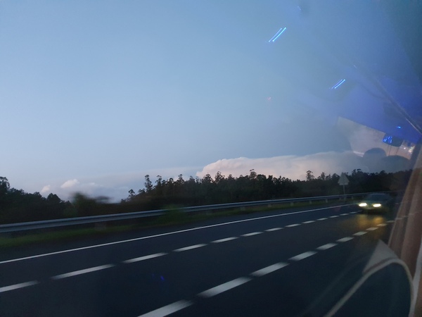
Heavy thunder clouds building up
- Photographer: Claus Nedergaard Jacobsen
- Date Taken: 2019:11:07 18:35:39
- GPS Location: 42.8374694N, -8.7339312E
Getting my feet fixed after returning home.The soles had grown thicker by approx. 0.5 cm!
- Photographer: Claus Nedergaard Jacobsen
- Date Taken: 2019:11:18 17:10:31
- GPS Location: 56.1684866N, 9.54664E