Page 3 of 30
Day 1, Tuesday, October 8
Absolutely wonderful day for crossing the Pyrenees. Don't forget to turn on the sound.

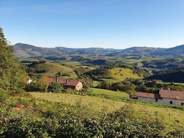
Starting out on the Camino on October 10. Still in St. Jean Pied de Port
- Photographer: Claus Nedergaard Jacobsen
- Date Taken: 2019:10:08 08:30:42
- GPS Location: 43.1612894N, -1.2378334E
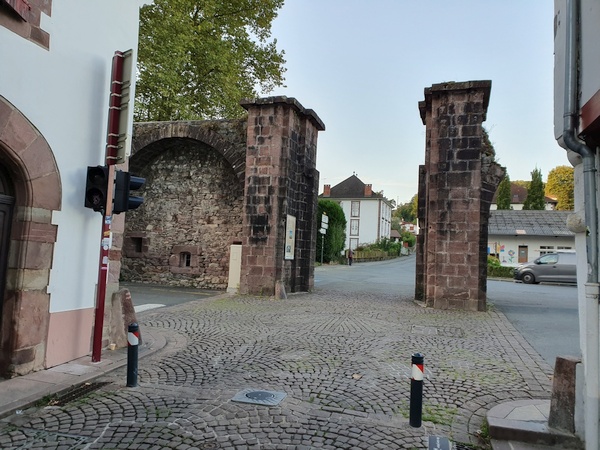
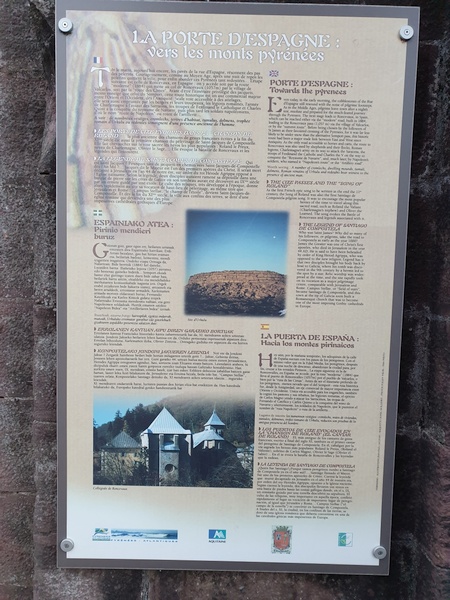
"La Porte d'Espagne" - the Spanish gate. Where the Camino officially starts in St. Jean Pied de Port. Before you head up the Pyrenees.
- Photographer: Claus Nedergaard Jacobsen
- Date Taken: 2019:10:08 08:31:57
- GPS Location: 43.1615644N, -1.2389398E

"La Porte d'Espagne" - the Spanish gate. Where the Camino officially starts in St. Jean Pied de Port. Before you head up the Pyrenees.
- Photographer: Claus Nedergaard Jacobsen
- Date Taken: 2019:10:08 08:32:11
- GPS Location: 43.1615644N, -1.2389398E

"La Porte d'Espagne" - the Spanish gate. Where the Camino officially starts in St. Jean Pied de Port. Before you head up the Pyrenees.
- Photographer: Claus Nedergaard Jacobsen
- Date Taken: 2019:10:08 08:32:14
- GPS Location: 43.1615644N, -1.2389398E
"La Porte d'Espagne" - the Spanish gate. Where the Camino officially starts in St. Jean Pied de Port. Before you head up the Pyrenees.
- Photographer: Claus Nedergaard Jacobsen
- Date Taken: 2019:10:08 08:32:32
- GPS Location: 43.1604547N, -1.238258E

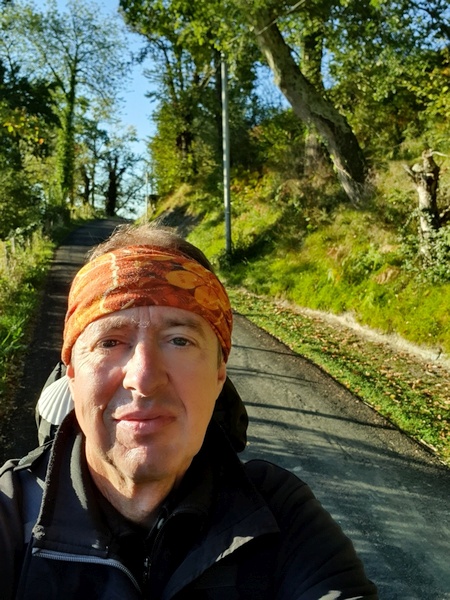
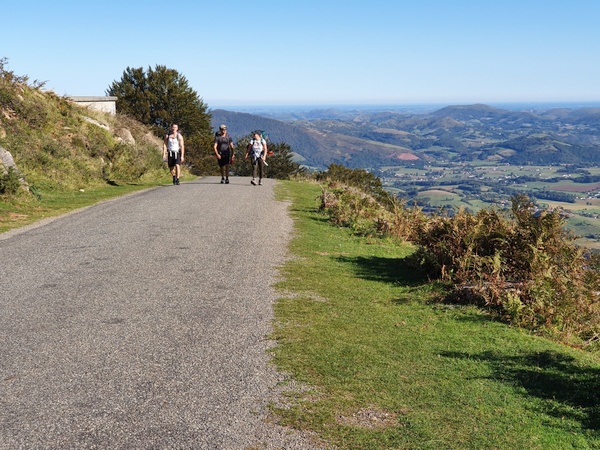
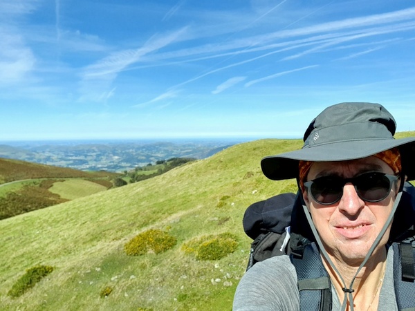
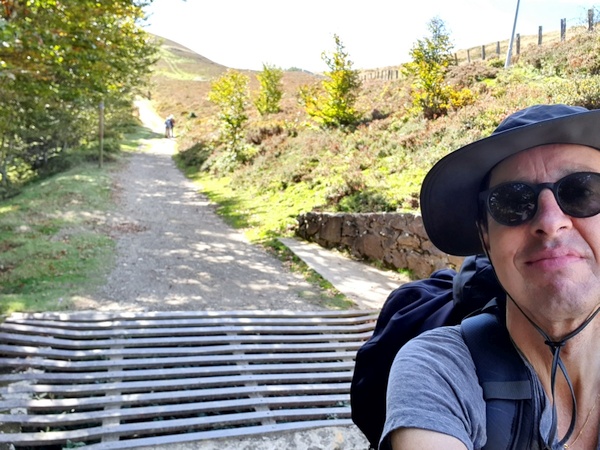
Pilgrims heading up Route Napoleon to cross the Pyrenees. Beautiful weather on the first day.
- Photographer: Claus Nedergaard Jacobsen
- Date Taken: 2019:10:08 09:09:49
- GPS Location: 43.1368378N, -1.2384432E

Pilgrims heading up Route Napoleon to cross the Pyrenees. Beautiful weather on the first day.
- Photographer: Claus Nedergaard Jacobsen
- Date Taken: 2019:10:08 09:09:53
- GPS Location: 43.1341852N, -1.2384224E
View of the mountains from the climb up the Pyrenees.
- Photographer: Claus Nedergaard Jacobsen
- Date Taken: 2019:10:08 09:09:57
- GPS Location: 43.1341852N, -1.2384224E
Climbing the Pyrenees. Not exactly rock climbing but the pulse gets up and you get to sweat.
- Photographer: Claus Nedergaard Jacobsen
- Date Taken: 2019:10:08 09:10:12
- GPS Location: 43.1341852N, -1.2384224E
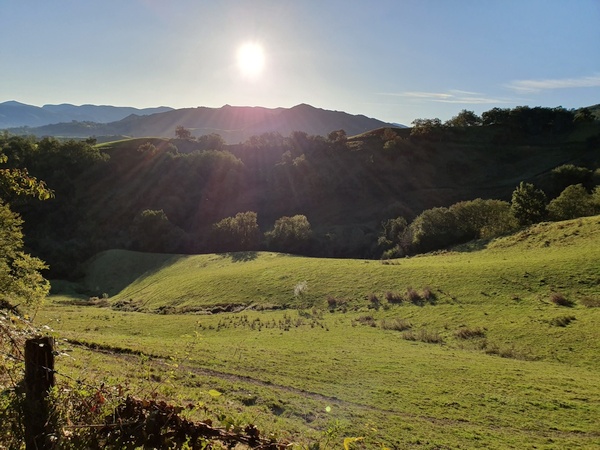
Beautiful scenery when ascending to the pass between France and Spain via Route Napoleon.
- Photographer: Claus Nedergaard Jacobsen
- Date Taken: 2019:10:08 10:12:49
- GPS Location: 43.1232969N, -1.2445826E

Climbing the Pyrenees. Not exactly rock climbing but the pulse gets up and you get to sweat.
- Photographer: Claus Nedergaard Jacobsen
- Date Taken: 2019:10:08 10:12:53
- GPS Location: 43.1232969N, -1.2445826E

Climbing the Pyrenees. Not exactly rock climbing but the pulse gets up and you get to sweat.
- Photographer: Claus Nedergaard Jacobsen
- Date Taken: 2019:10:08 10:12:57
- GPS Location: 43.1232969N, -1.2445826E

Climbing the Pyrenees. Not exactly rock climbing but the pulse gets up and you get to sweat.
- Photographer: Claus Nedergaard Jacobsen
- Date Taken: 2019:10:08 10:17:29
- GPS Location: 43.1217761N, -1.2436486E
Other pilgrims walking up Route Napoleon. Beautfiful view into France
- Photographer: Claus Nedergaard Jacobsen
- Date Taken: 2019:10:08 10:52:41
- GPS Location: 43.11231N, -1.2372913E
Beautfiful view into France
- Photographer: Claus Nedergaard Jacobsen
- Date Taken: 2019:10:08 10:52:48
- GPS Location: 43.11231N, -1.2372913E
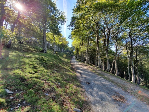
Route Napoleon, still in France. Bright sunny day. Beautiful
- Photographer: Claus Nedergaard Jacobsen
- Date Taken: 2019:10:08 10:52:53
- GPS Location: 43.11231N, -1.2372913E

Nice water hole on Route Napoleon. Still in France
- Photographer: Claus Nedergaard Jacobsen
- Date Taken: 2019:10:08 10:57:18
- GPS Location: 43.1095968N, -1.2385086E

Route Napoleon. France
- Photographer: Claus Nedergaard Jacobsen
- Date Taken: 2019:10:08 11:52:07
- GPS Location: 43.1079997N, -1.2393471E

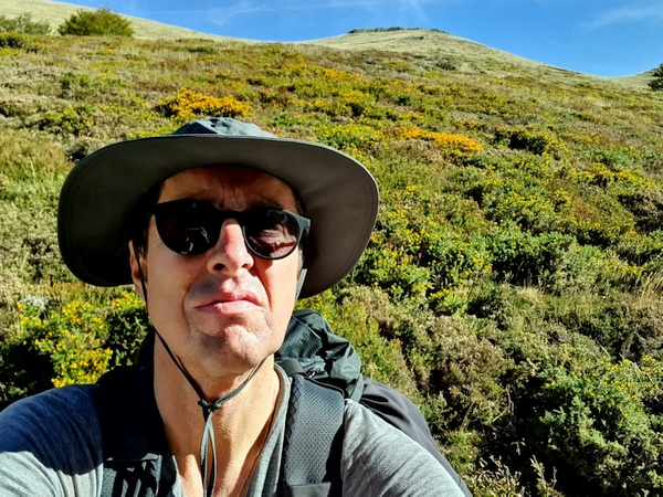
Beautiful flowers near the Camino in France. Not at the top of the Pyrenees yet.
- Photographer: Claus Nedergaard Jacobsen
- Date Taken: 2019:10:08 11:54:21
- GPS Location: 43.1078022N, -1.2393343E

The first of many milestones with remembrance stones
- Photographer: Claus Nedergaard Jacobsen
- Date Taken: 2019:10:08 12:13:14
- GPS Location: 43.0978829N, -1.2413242E
The first of many milestones with remembrance stones
- Photographer: Claus Nedergaard Jacobsen
- Date Taken: 2019:10:08 12:13:36
- GPS Location: 43.0978829N, -1.2413242E

The first of many milestones with remembrance stones
- Photographer: Claus Nedergaard Jacobsen
- Date Taken: 2019:10:08 12:13:55
- GPS Location: 43.0978829N, -1.2413242E
Still in France. Approaching the top of the Pyrenees.
- Photographer: Claus Nedergaard Jacobsen
- Date Taken: 2019:10:08 12:57:08
- GPS Location: 43.0895906N, -1.246605E

Sheep in France
- Photographer: Claus Nedergaard Jacobsen
- Date Taken: 2019:10:08 12:59:43
- GPS Location: 43.0892269N, -1.2470906E

We thought this was the border with Saint statues but it was not. La Vierge de Biakorri
- Photographer: Claus Nedergaard Jacobsen
- Date Taken: 2019:10:08 13:19:34
- GPS Location: 43.0804348N, -1.2516774E

Lovely grass field in front of the the Saint statues, La Vierge de Biakorri
- Photographer: Claus Nedergaard Jacobsen
- Date Taken: 2019:10:08 13:20:45
- GPS Location: 43.0804422N, -1.2516393E
Lovely grass field in front of the Saint statues, La Vierge de Biakorri
- Photographer: Claus Nedergaard Jacobsen
- Date Taken: 2019:10:08 13:20:56
- GPS Location: 43.0804422N, -1.2516393E
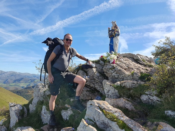
Saint statues at "La Vierge de Biakorri", shortly before the Spanish border
- Photographer: Claus Nedergaard Jacobsen
- Date Taken: 2019:10:08 13:30:46
- GPS Location: 43.0805093N, -1.2516503E

Eagles flying in the wind
- Photographer: Claus Nedergaard Jacobsen
- Date Taken: 2019:10:08 14:06:55
- GPS Location: 43.0725524N, -1.2668225E

Eagles flying in the wind
- Photographer: Claus Nedergaard Jacobsen
- Date Taken: 2019:10:08 14:07:08
- GPS Location: 43.0725524N, -1.2668225E

Eagles flying in the wind
- Photographer: Claus Nedergaard Jacobsen
- Date Taken: 2019:10:08 14:07:09
- GPS Location: 43.0725524N, -1.2668225E

Cruz de Thibault
- Photographer: Claus Nedergaard Jacobsen
- Date Taken: 2019:10:08 14:30:20
- GPS Location: 43.0590265N, -1.2674985E

Cruz de Thibault. In memory of resistance people tortured to death during WW2.
- Photographer: Claus Nedergaard Jacobsen
- Date Taken: 2019:10:08 14:32:49
- GPS Location: 43.0582836N, -1.2672466E

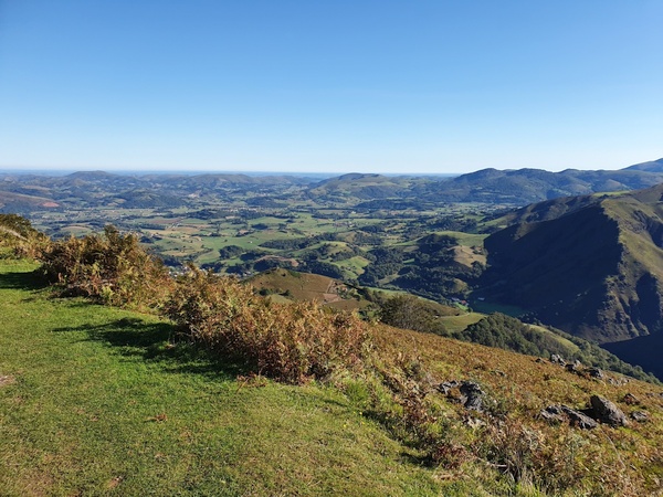
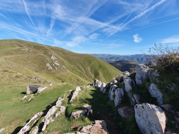
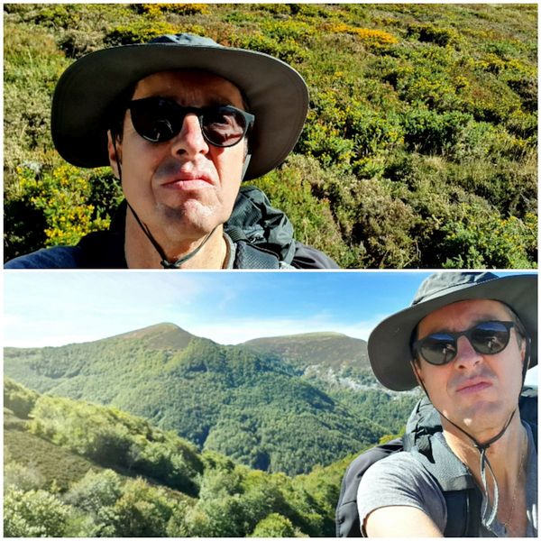
View of the Pyrenees
- Photographer: Claus Nedergaard Jacobsen
- Date Taken: 2019:10:08 14:48:34
- GPS Location: 43.0492961N, -1.266385E

View of the Pyrenees
- Photographer: Claus Nedergaard Jacobsen
- Date Taken: 2019:10:08 14:48:41
- GPS Location: 43.0492961N, -1.266385E

View of the Pyrenees
- Photographer: Claus Nedergaard Jacobsen
- Date Taken: 2019:10:08 14:48:45
- GPS Location: 43.0492961N, -1.266385E

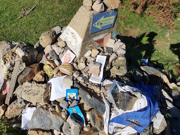
765 km to go according to this sign at the French side of the border. Here St. James is "Saint-Jacques". We call him "Jacob" and so do the Germans
- Photographer: Claus Nedergaard Jacobsen
- Date Taken: 2019:10:08 14:52:26
- GPS Location: 43.0473271N, -1.2649247E

Finally at the French-Spanish border, "Fuente de Roldán". The lady is Australian, I found out.
- Photographer: Claus Nedergaard Jacobsen
- Date Taken: 2019:10:08 14:53:16
- GPS Location: 43.0473271N, -1.2649247E

The French-Spanish border, "Fuente de Roldán". No passport control
- Photographer: Claus Nedergaard Jacobsen
- Date Taken: 2019:10:08 15:02:43
- GPS Location: 43.0468308N, -1.2647437E
The French-Spanish border, "Fuente de Roldán". No passport control for humans. But animals have to demonstrate ability to cross that grid
- Photographer: Claus Nedergaard Jacobsen
- Date Taken: 2019:10:08 15:03:02
- GPS Location: 43.046799N, -1.2647258E

Into Spain
- Photographer: Claus Nedergaard Jacobsen
- Date Taken: 2019:10:08 15:27:27
- GPS Location: 43.0384725N, -1.2833846E
Beautiful autumn day when entering Spain through wood.
- Photographer: Claus Nedergaard Jacobsen
- Date Taken: 2019:10:08 15:27:40
- GPS Location: 43.0384725N, -1.2833846E

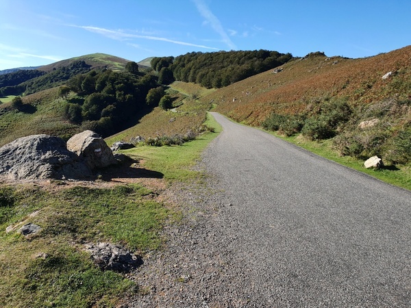
Hilly landscape. Still in the Pyrenees at some 1400 meter altitude. We started out in 300 meters at Saint Jean Pied de Port
- Photographer: Claus Nedergaard Jacobsen
- Date Taken: 2019:10:08 15:34:37
- GPS Location: 43.0369722N, -1.2893322E

Hilly landscape. Still in the Pyrenees at some 1400 meter altitude. Beautiful autumn colours.
- Photographer: Claus Nedergaard Jacobsen
- Date Taken: 2019:10:08 15:41:13
- GPS Location: 43.0345439N, -1.2914488E

Hilly landscape. Still in the Pyrenees at some 1400 meter altitude. Beautiful autumn colours.
- Photographer: Claus Nedergaard Jacobsen
- Date Taken: 2019:10:08 15:49:56
- GPS Location: 43.0305168N, -1.2951544E
Hilly landscape. Still in the Pyrenees at some 1400 meter altitude. Beautiful autumn colours.
- Photographer: Claus Nedergaard Jacobsen
- Date Taken: 2019:10:08 15:50:40
- GPS Location: 43.0305168N, -1.2951544E
Hilly landscape. Still in the Pyrenees at some 1400 meter altitude. Beautiful autumn colours.
- Photographer: Claus Nedergaard Jacobsen
- Date Taken: 2019:10:08 15:50:40
- GPS Location: 43.0305168N, -1.2951544E
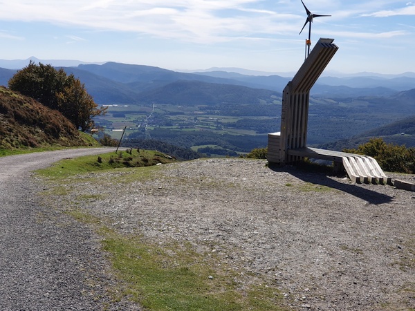
Fortín Wellington. Finally we reached the top. Now it is downhill. Which turned out to be more difficult than uphill.
- Photographer: Claus Nedergaard Jacobsen
- Date Taken: 2019:10:08 15:59:07
- GPS Location: 43.0262074N, -1.2954276E

Horses in the mountains. No fences, we could tell. Wonder how they catch them. With food, probably
- Photographer: Claus Nedergaard Jacobsen
- Date Taken: 2019:10:08 15:59:19
- GPS Location: 43.0262074N, -1.2954276E
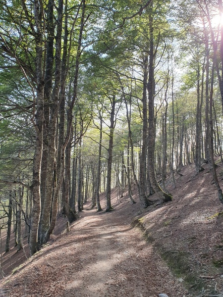
Downhill through wood into Spain towards Roncevalles.
- Photographer: Claus Nedergaard Jacobsen
- Date Taken: 2019:10:08 16:22:11
- GPS Location: 43.0193654N, -1.2989451E
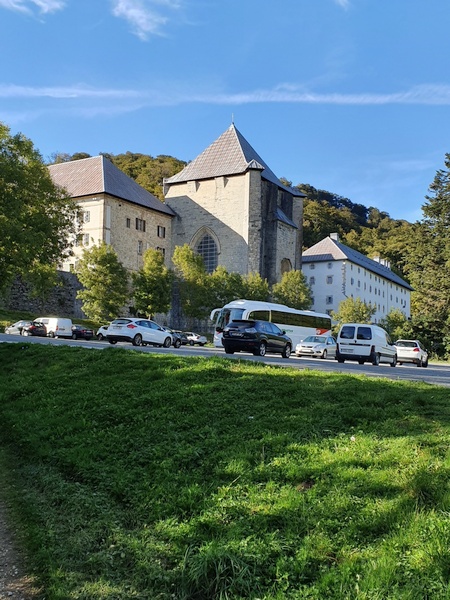
The monastery at Roncevalle where I ended up sleeping. It had but large dormitories.
- Photographer: Claus Nedergaard Jacobsen
- Date Taken: 2019:10:08 17:12:30
- GPS Location: 43.0087899N, -1.3186502E

Sign next to the monastery. This is via road, though, not the Camino.
- Photographer: Claus Nedergaard Jacobsen
- Date Taken: 2019:10:08 17:18:00
- GPS Location: 43.0079578N, -1.3194857E

My German friend, Stefan, with whom I drank a beer at Roncevalles. Well then another, then .. I think we stopped at 5. Boy, it was good. Stefan and I are still in contact.
- Photographer: Claus Nedergaard Jacobsen
- Date Taken: 2019:10:08 19:10:31
- GPS Location: 43.0085179N, -1.3195887E
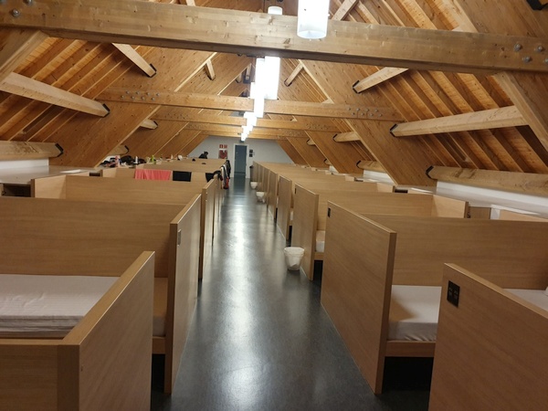
A dormitory at Roncevalles. 100 beds in each but lots of privacy. No gender separation. Excellent quality, excellent bathrooms. I think they have a total of more than 500 beds. Run by voluntaries. No complaints about my snoring....
- Photographer: Claus Nedergaard Jacobsen
- Date Taken: 2019:10:08 21:57:15
- GPS Location: 43.0102987N, -1.3193782E